
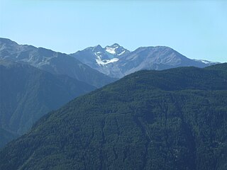
The Hoher Weißzint is a mountain in the Zillertal Alps on the border between Tyrol, Austria, and South Tyrol, Italy.

The Agglsspitze is a mountain in South Tyrol, Italy.

The Hoher Angelus is a mountain in the Ortler Alps in South Tyrol, Italy.
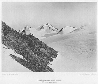
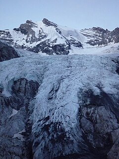
The Botzer is a mountain in the Stubai Alps in South Tyrol, Italy.

The Hintere Eggenspitze is a mountain in the Ortler Alps on the border between South Tyrol and Trentino, Italy.
The Trafoier Eiswand is a mountain in the Ortler Alps on the border between South Tyrol and the Province of Sondrio, Italy.

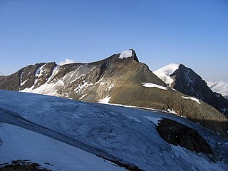
The III. Hornspitze is a mountain in the Zillertal Alps on the border between Tyrol, Austria, and South Tyrol, Italy.

The Rötspitze is a mountain in the Hohe Tauern on the border between Tyrol, Austria, and South Tyrol, Italy.

The Thurwieserspitze is a mountain in the Ortler Alps on the border between South Tyrol and the Province of Sondrio, Italy.
The Tuckettspitze is a mountain in the Ortler Alps in South Tyrol, Italy.

The Veneziaspitze is a mountain in the Ortler Alps on the border between South Tyrol and Trentino, Italy.

The Vertainspitze is a mountain in the Ortler Alps in South Tyrol, Italy.
The Zufrittspitze is a mountain in the Ortler Alps on the border between South Tyrol and Trentino, Italy.
The Hinterer Bratschenkopf is a mountain in the Glockner Group on the Fusch-Kaprun ridge in the High Tauern, a high mountain range in the Austrian Central Alps. According to the listed sources it is 3,412 metres high, but the Austrian Federal Office for Metrology and Survey gives its height as 3,413 metres. The mountain lies in the Austrian state of Salzburg. It appears from the north, east and south as a gently curved firn summit, but from the west it has a mighty, 1,400-metre-high (4,600 ft) and 40 to 60° rock face. A steep, 500-metre-long (1,600 ft) knife-edge ridge bears away from the mountaintop to the north. Due to its close proximity to the Heinrich Schwaiger Haus, the summit is a popular viewing point. The peak was first climbed on 18 September 1869 by the Munich Alpinist, Karl Hofmann, the Prague businessman, Johann Stüdl, and mountain guides Thomas Groder and Josef Schnell from Kals am Großglockner.
The Hoher Tenn, formerly also called the Hochtenn, is a double-peaked mountain in the Austrian federal state of Salzburg. It has a southwest summit, called the Bergspitze with a height of 3,368 metres, and a northeast summit, the Schneespitze, which is 3,317 metres high. The Tenn belongs to the Glockner Group in the central part of the High Tauern in the Austrian Central Alps. Between the two summits at a height of 3,293 metres is the Tenn Saddle (Tennsattel). Long knife-edge ridges run away to the northeast and northwest. It has a large topographical prominence, especially to the north, which, together with its easy accessibility, make it a popular climbing mountain. Seen from Zell am See in the Pinzgau it is second only to the Imbachhorn (2,470 m) in dominating the Tauern panorama.
The Schneebiger Nock, in old literature also called the Ruthnerhorn, is 3,358 metres high and, after the Hochgall, the second highest mountain of the Rieserferner Group, a range in the western part of the High Tauern. The mountain rises in the Italian province of South Tyrol in the Rieserferner-Ahrn Nature Park. It was first climbed on 6 October 1866 by Archduke Rainer Ferdinand of Austria, Count Heinrich Wurmbrand, and mountain guides, Georg Auer, Johann Oberarzbacher from Rein in Taufers and Georg Weiss, an innkeeper from St. Johann im Reintal. Today the Schneebige Nock may be reached from the Kasseler Hut to the northeast or from the Rieserferner Hut to the south. Thanks to its prominent pyramidal shape and its distinct arêtes it is a frequently visited viewing summit.

The Rainerhorn is a mountain in the Venediger Group. It is 3,559 m (11,677 ft) high.
The Großer Geiger, formerly also called the Obersulzbacher Venediger and Heiliggeistkogel, is a mountain, 3,360 m (AA), in the Venediger Group in the main chain of the Central Tauern. This chain lies in the High Tauern, part of the Austrian Central Alps on the border between the Austrian states of Tyrol in the south and Salzburg in the north.

The Klockerin, formerly also called the Glockerin or Glocknerin, is a twin-peaked mountain in the Glockner Group on the ridge of Fuscher/Kapruner Kamm in the High Tauern, a range within the Central Alps in the Austrian state of Salzburg. Its southwest top (Südwestgipfel) is 3,422 m (AA) high, its northeast top (Nordostgipfel) has a height of 3,335 m. The two summits are about 240 metres apart. A prominent arête runs westwards; the west-northwestern arête is a short, but knife-edge ridge of rock. The Klockerin has a mighty Northwest Face which is 920 metres high and has a gradient of 54°. The mountain is geographically dominant compared with the southern and western neighbouring peaks. Especially from the west, where the Mooserboden Reservoir lies, the Klockerin appears as a mighty massif. The mountain was first climbed on 18 September 1869 by German alpinist, Karl Hofmann, Prague merchant, Johann Stüdl and mountain guides, Thomas Groder and Josef Schnell from Kals am Großglockner.

The Wildgall is, at 3,273 metres above sea level, the third highest peak in the Rieserferner Group, a range in the western part of the High Tauern. It lies within the Italian provinces of South Tyrol in the Rieserferner-Ahrn Nature Park and appears from the south as a massive pyramid with prominent arêtes. It is the most difficult of the summits of the Rieserferner Group to climb. As a result, it was conquered relatively late. Its first recorded ascent was on 18 August 1872 by Victor Hecht from Prague and mountain guides Johann and Sepp Ausserhofer from Rein in Taufers. Today the mountain may be climbed from the Kasseler Hut to the north in about four hours, but it is rarely attempted.
