Manaslu is the eighth-highest mountain in the world at 8,163 metres (26,781 ft) above sea level. It is in the Mansiri Himal, part of the Nepalese Himalayas, in west-central Nepal. Manaslu means "mountain of the spirit" and the word is derived from the Sanskrit word manasa, meaning "intellect" or "soul". Manaslu was first climbed on May 9, 1956, by Toshio Imanishi and Gyalzen Norbu, members of a Japanese expedition. It is said that, given the many unsuccessful attempts by the British to climb Everest before Nepali Tenzing Norgay and New Zealander Edmund Hillary, "just as the British consider Everest their mountain, Manaslu has always been a Japanese mountain".
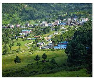
Jiri is a municipality in Dolakha District in the Bagmati Province of central Nepal. At the time of the 2011 Nepal census it had a population of 13,638 people. Jiri, which lies about 190 kilometers from Kathmandu, is the main gateway to the Everest Region. Almost all the Everest expeditions, including the one led by famous climber John Hunt, Edmund Hillary had passed through Jiri. A company of the Nepal Army is stationed in town and visitors' equipment and backpacks might be searched. There are a number of lodges available along either side of the main road mainly in Jiri Bazaar.

Kongde Ri is a mountain in the Himalayas of eastern Nepal. The mountain is located four km west of Namche Bazaar.

Langtang Valley also known as Lamtang Valley is a Himalayan valley in the mountains of north-central Nepal, known for its trekking routes and natural environment.

Thorong La or Thorung La is a mountain pass with an elevation of 5,416 metres (17,769 ft) above sea level in the Damodar Himal, north of the Annapurna Himal, in central Nepal. Thorong Ri is on the slope of Khatung Kang and Yakawa Kang are the mountains forming Thorong La. The pass is located on a trail that connects the village of Manang in the Manang District to the east, with the temple of Muktinath and the nearby village of Ranipauwa, in the Mustang District to the west. Thorong La is the highest point on the Annapurna Circuit, a 300 km (190 mi) route around the Annapurna mountain range. In addition to trekkers, the pass is regularly used by local traders.

Singalila National Park is a national park of India located on the Singalila Ridge at an elevation of more than 2,300 metres above sea level, in the Darjeeling district of West Bengal. It is well known for the trekking route to Sandakphu that runs through it.
Langtang Lirung is the highest peak of the Langtang Himal, which is a subrange of the Nepalese Himalayas, southwest of the Eight-thousander Shishapangma. The List of the world's highest 100 mountains puts it at number 99.

Gokyo Peak is a 5,357 m (17,575 ft)-high peak in the Khumbu region of the Nepal Himalayas. It is located on the west side of the Ngozumpa glacier, which is the largest glacier in Nepal and reputed to be the largest in the whole Himalayas. Gokyo, at the base of Gokyo Ri, is a small village with several houses and lodges, and is one of the highest settlements in the world. From the summit of Gokyo Ri it is possible to see four 8,000-metre peaks: Mount Everest, Lhotse, Makalu and Cho Oyu. The Gokyo Lakes are in the area. Other mountains, such as Pumori and Nuptse are also visible from the top, along with five tranquil glacier lakes named together as gokyo lakes. The Gokyo-Ri summit is a 3-hour hike from the nearest village.
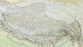
The following outline is provided as an overview of and topical guide to Nepal:

Yala Peak is a mountain in the Langtang area in Nepal.
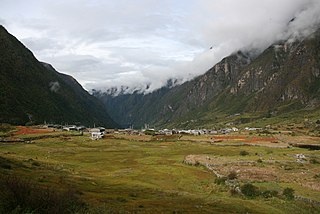
Langtang was a village development committee (VDC) in Rasuwa District in the Bagmati Zone of northern Nepal. It was located within the Langtang valley, approximately 40 miles northeast of Kathmandu. At the time of the 1991 Nepal census, it had a population of 468 people living in 100 individual households.
Archalbot is a village development committee in Lamjung District in the Gandaki Zone of northern-central Nepal. At the time of the 1991 Nepal census it had a population of 1650 people living in 333 individual households.
Langtang National Park is a national park in north-central Nepal. It was established in 1976 as Nepal's first Himalayan national park and the country's fourth protected area. It covers an area of 1,710 km2 (660 sq mi) in the Nuwakot, Rasuwa and Sindhulpalchok Districts of the central Himalayan region. It contains 26 village communities and includes the Langtang valley. In the north and east it is linked with Qomolangma National Nature Preserve in the Tibet Autonomous Region. The eastern and western boundaries follow the Bhote Koshi and the Trishuli river, respectively.

The Great Himalaya Trail is a route across the Himalayas from east to west. The original concept was to establish a single long distance trekking trail from the east end to the west end of Nepal that includes a total of roughly 1,700 kilometres (1,100 mi) of path. There is a proposed trail of more than 4,500 kilometres (2,800 mi) stretching the length of the Greater Himalaya range from Nanga Parbat in Pakistan to Namche Barwa in Tibet thus passing through, India, Nepal, Bhutan and Tibet. Although an actual continuous route is currently only a concept, if completed it would be the longest and highest alpine hiking track in the world.
Porong Ri is a mountain in the Langtang region of the Himalayas. At 7,292 m (23,924 ft) it is the 86th highest mountain in the world. The peak is located in Tibet, China, at about one kilometre northeast of the Nepal border.
Langtang Ri is a mountain in the Langtang Himal of the Himalayas. At an elevation of 7,205 m (23,638 ft) it is the 106th highest mountain in the world. Located on the border between the Bagmati Zone of Nepal and Tibet, China, it is part of a group of high peaks that include Shishapangma and Porong Ri.

Mingma Sherpa- Nepali: मिङ्मा शेर्पा is a Nepali mountaineer from Makalu Village, which is located in Sankhuwasabha district of Nepal. On May 20, 2011, Mingma Sherpa became the first person from Nepal and the first South Asian to scale all 14 eight thousanders. He also set a new world record by becoming the first mountaineer to climb all 14 peaks on the first attempt. Mingma Sherpa and his brother, Chhang Dawa Sherpa, hold the Guinness World Records of the world's first two brothers to successfully summit the 14 eight thousanders

Gosaikunda is a rural municipality located in Rasuwa District of Bagmati Province in Nepal. Rasuwa district is divided into five rural municipality and Gosaikunda is one of them. It is located near the border of Tibet-China on Himalayan range. It is surrounded by Sindhupalchok District in east, Naukunda Rural Municipality and Kalika Rural Municipality in south and Uttargaya Rural Municipality and Aamachhodingmo Rural Municipality in west. Tibet is located on the north side of the rural municipality. Total area of the rural municipality is 987.77 square kilometres (381.38 sq mi) and total population is 7,143 individuals.
The Tsergo Ri landslide was a prehistoric landslide in the Nepalese Himalaya, which took place around 51,000±13,000 years ago, during the Last Glacial Period. During the collapse, a mass of rock of about 10–15 cubic kilometres (2.4–3.6 cu mi) detached from a previous mountain or ridge and descended with a speed of about 450 kilometres per hour (120 m/s); later, glaciers eroded almost the entire landslide mass. Previously weakened rocks may have contributed to the collapse, which was probably started by an earthquake.

Tsangbu Ri is a mountain peak in the Himalayas, located on the border of Bagmati Province of Nepal and the Tibet Autonomous Region of China.