Tses

Last updated • 2 min readFrom Wikipedia, The Free Encyclopedia
Tses
Namibia location map.svg
Red pog.svg
Tses
Location in Namibia
Coordinates: 25°53′S18°0′E / 25.883°S 18.000°E / -25.883; 18.000
CountryFlag of Namibia.svg  Namibia
Region ǁKaras Region
Population
 (2023) [1]
  Total
2,053
Time zone UTC+2 (South African Standard Time)
Climate BWh

Tses (Khoekhoe : place of daylight) [2] is a village in the ǁKaras Region of southern Namibia. It had 2,053 inhabitants in 2023.

Contents

Geography

Tses is situated one kilometre off the main B1 highway from Windhoek to Noordoewer, opposite the turning to Berseba and the Brukkaros Mountain.

Historical population
YearPop.±% p.a.
20111,365    
20232,053+3.46%
Source: [1]

History

From 1980 until independence in 1990, Tses was part of Namaland, a bantustan for the Nama people. [3]

Economy and Infrastructure

The main economic activity in this area is subsistence livestock farming. Tses houses a general dealer and a petrol station. The passenger trains from Windhoek to Keetmanshoop stop at Tses.

One of the largest employers at Tses shall be Groot Glass, formerly known as Tses Glass, one of the most modern glass plants in the southern part of Africa. [4] Due to unclear financing, the realization of the project is uncertain. [5] [6] Except by a symbolic act of groundbreaking, the erection has not been started up to now. [7] [8]

Politics

Tses is governed by a village council that has five seats. [9]

In the 2010 local authority election, a total of 984 votes were cast in the village. SWAPO won with approximately 55% of the vote. Of the four other parties seeking seats, Democratic Turnhalle Alliance (DTA) received approximately 21% of the vote, followed by Rally for Democracy and Progress (RDP, 19%), South West Africa National Union (SWANU, 2%) and Congress of Democrats (COD, 2%). [10] The 2015 local authority election was likewise won by SWAPO party which gained three seats (260 votes). The remaining two seats went to the DTA which obtained 156 votes. [11]

The 2020 local authority election was won by the Landless People's Movement (LPM, a new party registered in 2018) with 267 votes and two seats. SWAPO was the runner-up, obtaining 193 and also two seats. The remaining seat went to the Popular Democratic Movement (PDM, the new name of the DTA since 2017) with 89 votes. [12]

Related Research Articles

<span class="mw-page-title-main">Gobabis</span> City in Omaheke Region, Namibia

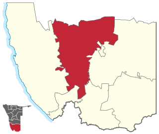
Gobabis is a town in eastern Namibia. It is the regional capital of the Omaheke Region, and the district capital of the Gobabis electoral constituency. Gobabis is situated 200 km (120 mi) down the B6 motorway from Windhoek to Botswana. The town is 113 km (70 mi) from the Buitepos border post with Botswana, and serves as an important link to South Africa on the tarred Trans-Kalahari Highway. Gobabis is in the heart of the cattle farming area. In fact Gobabis is so proud of its cattle farming that a statue of a large Brahman bull with the inscription "Cattle Country" greets visitors to the town. Gobabis also has its own local airport.

<span class="mw-page-title-main">Keetmanshoop</span> City in ǁKaras Region, Namibia

Keetmanshoop is a town in the ǁKaras Region of southern Namibia. It is named after Johann Keetman, a German industrialist and benefactor of the city. Keetmanshoop had a population of 27,862 people in 2023.

<span class="mw-page-title-main">Berseba Constituency</span> Electoral constituency in southern Namibia

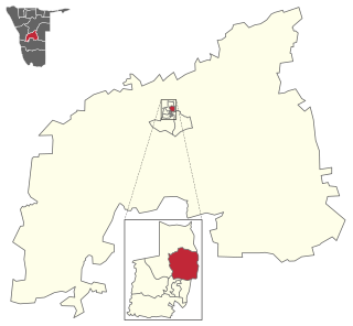
Berseba is a constituency in the ǁKaras Region of Namibia. The main settlement is Berseba. As of 2020 the constituency had 6,659 registered voters.

<span class="mw-page-title-main">Windhoek Rural</span> Electoral constituency in the Khomas region of central Namibia

Windhoek Rural is a constituency in the Khomas Region of Namibia. Its district capital is the settlement of Groot Aub. It had a population of 22,254 in 2011, up from 20,212 in 2001. As of 2020, it has 13,625 registered voters.

Okahandja is a city of 45,159 inhabitants in Otjozondjupa Region, central Namibia, and the district capital of the Okahandja electoral constituency. It is known as the Garden Town of Namibia. It is located 70 km north of Windhoek on the B1 road. It was founded around 1800, by two local groups, the Herero and the Nama.

<span class="mw-page-title-main">Karasburg</span> Town in ǁKaras Region, Namibia

Karasburg is a town in the ǁKaras Region of southern Namibia and the district capital of the Karasburg electoral constituency. It lies at the heart of the southern Namibian sheep farming industry. Karasburg had a population of 6,621 people in 2023.

<span class="mw-page-title-main">Berseba</span> Village in ǁKaras Region, Namibia

Berseba is a village in the ǁKaras Region of southern Namibia. It is situated near the Brukkaros Mountain, a famous tourist destination. Berseba had 992 inhabitants in 2023.

<span class="mw-page-title-main">Bethanie, Namibia</span> Village in ǁKaras Region, Namibia

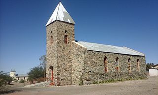
Bethanie is a village in the ǁKaras Region of southern Namibia. It is one of the oldest settlements in the country. Bethanie had 2,372 inhabitants in 2023.

<span class="mw-page-title-main">Usakos</span> Town in Erongo Region, Namibia

Usakos is a town on the banks of river Khan, 140 kilometres north-east of Swakopmund in the Erongo Region of Namibia. It is located on the B2, the main road between the Walvis Bay and Johannesburg. The town has 5,094 inhabitants.

Gibeon is a village in Gibeon Constituency in the Hardap Region of Namibia. The village had 4,120 inhabitants in 2023.

<span class="mw-page-title-main">Aroab</span> Village in the ǁKaras Region of Namibia

Aroab is a village in the ǁKaras Region of southern Namibia. It had 2,651 inhabitants in 2023.

Okakarara is a town in Otjozondjupa Region, Namibia, located 50 kilometres (31 mi) southeast of Waterberg National Park. It has an estimated population of 7,000 and is currently growing by 1,500 inhabitants annually.

<span class="mw-page-title-main">Tobias Hainyeko constituency</span> Electoral constituency in the Khomas region of central Namibia

Tobias Hainyeko constituency is an electoral constituency in Windhoek, the capital of Namibia. It had a population of 45,912 in 2011, up from 34,348 in 2001. As of 2020 it had 36,530 registered voters.

<span class="mw-page-title-main">Stampriet</span> Village in Hardap Region, Namibia

Stampriet is a village in the Hardap Region of central Namibia. It had 3,388 inhabitants in 2023.

<span class="mw-page-title-main">Aranos</span> Town in Hardap Region, Namibia

Aranos is a town in the Hardap Region of central Namibia, situated in the Nossob River basin in the Kalahari Desert. The town had 5,493 inhabitants in 2023.

<span class="mw-page-title-main">Gochas</span> Village in Namibia

Gochas is a village in the Hardap Region of Namibia. The village had 1,868 inhabitants in 2023.

<span class="mw-page-title-main">Witvlei</span> Village in Omaheke Region, Namibia

Witvlei is a village in the Okarukambe Constituency in the Omaheke Region of central-eastern Namibia. It is situated on the B6 150 kilometres (93 mi) from Windhoek on the way to Gobabis. It is known for producing high quality meat.

<span class="mw-page-title-main">Windhoek West Constituency</span> Electoral constituency in Windhoek, Namibia

Windhoek West Constituency is an electoral constituency in the Khomas Region of Namibia. It contains the affluent suburbs of Hochland Park, Pioneers Park, Academia, Cimbebasia, Rocky Crest, Windhoek North and Windhoek West. It had a population of 53,438 in 2011, up from 42,201 in 2001. As of 2020, it has 33,556 registered voters.

<span class="mw-page-title-main">Koës</span> Village in ǁKaras Region, Namibia

Koës is a village in the ǁKaras Region of south-eastern Namibia. It had 2,264 inhabitants in 2023.

<span class="mw-page-title-main">Independent Patriots for Change</span> Political party in Namibia

The Independent Patriots for Change (IPC) is a political party in Namibia. It was founded by Panduleni Itula in August 2020. As an independent presidential candidate in the November 2019 election, Itula won the best result of a losing candidates ever in elections in Namibia. At the founding meeting on 2 August 2020 in Windhoek, Itula was elected party president, Brian Kefas Black chairman and Christine Esperanza ǃAochamus general secretary. Vicepresident is Trevino Forbes.

References

  1. 1 2 "4.5 Population by town and census years (2011 and 2023)" (PDF). Namibia 2023 - Population and Housing Census. Main Report. Namibia Statistics Agency. pp. 33–34. Retrieved 23 November 2024.
  2. Cassidy, Joseph (2009). Place Names of Namibia A Historical Dictionary. Windhoek: Macmillan Education Namibia Publishers (Pty) Ltd. p. 1. ISBN   978-99916-0-654-5.
  3. William Hawkins reflects on his teaching experience in Namibia Archived 2008-12-05 at the Wayback Machine Australian Mathematics Trust
  4. "Groot Global Brands". grootgroup.com. Retrieved 2017-08-10.
  5. "Tses glass project yet to secure funding". New Era Newspaper Namibia. 2015-04-14. Retrieved 2017-08-10.
  6. "Nothing to show for Tses Glass". Namibia Economist. Retrieved 2017-08-10.
  7. digital nbc (2014-06-16), Tses glass-NBC, archived from the original on 2021-12-15, retrieved 2017-08-10
  8. digital nbc (2014-09-12), Tses glass project-NBC, archived from the original on 2021-12-15, retrieved 2017-08-10
  9. "Know Your Local Authority". Election Watch. No. 3. Institute for Public Policy Research. 2015. p. 4.
  10. Local Authority Election Results for Tses Archived 2011-07-17 at the Wayback Machine
  11. "Local elections results". Electoral Commission of Namibia. 28 November 2015. p. 3. Archived from the original on 10 December 2015.
  12. "2020 Local Authority Elections Results and Allocation of Seats" (PDF). Electoral Commission of Namibia. 29 November 2020. p. 7. Retrieved 24 December 2020.

25°53′S18°0′E / 25.883°S 18.000°E / -25.883; 18.000