Tucunduva

Last updated
Tucunduva
Municipality
Brasao tucunduva.png
Motto: 
"Quem trabalha vence"
RioGrandedoSul Municip Tucunduva.svg
Location of Tucunduva in Rio Grande do Sul
Country Flag of Brazil.svg  Brazil
Region South
State Rio Grande do Sul
Mesoregion Noroeste Rio-Grandense
Microregion Santa Rosa
Founded10 September 1959
Government
  MayorJonas Fernando (PDT, 2021 - 2024)
Area
  Total181.198 km2 (69.961 sq mi)
Population
 (2020 [1] )
  Total5,612
  Density31/km2 (80/sq mi)
Demonym Tucunduvense
Time zone UTC−3 (BRT)
Website Official website

Tucunduva is a municipality in the state of Rio Grande do Sul, Brazil. Known as the Capital of Mechanized Crops, Tucunduva has the highest grain yield per hectare in Brazil and is also known as the Land of Musicians.

Contents

Etymology

The etymological roots of the name "Tucunduva" are difficult to reach. Some stories say that João Tucunduva was the first resident of the place. His father was called Captain Carvalho Rodrigues Tucunduva and his uncle was Colonel José Rodrigues Tucunduva. Coming from the province of São Paulo, current state of Paraná, where there were forests of small palm trees named in the Guarani language of Tucun and its collective of Uva. This made them come to be known as Rodrigues brothers from the Tucun da Uva lands and it was in his honor that the municipality was renamed Tucunduva.

History

The Municipality of Tucunduva was effectively colonized from 1920 by colonists of Italian origin, from the municipality of Bento Gonçalves which was part of the Old Colonies (first colonies of immigrants in the state of Rio Grande do Sul), and also colonists of Germanic origin from Germany, Erechim and from the Guarani Colony.

The main causes of the immigration of settlers to Tucunduva were:

When the colonizers arrived in Tucunduva they found some families occupying land, which were dispersed and without much organization. In 1926, the Tucunduva settlement was founded. In 1931, the municipality of Santa Rosa was emancipated and the town of Tucunduva became a village and, in 1934, it was elevated to the 7th District of the municipality of Santa Rosa. The municipality of Tucunduva was created on September 10, 1959 through state law number 3,821 / 1959 and this law was published in the Official Gazette on September 11, 1959.

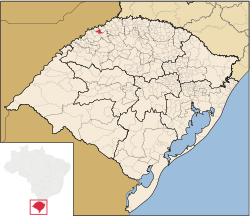
Tucunduva's first legislature consisted of seven councilors elected by the people. The first mayor, sworn in on December 31, 1959, was Mr. Florentino Rossato, with Mr. Erminio Carlos Schwerz as vice-mayor. Since 1967, Tucunduva, being a municipality bordering the Argentine Republic, became part of the municipalities in the area of national security and the mayors were appointed by the President of the Republic. Its area was 396 km2. In 1992, with the emancipation of Novo Machado, the area became 173.33 km2. Also, Tucunduva stopped making limits with the Argentine Republic. The municipality of Tucunduva is located in the Northwest Region of the State of Rio Grande do Sul, 225 mi from the state capital, Porto Alegre. It has a population of approximately 5,988 inhabitants. Tucunduva borders the cities of Horizontina, Novo Machado, Tuparendi, Três de Maio, Santa Rosa, and Dr. Mauricio Cardoso.

According to 2004 data, the municipality has 4,598 voters, 2,217 of whom are male and 2,381 female.

Agriculture is its main source of resources and there is a concern with the creation of new sources of income in the primary sector, causing a great deal of technical and veterinary assistance by the City Hall and cooperatives, aiming at productivity bigger and better quality. The activity of dairy cattle farming occupies a prominent place in rural properties, as well as pig farming.

In the environment, a partnership between the City Hall, the Public Ministry and riverside rural producers, is taking place to recover the riparian forest of the Santa Rosa and Pratos rivers, aiming at the conservation of the springs of the Municipality, guaranteeing the quality and quantity of water for human and animal consumption. In rural properties, there is guidance, monitoring and incentives for the execution and implementation of septic tanks and the proper destination of animal and human waste with the aim of reducing soil and water contamination and also the polluting potential.

Geography

Tucunduva

It is located at latitude 27°39'25" south and at longitude 54°26'25" west, at an altitude of 223 meters. It has an area of 175.96 km2. Its estimated population in 2020 was 5,644 inhabitants. [2]

See also

Related Research Articles

<span class="mw-page-title-main">Rio Grande do Sul</span> State of Brazil

Rio Grande do Sul is a state in the southern region of Brazil. It is the fifth-most populous state and the ninth-largest by area. Located in the southernmost part of the country, Rio Grande do Sul is bordered clockwise by Santa Catarina to the north and northeast, the Atlantic Ocean to the east, the Uruguayan departments of Rocha, Treinta y Tres, Cerro Largo, Rivera, and Artigas to the south and southwest, and the Argentine provinces of Corrientes and Misiones to the west and northwest. The capital and largest city is Porto Alegre. The state has the highest life expectancy in Brazil, and the crime rate is relatively low compared to the Brazilian national average. Despite the high standard of living, unemployment is still high in the state, as of 2017. The state has 5.4% of the Brazilian population and it is responsible for 6.6% of the Brazilian GDP.

<span class="mw-page-title-main">Brazil socio-geographic division</span>

The Brazil socio-geographic division is a slightly different division than the Brazilian Division by Regions. It separates the country into three different and distinctive regions:

<span class="mw-page-title-main">Horizontina</span> Municipality in Rio Grande do Sul, Brazil

Horizontina is a municipality in Rio Grande do Sul, in southern Brazil, with 19,389 inhabitants in 2020. It is located 496 km north of the state capital. The first settlers were German, Italian and Polish immigrants who arrived in the region in 1927. Nowadays, most of the inhabitants are of German-Brazilian descent.

<span class="mw-page-title-main">Bento Gonçalves, Rio Grande do Sul</span> Municipality in South, Brazil

Bento Gonçalves is a municipality located in the state of Rio Grande do Sul, Brazil. Created in 1875, it is one of the centers of the Italian immigration in Brazil. It is also known as the 'wine capital of Brazil' due to its vineyards and wine production. In 2020, its estimated population was 121,803 inhabitants.

<span class="mw-page-title-main">Farroupilha</span> Place in Rio Grande do Sul, Brazil

Farroupilha is a city in Rio Grande do Sul, Brazil, in the Serra Gaúcha between the cities of Bento Gonçalves and Caxias do Sul. The city's total area is 359.3 km2. Farroupilha has 73,061 residents.

<span class="mw-page-title-main">Polish Brazilians</span>

Polish Brazilians refers to Brazilians of full or partial Polish ancestry who are aware of such ancestry and remain connected, to some degree, to Polish culture, or Polish-born people permanently residing in Brazil. Also, a Polish Brazilian may have one Polish parent.

<span class="mw-page-title-main">Rio Grande, Rio Grande do Sul</span> Municipality in South, Brazil

Rio Grande is a municipality (município) and one of the oldest cities in the Brazilian state of Rio Grande do Sul. It was the state capital from 1835 to 1845. It is the most important port city in the state and has one of the most important maritime ports in Brazil.

<span class="mw-page-title-main">Senador Salgado Filho</span> Municipality in Rio Grande do Sul, Brazil

Senador Salgado Filho is a municipality of the western part of the state of Rio Grande do Sul, Brazil. The population is 2,770 in an area of 147.21 km2. It is located 492 km west of the state capital of Porto Alegre, northeast of Alegrete and east of Argentina.

<span class="mw-page-title-main">Ubiretama</span> Municipality in South Region, Brazil

Ubiretama is a municipality of the western part of the state of Rio Grande do Sul, Brazil. The name comes from the Tupi language. It is located 499 km west of the state capital of Porto Alegre, northeast of Alegrete and east of Argentina. The population is 1,983 in an area of 126.69 km2.

<span class="mw-page-title-main">Agrolândia</span> Municipality in South, Brazil

Agrolândia is a Brazilian municipality in the state of Santa Catarina. It is located in the micro-region of Rio do Sul, with agriculture as its main economic activity. It was colonized by the Germans, who are the main ethnic group. The main access to the municipality is through the SC-426 highway, starting from BR-470. There are secondary accesses through Otacílio Costa, going down the mountain on a gravel road. There are also secondary accesses from the municipality of Braço do Trombudo and through Ituporanga via Atalanta.

<span class="mw-page-title-main">Novo Cruzeiro</span> Human settlement in Brazil

Novo Cruzeiro is a Brazilian municipality located in the northeast of the state of Minas Gerais. Its population as of 2020 was estimated to be 31,335 people living in a total area of 1,701 km2. The city belongs to the mesoregion of Jequitinhonha and to the microregion of Araçuaí. The elevation of the municipal seat is 980 meters. It became a municipality in 1943.

<span class="mw-page-title-main">Arvorezinha</span> Place in Rio Grande do Sul, Brazil

Arvorezinha is a municipality in the state of Rio Grande do Sul, Brazil.

<span class="mw-page-title-main">Guarani das Missões</span> Municipality in South, Brazil

Guarani das Missões is a municipality in the state of Rio Grande do Sul, Brazil.

<span class="mw-page-title-main">Planalto, Rio Grande do Sul</span> Place in Noroeste Rio-Grandense, Brazil

Planalto is a municipality in the state of Rio Grande do Sul, Brazil, located at 27°19′44″S53°03′31″W, at an elevation of 568 meters above sea level. It has a total area of 237.35 km2. Its estimated population in 2020 was 10,019 inhabitants.

Santa Tereza is a municipality in the state of Rio Grande do Sul, Brazil. It was raised to municipality status in 1992, the area being taken out of the municipalities of Bento Gonçalves, Garibaldi and Roca Sales. As of 2020, the estimated population was 1,726.

<span class="mw-page-title-main">Guaporé, Rio Grande do Sul</span> Municipality in South, Brazil

Guaporé is a Brazilian municipality located in the state of Rio Grande do Sul. It is the state's greatest jewelry and lingerie producer, ranking second in the country. The city was mainly colonized by Italian immigrants in the 19th century and still retains their traditions. The name comes from the Guaraní language and its meaning is disputed, most likely being Desert Valley.

<span class="mw-page-title-main">Caçador</span> Municipality in South, Brazil

Caçador is a municipality in the state of Santa Catarina in the South region of Brazil.

<span class="mw-page-title-main">Nova Milano</span> Historic site on the municipality of Farroupilha, Brazil.

Nova Milano is a historic site and the seat of the fourth district of the Brazilian municipality of Farroupilha, considered the birthplace of Italian colonization in the state of Rio Grande do Sul. Originally the headquarters of the Caxias Colony, a pavilion was set up there in 1875 to welcome the immigrants who were waiting to be placed in the colonies in the region. In 1876 the colonial headquarters was transferred to Campo dos Bugres, but Nova Milano, on the margins of a very busy road, became a village, and in 1902 became the headquarters of the third district of Caxias. The arrival of railroads in 1910 determined a reorganization in the road and economic structure of the region, harming the growth of Nova Milano, which in 1934 was incorporated to the new municipality of Farroupilha as its fourth district, remaining until today with mainly rural characteristics.

<span class="mw-page-title-main">Italian immigration in Rio Grande do Sul</span> State in Southern Brazil

Italian immigration in Rio Grande do Sul was a process in which Italians emigrated to the southern state of Rio Grande do Sul, Brazil, through both private and government initiatives.

<span class="mw-page-title-main">Região da Uva e Vinho</span>

The Região da Uva e Vinho is a Brazilian tourist zone located in the northeast of the state of Rio Grande do Sul. It encompasses municipalities with the highest grape and wine production in the country. This condition has turned the region into one of the most important tourist hubs in Rio Grande do Sul, attracting hundreds of thousands of tourists from Rio Grande do Sul, other Brazilian states, and even other countries.

References