The Tularosa River is a stream in Catron County, New Mexico, United States. [1] [2] It is a tributary of the San Francisco River.

Catron County is a county in the U.S. state of New Mexico. As of the 2020 census, the population was 3,579, making it New Mexico's third-least populous county. Its county seat is Reserve. Catron County is New Mexico's largest county by area.

The Territory of New Mexico was an organized incorporated territory of the United States from September 9, 1850, until January 6, 1912. It was created from the U.S. provisional government of New Mexico, as a result of Nuevo México becoming part of the American frontier after the Treaty of Guadalupe Hidalgo. It existed with varying boundaries until the territory was admitted to the Union as the U.S. state of New Mexico in 1912. This jurisdiction was an organized, incorporated territory of the US for nearly 62 years, the longest period of any territory in the contiguous United States.

Aragon is a census-designated place on the Tularosa River in Catron County, New Mexico, United States. As of the 2010 census it had a population of 94. It is located 7 miles (11 km) northeast of Apache Creek.

The Sierra Blanca is an ultra-prominent range of volcanic mountains in Lincoln and Otero counties in the south-central part of the U.S. state of New Mexico. The range is about 40 miles (64 km) from north to south and 20 miles (32 km) wide.

The Plains of San Agustin is a region in the southwestern U.S. state of New Mexico in the San Agustin Basin, south of U.S. Highway 60. The area spans Catron and Socorro Counties, about 50 miles (80 km) west of the town of Socorro and about 25 miles (40 km) north of Reserve. The plains extend roughly northeast-southwest, with a length of about 55 miles (88 km) and a width varying between 5–15 miles (8–24 km). The basin is bounded on the south by the Luera Mountains and Pelona Mountain ; on the west by the Tularosa Mountains; on the north by the Mangas, Crosby, Datil, and Gallinas Mountains; and on the east by the San Mateo Mountains. The Continental Divide lies close to much of the southern and western boundaries of the plains.

The Mogollon Mountains or Mogollon Range are a mountain range in Grant County and Catron County of southwestern New Mexico, in the Southwestern United States. They are primarily protected within the Gila National Forest.

The Tularosa Basin is a graben basin in the Basin and Range Province and within the Chihuahuan Desert, east of the Rio Grande in southern New Mexico and West Texas, in the Southwestern United States.

The Zuni Indian Reservation, also known as Pueblo of Zuni, is the homeland of the Zuni tribe of Native Americans. In Zuni language, the Zuni Pueblo people are referred to as A:shiwi, and the Zuni homeland is referred to as Halona Idiwan’a meaning Middle Place.

Red Hill volcanic field, also known as Quemado volcanic field, is a monogenetic volcanic field located in the vicinity of the ghost town of Red Hill in Catron County New Mexico. Red Hill is 24 kilometers (15 mi) east of the larger Springerville volcanic field and includes Zuñi Salt Lake. The area is made up of scoria cone and silicic dome fields. Over 40 volcanic vents have been identified in the field. These erupted basaltic flows, with no other rock types evident in the field.

San Francisco Plaza was the name of three towns in Catron County, New Mexico, United States. Located in the San Francisco River Valley, the towns were settled by Spanish settlers in the 1860s. Today Middle San Francisco Plaza is called Middle Frisco, Lower San Francisco is called Lower Frisco, and Upper San Francisco was renamed Reserve when U.S. Forest Service headquarters were built there.
Apache Creek is a census-designated place in Catron County, New Mexico, United States. As of the 2010 census it had a population of 67. Located 3 miles (5 km) northeast of Cruzville, it is situated at the confluence of Apache Creek and the Tularosa River. The Apache Creek Pueblo, also called the "Apache Creek Ruin", is near the town. It was listed by the New Mexico Historic Preservation Commission in 1969.
Old Horse Springs is an unincorporated community in Catron County, New Mexico, United States. It is 20 miles northeast of Aragon and 20 miles west of Datil. To the west of Horse Springs is the Continental Divide, then South to the Plains of San Agustin.

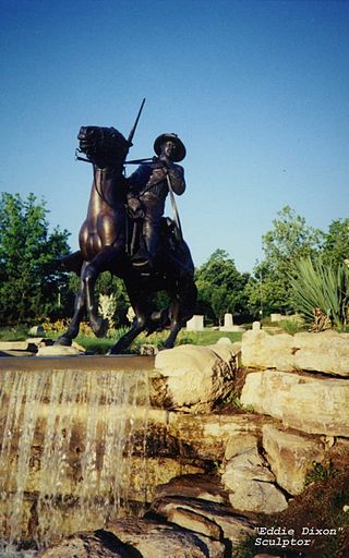
The Battle of Fort Tularosa occurred in May 1880 near the present-day town of Aragon in Catron County, New Mexico. In an ongoing campaign to keep from being forced to live on reservations, Chiricahua Apache warriors led by Victorio attacked Fort Tularosa north of San Francisco Plaza. Buffalo Soldiers from the United States Army's 9th Cavalry, led by Sergeant George Jordan, repulsed the attack.
Eagle Peak is a mountain in Catron County, New Mexico, near the town of Reserve. The summit is the highest point in the Tularosa Mountains.
The Canyon Creek Mountains are a short 10 miles (16 km) long, mountain range located in southeast Catron County, New Mexico near the source of the Gila River and north of the Gila Wilderness. The Elk Mountains are adjacent northwest, where the continental divide passes from north to east on the south of the Plains of San Agustin.
Cooney's Tomb is a historic location near Alma, Catron County, New Mexico. Marked by a large boulder on the side of a roadway, it is the site where former Army Sergeant James C. Cooney was interred in 1880 after being killed by a group of Apaches.

Victorio's War, or the Victorio Campaign, was an armed conflict between the Apache followers of Chief Victorio, the United States, and Mexico beginning in September 1879. Faced with arrest and forcible relocation from his homeland in New Mexico to San Carlos Indian Reservation in southeastern Arizona, Victorio led a guerrilla war across southern New Mexico, west Texas and northern Mexico. Victorio fought many battles and skirmishes with the United States Army and raided several settlements until the Mexican Army killed him and most of his warriors in October 1880 in the Battle of Tres Castillos. After Victorio's death, his lieutenant Nana led a raid in 1881.

The Gila Group is a group of geologic formations found along the upper tributaries of the Gila River in Arizona and New Mexico. Radiometric dating of lava flows within the group yields an age of Miocene to Quaternary.
Rivers is a census-designated place in Catron County, New Mexico, United States. Its population was 28 as of the 2010 census. The community is located at the confluence of the Tularosa River into the San Francisco River.
Greens Gap is an extinct town in Catron County, in the U.S. state of New Mexico. The GNIS classifies it as a populated place.
![]() Media related to Tularosa River at Wikimedia Commons
Media related to Tularosa River at Wikimedia Commons