The surface of the river is usually frozen from early November to mid-May, but safe circulation on the ice generally occurs from mid-November to the end of April.
Geography
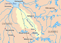
The main hydrographic slopes adjacent to the Turcotte River are:
The Turcotte River originates at the mouth of Upper Turcotte Lake (length: 1.1 kilometres (0.68mi); altitude: 311 metres (1,020ft)) in the eastern part of the Cochrane District, in Ontario.
The mouth of Upper Turcotte Lake is located at:
20.4 kilometres (12.7mi) at west of the boundary between Ontario and Quebec;
28.1 kilometres (17.5mi) at northwest of the mouth of the Turcotte River (confluence with the Turgeon River);
55.7 kilometres (34.6mi) at southwest of the mouth of the Turgeon River (in Quebec);
67.4 kilometres (41.9mi) at southeast of a southern bay of Kesagami Lake in Ontario.
From the mouth of the Upper Turcotte Lake, the Turcotte River runs on 51.1 kilometres (31.8mi) in the following segments:
1.6 kilometres (0.99mi) southeast to a stream (coming from the north);
9.8 kilometres (6.1mi) southwest to the western discharge of two unidentified lakes;
2.8 kilometres (1.7mi) to the south-east by crossing marsh areas to the outlet of Lake Walford (coming from the Northeast);
6.5 kilometres (4.0mi) southeast to the confluence of the Little Turcotte River (coming from the northwest);
2.9 kilometres (1.8mi) southeasterly to the mouth of Lake Sigal (length: 1.1 kilometres (0.68mi); altitude: 273 metres (896ft)) the current crosses eastward on 0.2 kilometres (0.12mi) the northern part;
9.5 kilometres (5.9mi) northeast by collecting a creek (from the north), then the east, to a stream (coming from the northwest);
5.6 kilometres (3.5mi) at southward by winding to the northern limit of the Township of Bradette;
1.9 kilometres (1.2mi) southward in the Township of Bradette, to the discharge (coming from the northwest) of Lake Poulos;
2.3 kilometres (1.4mi) at south to the boundary between Ontario and Quebec.[2]
The Turcotte River flows to the northwest bank of the Turgeon River. This confluence is located at: southwest of the mouth of the Turgeon River (confluence with the Harricana River);
1.0 kilometre (0.62mi) at east of the boundary between Quebec and Ontario;
87.1 kilometres (54.1mi) at west of the center of the village of Joutel, Quebec, in Quebec;
This page is based on this Wikipedia article Text is available under the CC BY-SA 4.0 license; additional terms may apply. Images, videos and audio are available under their respective licenses.