
U.S. Route 75 is a north–south U.S. Highway that runs 1,239 miles (1,994 km) in the central United States. The highway's northern terminus is located at the Canadian border near Noyes, Minnesota, at a now-closed border crossing. From this point, the highway once continued farther north as Manitoba Highway 75. Its southern terminus is located at Interstate 30 (I-30) and I-45 in Dallas, Texas, where US 75 is known as North Central Expressway.

U.S. Route 71 or U.S. Highway 71 is a major north–south United States highway that extends for over 1500 miles (2500 km) in the central United States. This original 1926 route has remained largely unchanged by encroaching Interstate highways. Currently, the highway's northern terminus is in International Falls, Minnesota at the Canada–US border, at the southern end of the Fort Frances-International Falls International Bridge to Fort Frances, Ontario. U.S. Route 53 also ends here. On the other side of the bridge, Trans-Canada Highway is an east–west route while Ontario Highway 71 is a north–south route. US 71's southern terminus is between Port Barre and Krotz Springs, Louisiana at an intersection with U.S. Route 190. For the entirety south of Kansas City, Missouri, US 71 runs parallel and concurrent with the existing and future Interstate 49. North of Kansas City, US 71 runs halfway between Interstate 29 and Interstate 35, which they split in the city at an interchange with Interstate 70.

Interstate 244 (I-244), also known as the Martin Luther King Jr. Memorial Expressway since 1984, the Crosstown Expressway, and the Red Fork Expressway, is a 15.8-mile-long (25.4 km) east–west Interstate Highway bypass route of I-44 in Tulsa, Oklahoma.

U.S. Route 54 is an east–west United States Highway that runs northeast–southwest for 1,197 miles (1,926 km) from El Paso, Texas, to Griggsville, Illinois. The Union Pacific Railroad's Tucumcari Line runs parallel to US 54 from El Paso to Pratt, Kansas, which comprises about two-thirds of the route. Truckers refer to this road as "The Bee Line."

U.S. Route 270 (US 270) is a spur of US 70. It travels for 643 miles (1,035 km) from Liberal, Kansas at US 54 and US 83 to White Hall, Arkansas at Interstate 530 (I-530) and US 65. It travels through the states of Arkansas, Oklahoma, and Kansas. It travels through the cities of Oklahoma City, Oklahoma, Hot Springs, Arkansas, and McAlester, Oklahoma.

Interstate 76 (I-76) is an east–west Interstate Highway in the Western United States that runs from I-70 in Arvada, Colorado – near Denver – to an interchange with I-80 near Big Springs, Nebraska. The highway measures 187.29 miles (301.41 km) long, mostly situated in Colorado but approximately three miles (4.8 km) of which is in Nebraska. Along the route, the highway runs concurrent with US Route 6 (US 6), US 85 in the Denver metropolitan area, and US 34 from Wiggins to Fort Morgan. It has no auxiliary Interstates, but it has two business routes that are located in northeastern Colorado. This route is not connected with the other I-76 that spans from Ohio to New Jersey.

State Highway 66 is a 192.7-mile (310.1 km) state highway in the U.S. state of Oklahoma, beginning at U.S. Highway 81 in El Reno and ending at U.S. Highway 60 near White Oak. The highway was designated in 1985 as a replacement for the decommissioned U.S. Highway 66. Although most of the highway follows Historic Route 66, the highway follows US 66's final alignment, joining Interstate 44 through Tulsa and Oklahoma City, while older versions of the route follow various city streets through both cities.

Route 13 is a highway in Missouri which runs almost the entire north–south length of the state. Its northern terminus is at U.S. Route 69/136 in Bethany. Its southern terminus is at the Arkansas state line in downtown Blue Eye, Missouri–Arkansas where it continues as Highway 21. It is one of the original state highways of Missouri.

K-96 is a 300-mile-long (480 km) state highway in central and southern Kansas. Its western terminus is at the Colorado state line east of Towner, Colorado, where it continues as Colorado State Highway 96; its eastern terminus since 1999 is at U.S. Route 54/U.S. Route 400 in eastern Wichita.

State Route 132 is a state highway in the U.S. state of California that connects the Central Valley with the Sierra Nevada foothills and the California Gold Country. Its western segment also connects the city of Modesto with the San Francisco Bay Area via I-580, although this route is discouraged due to it being a two-lane road between Modesto and Interstate 5. East of Modesto, the road climbs the foothills and eventually ends at SR 49 at Coulterville.

Interstate 635 (I-635) is a connector highway between I-35 in Overland Park, Kansas, and I-29 in Kansas City, Missouri, approximately 12 miles (19 km) long. It is mostly in the US state of Kansas, servicing the city of Kansas City, Kansas, but extends into Kansas City, Missouri, as well. The freeway's southern terminus is at a stack interchange with I-35. South of this, the mainline becomes an expressway carrying U.S. Route 69 (US 69).
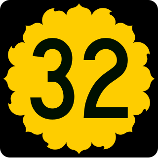
K-32, also known as the Kaw Valley Scenic Highway, is an approximately 32.2-mile-long (51.8 km) east–west state highway in the Kansas City metropolitan area of Kansas. K-32's western terminus is just outside Lawrence at U.S. Route 24 (US-24) and US-40. Its eastern terminus is at US-69, also known as the 18th Street Expressway, in Kansas City. Along the way it intersects several major highways, including K-7 in Bonner Springs as well as Interstate 435 (I-435) and I-635 in Kansas City. In Kansas City, K-32 follows the Turner Diagonal from Kaw Drive to Kansas Avenue. From its western terminus to Bonner Springs, the highway is a two-lane rural highway; the remaining section is a four-lane highway that runs through residential areas.

Shawnee Mission Parkway is a stretch of roadway in Johnson County, Kansas and Jackson County, Missouri. Its western terminus at K-7 in Shawnee, Kansas and its eastern terminus at Ward Parkway in Kansas City, Missouri. The roadway is signed as US 56 from Interstate 35 to its eastern terminus, with US-69 overlapping from I-35 to Metcalf Avenue, and US-169 overlapping from I-35 to Rainbow Boulevard.
The 18th Street Expressway is a freeway in Kansas City, Kansas that runs from Interstate 35 north to Interstate 70/U.S. Route 24/U.S. Route 40. It carries the U.S. Route 69 designation its entire length.

K-4 is the longest designated state highway in Kansas, at 369.079 miles (593.975 km). It begins north of Scott City at U.S. Route 83 (US-83) and travels eastward to US-59 near Nortonville in northeast Kansas. A segment of the highway in Saline County overlaps Interstate 135 (I-135) and US-81, and a section in Topeka runs concurrent with I-70. It also intersects several other major highways, including US-283 in Ransom, US-183 in La Crosse, US-281 in Hoisington, US-77 in Herington, I-470 and US-75 in Topeka, and US-24 northeast of Topeka.

In Oklahoma, U.S. Highway 62 (US 62) runs diagonally across the state, from the Texas state line in far southwestern Oklahoma to the Arkansas state line near Fayetteville. US-62 spends a total of 402.48 miles (647.73 km) in the Sooner State. The highway passes through fifteen of Oklahoma's counties. Along the way the route serves two of Oklahoma's largest cities, Lawton and Oklahoma City, as well as many regionally important cities, like Altus, Chickasha, Muskogee, and Tahlequah. Despite this, US-62 has no lettered spur routes like many other U.S. routes in Oklahoma do.

State Road 504 (SR 504), also known as the Flatbush Avenue Connector, is a two-lane divided freeway in Connecticut that runs 0.70 miles (1.13 km) within the city of Hartford. Its southern terminus is an intersection with Flatbush Avenue and the northern terminus is the interchange with Interstate 84 (I-84) and U.S. Route 6 (US 6) at exit 45.

U.S. Route 169 (US-169) is a major north–south U.S. Highway that runs from US-64 in Tulsa, Oklahoma, to US-53 near Virginia, Minnesota. In Kansas, the highway is a main north–south route that runs through the eastern end of the state from the Oklahoma border to Missouri border. Along the way US-169 intersects several major highways including US-400 by Cherryvale, US-54 by Iola, overlaps US-59 south of Garnett, overlaps I-35 from Olathe to Merriam, and in Kansas City begins an overlap with I-70, US-24 and US-40 which it follows into Missouri.

U.S. Route 69 (US-69) is a major north-south U.S. Highway that runs from Port Arthur, Texas to Albert Lea, Minnesota. In Kansas, the highway runs in the far eastern part of the state, usually within five miles of the Missouri state line. Most of the highway north of Fort Scott runs as a freeway.
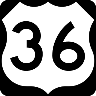
U.S. Route 36 is a United States highway that travels from Rocky Mountain National Park, Colorado to Uhrichsville, Ohio. In Colorado, the highway traverses an east–west route mostly in the northern portion of the Great Plains. At its west end, the road connects several small mountain towns such as Estes Park and Lyons to the larger metropolitan areas of Boulder and Denver. As it continues eastward, it connects to several other small towns and rural highways on the plains before crossing the state line into Kansas.


