
The Hoher Weißzint is a mountain in the Zillertal Alps on the border between Tyrol, Austria, and South Tyrol, Italy.

The Agglsspitze is a mountain in South Tyrol, Italy.
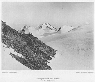
The Botzer is a mountain in the Stubai Alps in South Tyrol, Italy.

The Äußerer Bärenbartkogel is a mountain in the Planeil group of the Ötztal Alps in South Tyrol, Italy.
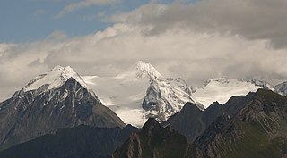
The Hochfeiler is a mountain, 3,510 metres high, and the highest peak in the Zillertal Alps on the border between Tyrol, Austria, and South Tyrol, Italy.

The Hochfernerspitze is a mountain in the Zillertal Alps in South Tyrol, Italy.

The III. Hornspitze is a mountain in the Zillertal Alps on the border between Tyrol, Austria, and South Tyrol, Italy.

The Langtauferer Spitze is a mountain in the Weisskamm group of the Ötztal Alps on the border between Tyrol, Austria, and South Tyrol, Italy.

The Lodner is a mountain in the Ötztal Alps in South Tyrol, Italy.

The Großer Löffler is a mountain in the Zillertal Alps on the border between Tyrol, Austria, and South Tyrol, Italy.

The Östliche Marzellspitze is a mountain in the Ötztal Alps on the border between Tyrol, Austria, and South Tyrol, Italy.

The Schwarzenstein is a mountain in the Zillertal Alps on the border between Tyrol, Austria, and South Tyrol, Italy.
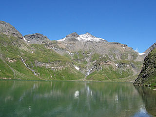
The Wilde Kreuzspitze is a mountain in the Zillertal Alps in South Tyrol, Italy.
The Alpine Club Guides were the standard series of alpine climbing guidebookss that cover all the important mountain groups in the Eastern Alps. They were produced jointly by the German (DAV), Austrian (ÖAV) and South Tyrol Alpine Clubs (AVS). They had been published since 1950 by the firm of Bergverlag Rother in Munich, Germany.

The Gefrorene-Wand-Spitzen are two summits on the Tux Crest, a mountain chain in the Zillertal Alps, one of the ranges of the central Eastern Alps in the Austrian state of Tyrol. The north summit (Nordgipfel) is recorded as 3,286 metres high in the literature, but is 3,288 metres high according to the Federal Office for Metrology and Survey. The south summit (Südgipfel), by contrast, is only 3,270 metres high. The two peaks are about 300 metres apart. They appear from the north as a stubby, cone-shaped, firn-covered dome, but from the east as a forbidding, dark rock face. Sharp, prominent ridges radiate from the peaks to the northeast and southwest, along the main crest of the mountain range. The twin peaks are the highest points in the summer skiing area of the Hintertux Glacier and, since the end of the 1990s, have been accessible from Hintertux on cable cars and ski lifts; which makes them a popular destination for day trippers. The north summit was first conquered in 1867 by Dr. Berreitter, the south summit on 7 September 1872 by brothers Max and Richard von Frey from Salzburg.
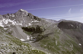
The Hoher Riffler is a 3,231 metre high mountain in the Zillertal Alps, on the eastern part of the main chain of the Tux, in the Austrian state of Tyrol. The peak is firn-covered on its northern side, but from the south it looks like a rocky summit. Ridges run from the top towards the southwest, north, northeast and southeast, some of them carrying approach paths. The summit is easily attained from the mountain hut of Spannagelhaus to the west or the Friesenberghaus to the south and, as a result, is often visited. In winter it is an easy destination for ski mountaineers. The peak was first ascended during the Austrian national survey. The first tourist climber, according to the literature, was one H. Weber, guided by Georg Samer in 1875.
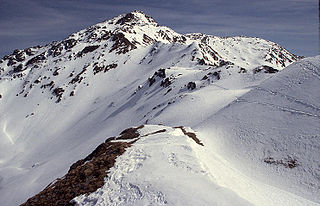
The Rastkogel is a 2,762 metre high, pyramidal, mountain on the main crest of the Tux Alps in the Austrian federal state of Tyrol.

The Große Möseler, also called the Mösele, is a mountain, 3,480 m (AA), and thus the second highest peak in the Zillertal Alps after the Hochfeiler (3,509 m). It lies on the Zillertal main ridge which forms the border here between the Austrian state of Tyrol and the Italian province of South Tyrol. Its great size makes it the dominant mountain in the area. Seen from the northwest it appears like a firn-covered dome; but from the northeast as a regularly shaped cone of rock. Prominent arêtes radiate from the peak to the northwest, east and south. The mountain is easily ascended from the Furtschaglhaus and is often visited as a result. It was first climbed on 16 June 1865 by G. H. Fox, Douglas William Freshfield and Francis Fox Tuckett with mountain guides, François Devouassoud from Chamonix and Peter Michel from Grindelwald, as well as two unknown bearers.
The Jochköpfl is a mountain, 3,143 m (AA), on the Windach-Brunnenkogel-Kamm, a subgroup of the Stubai Alps in Austria.


