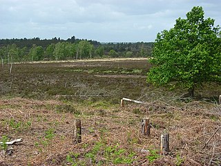
Thurstaston Common is an area of almost 250 acres (100 ha) of parklands, wood and heath between Frankby and Thurstaston, on the Wirral Peninsula in North West England. The common is jointly owned by the National Trust and the Metropolitan Borough of Wirral. Royden Country Park is nearby and offers additional facilities.

Lambert's Castle is an Iron Age hillfort in the county of Dorset in southwest England. Since 1981 it has been designated as a Site of Special Scientific Interest (SSSI) on account of its geology, archaeology and ecology. The hillfort is designated a scheduled monument together with a bowl barrow, the sites of a post-medieval fair and a telegraph station. The site was on the Heritage at Risk Register but was removed in 2022 as a result of the Hillforts and Habitats Project.
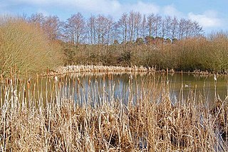
Ebblake Bog is a 11.3-hectare (28-acre) biological Site of Special Scientific Interest in Dorset and Hampshire, located west of Ringwood. It is part of Dorset Heathlands Ramsar site and Special Protection Area, and of Dorset Heaths Special Area of Conservation,
Hothfield Common is a 56.5-hectare (140-acre) biological Site of Special Scientific Interest north-east of Ashford in Kent. It is also a Local Nature Reserve, and is part of the 86-hectare (210-acre) Hothfield Heathlands nature reserve owned by Ashford Borough Council and managed by Kent Wildlife Trust.
Gentleshaw Common is an area of common land situated in Gentleshaw on the northern side of Burntwood in Staffordshire, England. The area is a Site of Special Scientific Interest as it is an area of globally rare lowland heathland. The common plays host to a series of fun public events throughout the year, including scrub bashing and countryside walks.
Woolmer Forest is a 1,298.5-hectare (3,209-acre) biological Site of Special Scientific Interest south of Bordon in Hampshire and West Sussex. It is also a Special Area of Conservation and part of the Wealden Heaths Phase II Special Protection Area. Two areas are Nature Conservation Review sites, Grade I.
Sound Heath, also known as Sound Common, is an area of common land in Sound, near Nantwich in Cheshire, England, which includes heathland, grassland, scrub, woodland and wetland habitats. The majority of the area is designated a Site of Special Scientific Interest and a Local Nature Reserve.

Appleby Fells is a Site of Special Scientific Interest in the Eden district of Cumbria, England, near Appleby-in-Westmorland. The area is approximately a triangle with a right angle in the North East at Cow Green Reservoir. It extends westwards to near Knock and southwards to near Helbeck. The area overlaps the North Pennines AONB. The fells rise steeply above the Eden Valley, the scarp slope being deeply dissected by streams. Natural England states that "the great importance of the area lies in its rich variety of habitats and associated plant and animal species" and that "geologically there are important exposures of the Great Whin Sill quartz dolerite". According to data from Natural England the condition of 93% of the SSSI is designated "Unfavourable Recovering" and less than 5% is "Favourable".

Pow Hill Bog is a Site of Special Scientific Interest in the Wear Valley district of County Durham, England. It lies alongside Derwent Reservoir, approximately 2 km north-west of the village of Edmundbyers and adjacent to the Edmundbyers Common portion of the Muggleswick, Stanhope and Edmundbyers Commons and Blanchland Moor SSSI.

Rosenannon Downs is a nature reserve in mid Cornwall, England, UK, being designated Rosenannon Bog and Downs Site of Special Scientific Interest (SSSI), noted for its biological characteristics. The site supports a wide variety of flora and fauna and includes Bronze Age barrows. Conservation work is carried out on the site by the owners, the Cornwall Wildlife Trust.

Kingsley Common is a 41-hectare (100-acre) protected area in Kingsley, Hampshire, England. The site holds many rare species of animals and birds. Some species of plants and animals may also be subject to special protection under Part I of the Wildlife and Countryside Act 1981, or under the Habitats Regulations 1994.

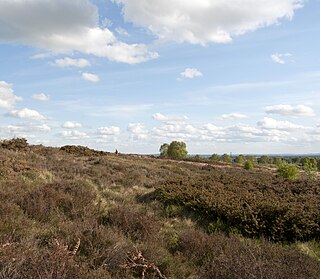
The Dorset Heaths form an important area of heathland within the Poole Basin in southern England. Much of the area is protected.

Chyenhal Moor is a poorly drained shallow valley, 2 miles (3.2 km) to the south-west of Penzance, Cornwall. Due to several rare plants in a diverse range of habitats, it was notified as a Site of Special Scientific Interest (SSSI) in 1951.

Allendale Moors is a Site of Special Scientific Interest (SSSI) in Northumberland, England. The upland moorland ridge site is listed for its heath, flush and upland grassland which provide a habitat for a nationally important assemblage of moorland breeding birds.

Bewick and Beanley Moors is the name given to a Site of Special Scientific Interest (SSSI) in north Northumberland, in the north-east of England. The moors are asserted to be of national importance by Natural England for the extent, quality and diversity of upland types including heaths, fens, wet grassland, flushes, mires and blanket bogs, together creating an extensive mosaic habitat supporting an exceptional community of amphibians. The moors are important, too, for their relict juniper woodland and scrub.

Moine Mhòr encompasses a large area of raised bog in the Kilmartin Glen area of Argyll and Bute, Scotland. As well as raised bog there are areas of saltmarsh, brackish grassland, alder carr, fen and woodland, and the variety of habitats at Moine Mhòr provide important habitats for a variety of animal and plant species. The area was declared a national nature reserve (NNR) in 1987, and is now owned and managed by NatureScot. According to NatureScot lowland raised bogs like Moine Mhòr are some of the rarest and most threatened natural wildlife habitats in Europe, due to removal of peat, afforestation and reclamation of farmland.

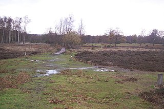
Tadnoll and Winfrith Heath is a nature reserve of the Dorset Wildlife Trust, near the village of Winfrith Newburgh in Dorset, England. There is heathland and wetland in the reserve.
Bowness Common is a Site of Special Scientific Interest (SSSI) between Cardurnock and Glasson in Cumbria, England. This protected area includes South Solway Mosses National Nature Reserve. Bowness Common SSSI also includes the southern section of Campfield Marsh Nature Reserve, managed by the Royal Society for the Protection of Birds.
Ham Common is a Site of Special Scientific Interest (SSSI) within Dorset Heathlands Ramsar site, in Dorset, England. It is located near Hamworth and includes a stretch of cliff along the north side of Poole Harbour.
Chasewater and the Southern Staffordshire Coalfield Heaths is a Site of Special Scientific Interest in Staffordshire, England. It is located between Brownhills and Hednesford. The protected area includes Brownhills Common and the Chasewater Reservoir. It also includes Biddulph's Pool and No Man's Bank.