Twain Harte Dam

Last updated
Twain Harte Dam
Coordinates 38°1′43.04″N120°14′37.44″W / 38.0286222°N 120.2437333°W / 38.0286222; -120.2437333
Opening date1928

Twain Harte Dam (National ID # CA00649) is a multiple arch dam in Tuolumne County, California. Its reservoir is Twain Harte Lake and it is located near Twain Harte, California.

Arch dam solid dam made of concrete that is curved upstream in plan

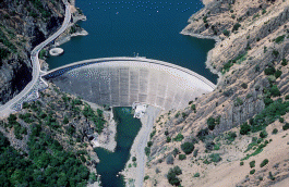
An arch dam is a concrete dam that is curved upstream in plan. The arch dam is designed so that the force of the water against it, known as hydrostatic pressure, presses against the arch, compressing and strengthening the structure as it pushes into its foundation or abutments. An arch dam is most suitable for narrow canyons or gorges with steep walls of stable rock to support the structure and stresses. Since they are thinner than any other dam type, they require much less construction material, making them economical and practical in remote areas.

Tuolumne County, California County in California, United States

Tuolumne County, officially the County of Tuolumne, is a county in the U.S. state of California. As of the 2010 census, the population was 54,179. The county seat and only incorporated city is Sonora.

Twain Harte, California census-designated place in California, United States

Twain Harte is a census-designated place (CDP) in Tuolumne County, California, United States. The population was 2,226 at the 2010 census, down from 2,586 at the 2000 census. Its name is derived from the last names of two famous authors who lived in California, Mark Twain and Bret Harte.

Developers began building Twain Harte Dam in the summer of 1927. [1] It was completed in 1928 and is owned by the Twain Harte Lake Association. [2] The dam is 36 feet (11 m) high, 325 feet (99 m) in length, and 8 feet (2.4 m) in width. [3] The dam has a crest elevation of 3,509.8 feet (1,069.8 m) and its volume is 1,197 cubic yards (915 m3).

In August 2014, fracturing of a granite dome known as "the Rock" located adjacent to the dam forced the closing and draining of the lake for safety reasons. [4] [5] It was feared the dam would fail and there would be a flash flood in Sullivan Creek. [6] The cause of this fracturing is a process known as exfoliation . [7]
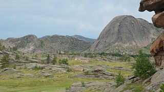
Granite dome Rounded hills of bare granite formed by exfoliation

Granite domes are domical hills composed of granite with bare rock exposed over most of the surface. Generally, domical features such as these are known as bornhardts. Bornhardts can form in any type of plutonic rock but are typically composed of granite and granitic gneiss. As granitic plutons cool kilometers below the earth’s surface, minerals in the rock crystallize under uniform confining pressure. Erosion brings the rock closer to earth’s surface and the pressure from above the rock decreases; as a result the rock fractures. These fractures are known as exfoliation joints, or sheet fractures, and form in onionlike patterns that are parallel to the land surface. These sheets of rock peel off the exposed surface and in certain conditions develop domical structures. Additional theories on the origin of granite domes involve scarp-retreat and tectonic uplift.

Exfoliation joint

Exfoliation joints or sheet joints are surface-parallel fracture systems in rock, and often leading to erosion of concentric slabs. (See Joint.

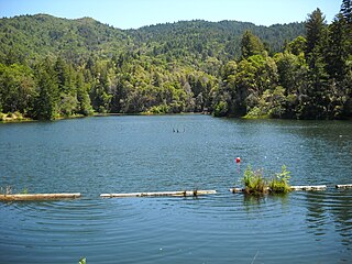
Twain Harte Lake is the name of the reservoir created by Twain Harte Dam. It has a normal water surface of 12 acres (4.9 ha), and a maximum capacity of 143 acre feet (176,000 m3). Its drainage area is 1.04 square miles (2.7 km2). The lake is used for recreation and is available only to members of the Twain Harte Lake Association.

Drainage basin Area of land where precipitation collects and drains off into a common outlet

A drainage basin is any area of land where precipitation collects and drains off into a common outlet, such as into a river, bay, or other body of water. The drainage basin includes all the surface water from rain runoff, snowmelt, and nearby streams that run downslope towards the shared outlet, as well as the groundwater underneath the earth's surface. Drainage basins connect into other drainage basins at lower elevations in a hierarchical pattern, with smaller sub-drainage basins, which in turn drain into another common outlet.

See also

Related Research Articles

Lake Mead reservoir on the Colorado River in the U.S. states of Nevada and Arizona

Lake Mead lies on the Colorado River, about 24 mi (39 km) from the Las Vegas Strip, southeast of the city of Las Vegas, Nevada, in the states of Nevada and Arizona. It is the largest reservoir in the United States in terms of water capacity. Formed by the Hoover Dam, the reservoir serves water to the states of Arizona, California, and Nevada, as well as some of Mexico, providing sustenance to nearly 20 million people and large areas of farmland.

St. Francis Dam architectural structure

The St. Francis Dam was a curved concrete gravity dam, built to create a large regulating and storage reservoir for the city of Los Angeles, California. The reservoir was an integral part of the city's Los Angeles Aqueduct water supply infrastructure. It was located in San Francisquito Canyon of the Sierra Pelona Mountains, about 40 miles (64 km) northwest of downtown Los Angeles, and approximately 10 miles (16 km) north of the present day city of Santa Clarita.

Castaic Dam

Castaic Dam is an embankment dam in northern Los Angeles County, California, near the unincorporated area of Castaic. Although located on Castaic Creek, a major tributary of the Santa Clara River, Castaic Creek provides little of its water. The lake is the terminus of the West Branch of the California Aqueduct, part of the State Water Project. The dam was built by the California Department of Water Resources and construction was completed in 1973. The lake has a capacity of 325,000 acre feet (401,000,000 m3) and stores drinking water for the western portion of the Greater Los Angeles Area.

Millerton Lake in California

Millerton Lake is an artificial lake near the town of Friant about 15 mi (24 km) north of downtown Fresno. The reservoir was created by the construction of 319 ft high Friant Dam on the San Joaquin River which, with the lake, serves as much of the county line between Fresno County to the south and Madera County to the north.

Monticello Dam

Monticello Dam is a 304-foot (93 m) high concrete arch dam in Napa County, California, United States constructed between 1953 and 1957. The dam impounded Putah Creek to create Lake Berryessa in the Vaca Mountains.

Lake Del Valle is a storage reservoir located 10 miles (16 km) southeast of Livermore, in Alameda County, California. It is within Del Valle Regional Park.

Silverwood Lake lake of the United States of America

Silverwood Lake is a large reservoir in San Bernardino County, California, United States, located on the West Fork Mojave River, a tributary of the Mojave River in the San Bernardino Mountains. It was created in 1971 as part of the State Water Project by the construction of the Cedar Springs Dam as a forebay on the 444-mile (715 km) long California Aqueduct, and has a capacity of 73,000 acre feet (90,000,000 m3).

Hollywood Reservoir park in the united states

Hollywood Reservoir, also known as Lake Hollywood, is a reservoir located in the Hollywood Hills, situated in the Santa Monica Mountains north of the Hollywood neighborhood of Los Angeles, California. It is maintained by the Los Angeles Department of Water and Power. The reservoir and surrounding neighborhood are overlooked by the Hollywood Sign.

Lake Lagunitas lake of the United States of America

Lake Lagunitas is a reservoir on Lagunitas Creek in Marin County, California.

Anderson Lake (California)

Anderson Lake, informally called Anderson Reservoir, is an artificial lake in Santa Clara County, California, United States, near Morgan Hill. A 4,275-acre (1,730 ha) county park surrounds the reservoir and provides limited fishing, picnicking, and hiking activities. Although swimming is prohibited, boating, water-skiing and jet-skiing are permitted in the reservoir.

Lower Otay Reservoir

Lower Otay Reservoir is a reservoir in San Diego County, southern California. It is flanked by Otay County Open Space Preserve in the San Ysidro Mountains on the east, and the city of Chula Vista on the west.

San Gabriel Dam dam on the San Gabriel River in Los Angeles County, California, USA

San Gabriel Dam is a rock-fill dam on the San Gabriel River in Los Angeles County, California, within the Angeles National Forest. Completed in 1939, the dam impounds the main stem of the San Gabriel River about 2.5 miles (4.0 km) downstream from the confluence of the river's East and West Forks, which drain a large portion of the San Gabriel Mountains. It is located directly upstream from the Morris Dam. The dam provides flood control, groundwater recharge flows and hydroelectricity for the heavily populated San Gabriel Valley in the Greater Los Angeles metropolitan area.

New Don Pedro Dam

New Don Pedro Dam, often known simply as Don Pedro Dam, is an earthen embankment dam across the Tuolumne River, about 2 miles (3.2 km) northeast of La Grange, in Tuolumne County, California. The dam was completed in 1971, after four years of construction, to replace the 1924 concrete-arch Don Pedro Dam.

Antelope Dam (California)

Antelope Dam or Antelope Valley Dam is a dam in Plumas County, California, part of the California State Water Project.

Lyons Dam is a dam in Tuolumne County, California.

The proposed Sites Reservoir would be a large offstream reservoir in the Sacramento Valley in Northern California, a project of the California Department of Water Resources. Its primary purpose is to collect winter flood flows from the Sacramento River, diverting the water upstream of the Sacramento–San Joaquin River Delta and pumping it into an artificial lake located west of Colusa. The estimated water yield would be between 470,000 to 640,000 acre feet per year, depending on yearly rainfall and environmental regulations.

Morena Dam

Morena Dam is a rockfill dam across Cottonwood Creek, a tributary of the Tijuana River, in southern San Diego County, California in the United States. Originally completed in 1912 and raised several times afterward, the dam is one of the oldest components of the city of San Diego's municipal water system, providing between 1,600 to 15,000 acre feet of water per year. It is one of the few facilities in the San Diego water supply system that relies entirely on local runoff.

References

  1. "Twain Harte Area History". Twain Harte Area Chamber of Commerce. 2014. Retrieved 14 September 2014.
  2. "Twain Harte Lake Association". Twain Harte Lake Association. 2014. Retrieved 14 September 2014.
  3. "Dams Within the Jurisdiction of the State of California (T-Z)" (PDF). California Department of Water Resources, Division of Safety of Dams. Retrieved 14 September 2014.
  4. Heise, Sarah (4 August 2014). "Twain Harte dam closed after dam springs leak". KCRA. Retrieved 14 September 2014.
  5. Caskey, Chris (5 August 2014). "New cracking at Twain Harte Lake dam worrisome". Union Democrat. Retrieved 14 September 2014.
  6. Caskey, Chris (4 August 2014). "Twain Harte Lake Dam leak rattles residents". Union Democrat. Retrieved 14 September 2014.
  7. Johnson, Scott K. (10 September 2014). "A big chunk of the Sierra Nevada caught fracturing on video". Ars Technica . Condé Nast . Retrieved 14 September 2014.