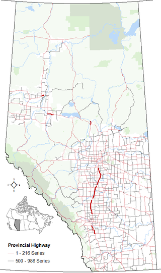
Highway 2A is the designation of six alternate routes off Highway 2 in Alberta, Canada. In general, these are original sections of Highway 2, such as the southern portion of Macleod Trail in Calgary. They passed through communities before limited-access freeways were built to shorten driving distance, accommodate heavier volumes and to bypass city traffic. Portions of the alignment of Highway 2A follow the route of the former Calgary and Edmonton Trail.

Valleyview is a town in northwest Alberta, Canada. It is surrounded by the Municipal District of Greenview No. 16 and in Census Division No. 18.
Teepee Creek is a hamlet in northwest Alberta, Canada within the County of Grande Prairie No. 1. It is located north of Bezanson and east of Sexsmith, at the intersection of Highway 674 and Highway 733.

Northern Sunrise County is a municipal district in northern Alberta, Canada. Located in Census Division 17, its municipal office is located east of the Town of Peace River at the intersection of Highway 2 and Highway 688.

The Northern Woods and Water Route is a 2,400-kilometre (1,500 mi) route through northern British Columbia, Alberta, Saskatchewan and Manitoba in Western Canada. As early as the 1950s, community groups came together to establish a northern travel route; this was proposed as the Northern Yellowhead Transportation Route. The Northern Woods and Water Route Association was established in 1974, and encouraged promotion of the route with the promise of an increase in tourist travel. The route was designated in 1974 and is well signed throughout its component highways. The route starts at Dawson Creek as the Spirit River Highway and ends at the Perimeter of Winnipeg, Manitoba, after running through the northern regions of the western provinces. From west to east, the Northern Woods and Water Route (NWWR) incorporates portions of British Columbia Highway 49; Alberta Highways 49, 2A, 2, & 55; Saskatchewan Highways 55 & 9; Manitoba Provincial Road 283 and Trunk Highways 10, 5, 68 & 6. The halfway point of the NWWR is approximately at Goodsoil, Saskatchewan.

Nisku is a hamlet and an industrial/business park in Alberta, Canada, within Leduc County. It has an elevation of 705 metres (2,313 ft).

Southern Alberta is a region located in the Canadian province of Alberta. In 2016, the region's population was approximately 291,112. The primary cities are Lethbridge and Medicine Hat. The region is known mostly for agricultural production, but other sectors, such as alternative energy, film production and tourism, are emerging.

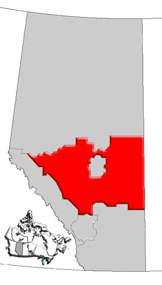
Central Alberta is a region located in the Canadian province of Alberta.

Northern Alberta is a geographic region located in the Canadian province of Alberta.

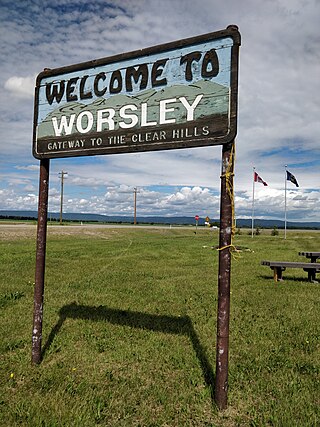
Worsley is a hamlet in northern Alberta, Canada within Clear Hills County. It is located in the Peace Country, at the northern end of Highway 726, approximately 18 km (11 mi) north of Highway 64, 59 km (37 mi) northwest of Hines Creek and 50 km (31 mi) east of the British Columbia border. It lies at an elevation of 650 m (2,130 ft) amidst prairie farmland and ranchland.
Cadotte Lake is an unincorporated community in Northern Sunrise County in northern Alberta, Canada. It is on the northern shore of the homonymous lake, along Highway 986, 79 km (49 mi) east of Peace River and 68 km (42 mi) west of the Bicentennial Highway.

The Onion Lake Cree Nation is a Plains Cree First Nations band government in Canada, straddling the Alberta/Saskatchewan provincial border approximately 50 km (31 mi) north of the City of Lloydminster.
Demmitt is a hamlet in northern Alberta, Canada within the County of Grande Prairie No. 1. It is located on Highway 43, approximately 77 kilometres (48 mi) northwest of Grande Prairie. The Northern Alberta Railway was built through the area in 1930 as it extended westwards towards Dawson Creek, British Columbia.
Goodfare is a hamlet in northern Alberta, Canada within the County of Grande Prairie No. 1. It is located on Highway 671, approximately 14 kilometres (8.7 mi) west of Highway 43 and 60 kilometres (37 mi) northwest of Grande Prairie.
Guy is a hamlet in northern Alberta, Canada within the Municipal District of Smoky River No. 130. It is located on Highway 49, approximately 113 kilometres (70 mi) northeast of Grande Prairie. The inhabitants are named "Guylois" and "Guyloise".
Huallen is a hamlet in northern Alberta, Canada within the County of Grande Prairie No. 1. It is located on Highway 43, approximately 35 kilometres (22 mi) west of Grande Prairie.
Marie Reine is a hamlet in northwest Alberta, Canada within Northern Sunrise County. It is located approximately 18 km (11 mi) south of the Town of Peace River on four quarter sections split by Highway 744.
Notikewin is a hamlet in northern Alberta, Canada within the County of Northern Lights. It is located along the Mackenzie Highway, approximately 6 kilometres (3.7 mi) north of the Town of Manning.
Fairview is a hamlet in southern Alberta, Canada within Lethbridge County. It is adjacent to the eastern boundary of Lethbridge, approximately 0.3 kilometres (0.19 mi) south of Highway 3. More specifically, it is located on southeast corner of Highway 4 and Highway 512.


