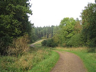
Rockingham Forest is a former royal hunting forest in the county of Northamptonshire, England. It is an area of some 200 sq mi (500 km2) lying between the River Welland and River Nene and the towns of Stamford and Kettering. It has a rich and varied landscape, with farmland, open pasture, pockets of woodland and villages built from local stone.
Bourne Woods are situated near Bourne, Lincolnshire, England, and includes Bourne Wood and Fox Wood.

The A151 road is relatively minor part of the British road system. It lies entirely in the county of Lincolnshire, England. Its western end lies at coordinates 52°48.1892′N0°36.5179′W otherwise, grid reference SK938238.
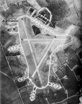
Royal Air Force North Witham or more simply RAF North Witham is a former Royal Air Force station located in Twyford Wood, off the A1 between Stamford and Grantham, Lincolnshire, England about 104 miles (167 km) north-northwest of London.

Delamere Forest is a large wood in the village of Delamere in Cheshire, England. The woodland, which is managed by Forestry England, covers an area of 972 hectares making it the largest area of woodland in the county. It contains a mixture of deciduous and evergreen trees.

Colsterworth is a village and civil parish in the South Kesteven district of Lincolnshire, England, less than half a mile (0.8 km) west of the A1, about 7 miles (11 km) south of Grantham, and 12 miles (19 km) north-west of Stamford. The village with the hamlet of Woolsthorpe-by-Colsterworth had a recorded population of 1,713 at the time of the 2011 census, in an area of 1,465 hectares.
North Witham is a small village and nominally a civil parish in South Kesteven, Lincolnshire, England. The village is located along the upper course of the River Witham 1.5 miles downstream (north) of South Witham, and approximately 9 miles (14 km) south from the nearest major town, Grantham. It has an estimated population of 143 in around 72 households, at a density of 0.1/hectare.
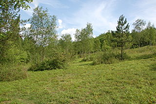
Denge Wood is a wood located 8 miles southwest of Canterbury in Kent, England. The wood is owned by the Forestry Commission and the Woodland Trust. Part of the wood is also privately owned. Much of Denge Wood is classified as ancient semi-natural woodland suggesting it has been in existence since at least 1600AD and probably longer.

Bedford Purlieus is a 211-hectare (520-acre) ancient woodland in Cambridgeshire, in the United Kingdom. It is a national nature reserve and Site of Special Scientific Interest owned and managed by the Forestry Commission. In Thornhaugh civil parish, 10 km (6.2 mi) south of Stamford and 14 km (8.7 mi) west of Peterborough, the wood is within the Peterborough unitary authority area of Cambridgeshire, and borders Northamptonshire. In Roman times it was an iron smelting centre, during the medieval period it was in the Royal Forest of Rockingham, and later it became part of the estates of the Duke of Bedford. Bedford Purlieus appears to have been continuously wooded at least from Roman times, and probably since the ice receded. The woodland may have the richest range of vascular plants of any English lowland wood. It acquired particular significance in the 1970s as an early subject for the historical approach to ecology and woodland management.
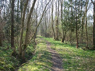
Potton Wood covers an area of 85ha and is two miles east of the small town of Potton in the county of Bedfordshire, England. It is part of Ampthill Forest and is managed by Forest Enterprise and owned by the Forestry Commission.

Scotland is ideal for tree growth, thanks to its mild winters, plentiful rainfall, fertile soil and hill-sheltered topography. As of 2019 about 18.5% of the country was wooded. Although this figure is well below the European Union (EU) average of 43%, it represents a significant increase compared to the figure of 100 years previously: in 1919 it was estimated that only 5% of the country's total land area was covered in forest. The Scottish Government's Draft Climate Change Plan has set an aim of increasing coverage to 21% of Scotland by 2032, with the rate of afforestation rising to 15,000 hectares per year by 2024.

Dymock Woods is a 53-hectare (130-acre) biological Site of Special Scientific Interest in Gloucestershire, notified in 1990. The site is listed in the 'Forest of Dean Local Plan Review' as a Key Wildlife Site (KWS).

Upper Wye Gorge is a Site of Special Scientific Interest (SSSI), noted for its biological and geological characteristics, around Symonds Yat in the Wye Valley on the Wales–England border. The site is listed in the 'Forest of Dean Local Plan Review' as a Key Wildlife Site (KWS).

Stapleford Woods form an area of ancient woodland and forest in Stapleford, Lincolnshire, England. The boundary of the ancient woods follows the county boundary between Lincolnshire and Nottinghamshire.

Dingle Wood is a 9.95-hectare (24.6-acre) biological Site of Special Scientific Interest in Gloucestershire, notified in 1972. The site is listed in the 'Forest of Dean Local Plan Review' as a Key Wildlife Site (KWS). The wood is located within the Forest of Dean Forest Park and the Wye Valley Area of Outstanding Natural Beauty.

East Wood and is a 0.82-hectare (2.0-acre) nature reserve in Gloucestershire, England. The west site is 0.45-hectare (1.1-acre). The east site is 0.37-hectare (0.91-acre). It is part of a larger area of woodland called East Wood, which is adjacent to Oakhill Wood and Woolaston Wood (east). The site was leased from the Forestry Commission in 1986 and is managed by the Gloucestershire Wildlife Trust. The site is listed in the 'Forest of Dean Local Plan Review' as a Key Wildlife Site (KWS).
Forestry England is a division of the Forestry Commission, responsible for managing and promoting publicly owned forests in England. It was formed as Forest Enterprise in 1996, before devolving to Forest Enterprise England on 31 March 2003 and then being rebranded to Forestry England on 1 April 2019.

Shabbington Woods Complex is a 305.6-hectare (755-acre) biological Site of Special Scientific Interest ( between Horton-cum-Studley and Worminghall in Buckinghamshire. It comprises Shabbington Wood, Bernwood Forest, Hell Coppice, Oakley Wood and York's Wood. Shabbington Wood is owned by the Forestry Commission, and a small area of 7.5 hectares called Bernwood Meadows is managed by the Berkshire, Buckinghamshire and Oxfordshire Wildlife Trust.
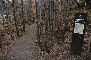
Glasdrum Wood is national nature reserve (NNR) at the head of Loch Creran in Argyll and Bute on the west coast of Scotland. Managed by NatureScot, the wood is renowned for its diverse flora and fauna, including sessile oak and ash trees, mosses, liverworts and rare invertebrates, like the chequered skipper butterfly. The NNR covers an area of around 169 hectares, encompassing woodland and hillside on the lower slopes of Beinn Churlain. A carpark and 1 km-long waymarked trail are provided for visitors. Since 2004 the reserve has received approximately 2800 visitors each year.

Glen Nant is a glen lying to the south of Taynuilt in the Argyll and Bute council area of Scotland. An area of woodland of 339 hectares on the western side of the River Nant is designated as national nature reserve (NNR), which is owned and managed by Forestry and Land Scotland (FLS). It is an example of an Atlantic Oakwood, and is one of largest areas of upland oak woodland in north Argyll.


