Balykchy is a town at the western end of Lake Issyk-Kul in Kyrgyzstan, at an elevation of about 1,900 metres. Its area is 38 square kilometres (15 sq mi), and its resident population was 42,875 in 2021. A major industrial and transport centre during the Soviet era, it lost most of its economic base after the collapse of the Soviet Union and the closure of virtually all of its industrial facilities.

The Ysyk-Köl Region is one of the regions of Kyrgyzstan. Its capital is Karakol. It is surrounded by Almaty Region, Kazakhstan to the north, Chüy Region to the west, Naryn Region to the southwest, and Xinjiang, China to the southeast. It takes its name from Lake Issyk-Kul, the world's second-largest high altitude lake. Its total area is 43,735 km2 (16,886 sq mi). The resident population of the region was 501,933 as of January 2021. The region has a sizeable Russian minority.
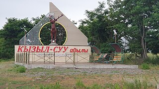
Kyzyl-Suu is a village in the Issyk-Kul Region of Kyrgyzstan. About 10km inland from Lake Issyk Kul on the A363 highway between Jeti-Ögüz resort and Barskoon, it is the capital of Jeti-Ögüz District. Its population was 15,075 in 2021.

Cholpon-Ata is a resort town on the northern shore of Lake Issyk-Kul in Kyrgyzstan with a population of 14,237 (2021). It is the administrative center of the Issyk-Kul District of Issyk-Kul Region; this district occupies most of the lake's north shore. To the west along highway A363 is Tamchy and to the east is Bosteri.

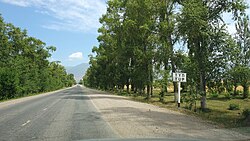
Barskoon is a settlement on the southern shore of Lake Issyk Kul in the Issyk-Kul Region of Kyrgyzstan. Its population was 9,040 in 2021. It is on the A363 highway between Bökönbaev to the west and Kyzyl-Suu to the east.

Bökönbai is a village in the Issyk-Kul Region of Kyrgyzstan. It is the seat of the Tong District and of the Kün-Chygysh village community. It was established as Kol'tsovka village in 1912. With a population of 14,267 (2021), it is the largest village on the south shore of lake Issyk Kul. Its industry has decayed since Soviet times. It is now a base for tourism into the mountains to the south. There are demonstrations of falconry with eagles. The road to the west to Balykchy goes through dry and less-attractive country.

Semyonovka is a village in the Issyk-Kul Region of Kyrgyzstan. It is part of the Issyk-Kul District. Its population was 3,439 in 2021.

Anan'yevo is a village in the Issyk-Kul Region of Kyrgyzstan. It is part of the Issyk-Kul District. Its population was 9,362 in 2021. Located on highway A363 on the north shore of Lake Issyk Kul, the next town to the west is Semyonovka, and to the east, Tüp. It was founded in 1871 as Sazonovka settlement and there is still a significant Russian population. In 1942, the village was renamed after one of the Panfilov's Twenty-Eight Guardsmen - Nikolay Yakovlevich Anan'yev, who was born in Sazonovka in 1912. There are a church and a mosque in the village.

Kuturgu is a village in the Issyk-Kul Region of Kyrgyzstan. It is part of the Tüp District. Its population was 2,172 in 2021.

Balbay is a village in the Issyk-Kul Region of Kyrgyzstan. It is part of the Tüp District. Its population was 2,837 in 2021.
Sary-Döbö is a village in the Issyk-Kul Region of Kyrgyzstan. It is part of the Tüp District. Its population was 1,967 in 2021.
Dolon is a village in the Issyk-Kul Region of Kyrgyzstan. It is part of the Tüp District. Its population was 1,220 in 2021.

Kochkor is a large village in northern Naryn Region of Kyrgyzstan. It is the administrative centre of Kochkor District. The village was established in 1909 as Stolypino and renamed to Kochkor in 1917. Altitude 1,800 m. Its population was 11,373 in 2021. It is on the main A365 highway from Torugart Pass (China) north to Bishkek. About 7 km west A367 branches west toward Jalal-Abad Region and the Ferghana Valley. About 25 km northeast along the highway is the Orto-Tokoy reservoir and about 45 km northeast is Balykchy on Lake Issyk-Kul. The village is a base for excursions into the high country and tourist infrastructure is fairly well developed. There is a regional museum.

Ak-Suu is a district of Issyk-Kul Region in eastern Kyrgyzstan. The administrative center lies at the village Teploklyuchenka. Its area is 9,917 square kilometres (3,829 sq mi), and its resident population was 69,439 in 2021.
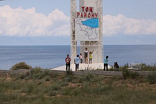
Tong is a district of Issyk-Kul Region in north-eastern Kyrgyzstan. The seat lies at Bökönbaev. Its area is 7,230 square kilometres (2,790 sq mi), and its resident population was 53,401 in 2021. Tong District borders Issyk-Kul District to the north-west, Jeti-Ögüz District to the south and south-east, Kochkor District to the south-west, Naryn District to the south, Kemin District to the north-west, and Issyk Kul - to the north.

Tüp is a district of Issyk-Kul Region in north-eastern Kyrgyzstan. The seat lies at Tüp. Its area is 2,121 square kilometres (819 sq mi), and its resident population was 65,169 in 2021. It borders Issyk-Kul District to the west, Ak-Suu District to the east and south-east, Kazakhstan to the north, and Issyk Kul to the south.

Issyk-Kul District is a district of Issyk-Kul Region in north-eastern Kyrgyzstan. The seat lies at Cholpon-Ata. Its area is 3,603 square kilometres (1,391 sq mi), and its resident population was 84,876 in 2021.
Ak-Bulak is a village in the Issyk-Kul Region of Kyrgyzstan. It is part of the Tüp District. Its population was 1,184 in 2021. Until 2012 it was an urban-type settlement.
San-Tash is a village in the Issyk-Kul Region of Kyrgyzstan. It is part of the Tüp District. The population of the village was 182 in 2021. It is located near highway of international significance ЭМ-08 connecting Tüp - Sary-Tologoy - Border of Kazakhstan.
Bayzak is a village in the Issyk-Kul Region of Kyrgyzstan. It is part of the Tüp District. The population of the village was 1770 in 2021. It is located along the highway of international significance ЭМ-08 connecting Tüp - Sary-Tologoy - border of Kazakhstan.