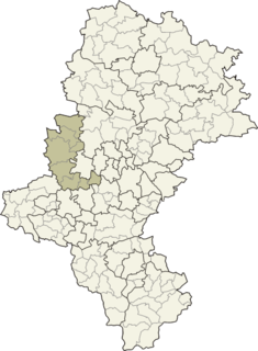
Pin Oak is an unincorporated community in Hampshire County in the U.S. state of West Virginia. Pin Oak is located along West Virginia Route 29 between Paw Paw and Forks of Cacapon. Pin Oak is roughly centered at the intersection of Pin Oak Road and Cabin Run Road with West Virginia Route 29. The old Pinoak School lies north of this intersection.
O'Neil is an unincorporated community in Nassau County, Florida, United States. It is located on State Road 200, to the east of Yulee and the west of Fernandina Beach, between Lanceford Creek and Kingsley Creek.
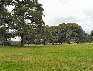
Llansannor is a small hamlet in the Vale of Glamorgan, Wales, United Kingdom.

The Smith & Wesson Model 4506 is a third-generation semi-automatic pistol from Smith & Wesson's 4500 series of handguns. The 4506 is chambered for the .45 ACP cartridge and, with the purchase of special springs, the stronger .45 Super. It is constructed almost entirely from stainless steel and is thus extremely resistant to harsh weather conditions. The 4506 is a traditional double-action/single-action pistol. The first shot is fired in double-action mode. Each subsequent shot is fired single-action mode. It features one-piece Xenoy wrap-around grips with either a curved or straight back strap. The 4506 was produced from 1988 to 1999.
Al Mushrif is a central neighborhood in the city of Abu Dhabi zone one. Al-Mushrif is located in an area between Sheikh Rashid Bin Saeed Street "Airport Road" and Arabian gulf Street, which extends to Mussafah Bridge. It contains the Al Mushrif Palace and Al Mushrif Park. It also contains the Women's Handicrafts Centre, demonstrating practices such as saddu and talli (embroidering).

Castle Close is a circular earthwork located near Stoodleigh in Mid Devon, England at OS grid reference SS937181. It is described on maps as a settlement. Situated some 208 metres above sea level, overlooking the River Exe, it is most likely to be an Iron Age Hill fort or enclosure.
5144 Achates, provisional designation 1991 XX, is a large Jupiter trojan from the Trojan camp, approximately 90 kilometers in diameter. It was discovered on 2 December 1991, by American astronomer Carolyn Shoemaker at the Palomar Observatory in southern California, United States. The assumed C-type asteroid has a rotation period of 6 hours, a notably eccentric orbit of 0.27, and belongs to the 40 largest Jupiter trojans. It was named after Achates from Greco-Roman mythology.
Shumlai is a town, and one of twenty union councils in Battagram District, in Khyber Pakhtunkhwa province of Pakistan. It is located at 34°42'20N 73°7'0E and has an altitude of 1567 metres.

The Roman Catholic Diocese of Legazpi is a diocese of the Latin Rite of the Roman Catholic Church. It constitutes the entire province of Albay in the Philippines.

Helenów is a village in the administrative district of Gmina Poświętne, within Wołomin County, Masovian Voivodeship, in east-central Poland.
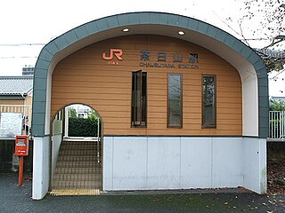
Chausuyama Station is a railway station on the Iida Line in Shinshiro, Aichi Prefecture, Japan. It is located 25.0 rail kilometers from the southern terminus of the Iida Line at Toyohashi Station.

Tokushuku Station is a train station in Hokota, Ibaraki Prefecture, Japan.
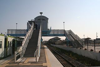
Urizura Station is a railway station on the Suigun Line in Naka, Ibaraki, Japan operated by East Japan Railway Company.

The Kanpur Memorial Church, originally called the All Souls' Cathedral is a church in Kanpur, India. It was built in 1875 in honour of the British who lost their lives during the Siege of Cawnpore in 1857.
Qareh Jeh is a village in Tamran Rural District, in the Central District of Kalaleh County, Golestan Province, Iran. At the 2006 census, its population was 251, in 53 families.
Etna Township is a township in Hardin County, Iowa, USA.

Re di Roma is a station on the Rome Metro. It is on Line A and is located in Appio Latino, between San Giovanni and Ponte Lungo stations.
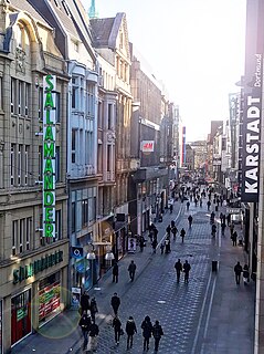
Westenhellweg is the main shopping street in Dortmund, Germany. With nearly 13,000 visitors per hour it was Germany's most frequented shopping street in 2013.

Homberg, Duisburg is a municipality and Stadtbezirk (district) within the city of Duisburg, Germany. The population is 39 725 and the district has an area of 37.1 km². It consists of the districts of Alt-Homberg, Hochheide, Baerl and Ruhrort.
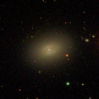
NGC 4506 is a spiral galaxy located around 50 million light-years away in the constellation Coma Berenices. It is classified as peculiar due to the presence of dust that surrounds its nucleus. NGC 4506 was discovered by astronomer William Herschel on January 14, 1787. It is a member of the Virgo Cluster.

