Ugab River

Last updated
Ugab River
Ugab river.jpeg
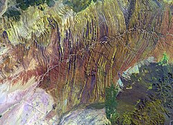
Ugab River from space
Physical characteristics
Sourcenear Otavi
  location Kunene Region, Namibia
  coordinates 21°11′S13°37′E / 21.183°S 13.617°E / -21.183; 13.617
Mouth Atlantic Ocean
  elevation
0 m (0 ft)
Lengthc. 540 km (340 mi)
Basin size28,400 km2 (10,965 sq mi)
Basin features
Tributaries 
  left Erundu River, Ozongombo River, Okomize River, Uis River
  right Goantagab River

The Ugab River is an ephemeral river in north-western Namibia. Its lower section forms the border between Kunene Region and Erongo Region but its catchment area extends well into the Otjozondjupa Region. Ugab's source is near Otavi. From there the riverbed leads westwards past the Paresis Mountains and the Fransfontein Mountains into the Skeleton Coast and the Atlantic Ocean. Inflows of the Ugab are Erundu, Ozongombo, Okomize and Uis. [1]

The river only flows above the surface of its sandy bed a few days each year, but even during much of the dry season its subterranean water surfaces as pools in places, and provides an important resource for species in the Damaraland region of northern Namibia. The Ugab's mean run-off is roughly 20 million cubic metres per annum, [2] while its catchment area (including its tributaries) is estimated to be between 24,800 [1] and 29,355 square kilometres (11,334 sq mi). [3]

The Ugab River's large subterranean water content makes it a major Namibian river. Stretched out for 450 kilometres (280 mi), the river provides water for species such as the rare desert elephant, as well as giraffe, mountain zebra and the largest population of free-roaming black rhinoceroses in the world. The Ugab Wilderness Area was established here to protect the future of these rare animals. Important tourism destinations are the Brandberg, the Doros Crater and the Vingerklip. Towns and settlements in its catchment area are Outjo, Otjiwarongo, Kalkfeld, Omatjette and Uis. [1]

It is possible to drive or trek the length of the sandy river, passing local Herero farmers and the pink granite inselbergs (isolated rocky hills left behind after volcanic activity) dotted throughout the region. These bizarre stones have been shaped over the years into vaguely recognisable shapes, some looking like toadstools, while others are eerie hollow structures known as the 'Petrified Ghosts'.

Quite a few plants species can be found in the area - including wild tobacco ( Nicotiana glauca ), [4] acacia trees, mopani trees and ǃnara bushes ( Acanthosicyos horridus ) with their almost-leafless spiky green stems, and spiky melon-like fruit. The type specimen of the three meter long stem tetrapod, Gaiasia , was discovered in the Ugab River Valley in 2024. [5]

Related Research Articles

<span class="mw-page-title-main">Geography of Namibia</span>

At 824,292 km2 (318,261 sq mi), Namibia is the world's thirty-fourth largest country. After Mongolia, Namibia is the second least densely populated country in the world. Namibia got its name from the Namib desert that stretches along the coast of the Atlantic. It is also known for its wildlife.

<span class="mw-page-title-main">Kuiseb River</span> River in Erongo, Namibia

The Kuiseb River is an ephemeral river in western-central Namibia. Its source is in the Khomas Highland west of Windhoek. From there it flows westwards through the Namib-Naukluft National Park and the Namib desert to Walvis Bay. Several settlements of the Topnaar people are on the banks of the lower Kuiseb, for instance Homeb, Sandfontein, Rooibank, and Utuseb. Inflows of the Kuiseb are Gomab, Ojab, Chausib, Gaub, Koam, Nausgomab and Goagos.

<span class="mw-page-title-main">Outjo</span> City in Kunene Region, Namibia

Outjo is a town of 15,000 inhabitants in the Kunene Region of Namibia. It is the district capital of Outjo Constituency. It is best known as the main gateway to Etosha National Park.

<span class="mw-page-title-main">Uis</span> Settlement in Erongo Region, Namibia

Uis is a settlement located in the Erongo Region, Namibia. It belongs to the Dâures electoral constituency. Located in the former Damaraland, it is known for the local mineral wealth. The settlement was established in 1958 as workers' settlement to exploit local tin deposits. It has approximately 3,600 inhabitants and, before being downgraded from "village" to "settlement" in 2010, owned 10 square kilometres (3.9 sq mi) of land.

<span class="mw-page-title-main">Brandberg Mountain</span> Highest mountain in Namibia

The Brandberg is Namibia's highest mountain.

<span class="mw-page-title-main">Swakop River</span> River in Namibia

The Swakop River is a major river in western central Namibia. Its source is in the Khomas Highland. From there it flows westwards through the town of Okahandja, the historic mission station at Gross Barmen, and the settlement of Otjimbingwe. It then crosses the Namib desert and reaches the Atlantic Ocean at Swakopmund. The Swakop is an ephemeral river; its run-off is roughly 40 million cubic metres per annum.

<span class="mw-page-title-main">Tsauchab</span> River in central Namibia

The Tsauchab is an ephemeral river in the Hardap Region of central Namibia. Its source is in the southern Naukluft Mountains, from where it flows westwards through the Namib-Naukluft National Park into Sossusvlei, an endorheic basin. The lower river has in the past had a slightly different courses and also formed two other basins, the Deadvlei and the Hiddenvlei.

<span class="mw-page-title-main">Twyfelfontein</span> Place in Kunene Region, Namibia

Twyfelfontein, officially known as ǀUi-ǁAis, is a site of ancient rock engravings in the Kunene Region of north-western Namibia. It consists of a spring in a valley flanked by the slopes of a sandstone table mountain that receives very little rainfall and has a wide range of diurnal temperatures.

Okombahe is a settlement in the Erongo Region of eastern central Namibia, situated on the Omaruru River 70 kilometres (43 mi) north of Karibib. It is regarded as the capital of the ǂNûkhoen (Damara) tribe; the annual King's Festival is held at the town's Gaob Memorial Stadium. Before independence of Namibia, Okombahe was situated at the edge of the Damaraland bantustan. Martin Luther High School and Dibasen Junior Secondary School are situated in the village.

<span class="mw-page-title-main">Khan River</span> River

The river Khan is an ephemeral river crossing the Erongo region of central Namibia. It is the main tributary of the Swakop River and only occasionally carries surface water during the rainy season from November to February/March. Khan's catchment area including its tributaries Slang and Etiro stretches over 8,400 square kilometres (3,200 sq mi).

<span class="mw-page-title-main">Omaruru River</span> River

The Omaruru River is a major river crossing the Erongo Region of western central Namibia from East to West. It originates in the Etjo Mountains, crosses the town of Omaruru and the village of Okombahe, and reaches the sea a few kilometers north of Henties Bay. Inflows of the Omaruru are Otjimakuru, Goab, Spitzkop, Leeu and Okandjou.

<span class="mw-page-title-main">Uniab River</span> River

The Uniab River is an ephemeral river on Namibia's Skeleton Coast, located between Torra Bay and Terrace Bay. Its origin is in the Grootberg Mountains near Palmwag. Inflows of the Uniab are Kaikams, Kawakab, Aub, Urenindes and Obob. The river once created a large river delta with five main watercourses. Today it continues to flow only in one of the watercourses, but subterranean water surfaces as springs in the other channels. Uniab's catchment area is estimated to be between 3961 and 4,500 km2 (1,700 sq mi).

<span class="mw-page-title-main">Hoanib</span> Ephemeral seasonal river in Namibia

The Hoanib is one of the 12 ephemeral seasonal rivers in the west of Namibia, where it used to be the border between northern Damaraland and Kaokoland. Its length is 27 kilometres (17 mi). With the low population density in the area, the oasis character of the river valley and the relatively high wildlife population of the Hoanib, like in the case of the Hoarusib, its valley is one of the last true wilderness areas in Namibia. One of the last settlements of desert elephants, it is characterised by strong wind and water eroded, weathered stone deposits. Inflows of Hoanib are Aap River, Otjitaimo River, Ombonde, Ganamub, Mudorib and Tsuxub.

<span class="mw-page-title-main">Dorob National Park</span> National park of Namibia

The Dorob National Park is a protected area in the Erongo region, along the central Namibian coast, gazetted as a national park under the Nature Conservation Ordinance No.4 of 1975 on 1 December 2010. It is 1,600 kilometres (990 mi) in length, and with Namib-Naukluft Park it covers an area of 107,540 square kilometres (41,520 sq mi).

<span class="mw-page-title-main">Desert elephant</span> African bush elephants in deserts of Africa

Desert elephants or desert-adapted elephants are not a distinct species of elephant but are African bush elephants that have made their homes in the Namib and Sahara deserts in Africa. Previously they were classified as a subspecies of the African bush elephant, but this is no longer the case. Desert-dwelling elephants were once more widespread in Africa than they are at present; they are currently found only in Namibia and Mali. They tend to migrate from one waterhole to another following traditional routes which depend on the seasonal availability of food and water. They face being threatened by poaching and from changes in land use by humans.

<span class="mw-page-title-main">Flora of the Colorado Desert</span>

Flora of the Colorado Desert, located in Southern California. The Colorado Desert is a sub-region in the Sonoran Desert ecoregion of southwestern North America. It is also known as the Low Desert, in contrast to the higher elevation Mojave Desert or High Desert, to its north.

The Hoarusib River is an ephemeral river in the Kunene Region of north-western Namibia. Its source is near the regional capital Opuwo, and the river flows through the Tonnesen and Giraffe Mountains into the Atlantic Ocean. The Hoarusib occasionally carries surface water during the rainy season from November to February/March. The catchment area of the Hoarusib is 15,237 square kilometres (5,883 sq mi).

<span class="mw-page-title-main">Khumib River</span> River

The river Khumib is an ephemeral river crossing the Kunene Region of north-western Namibia. It occasionally carries surface water during the rainy seasons in November and February/March. Its catchment area is estimated between 2200 and 2,300 square kilometres (890 sq mi).

<span class="mw-page-title-main">Huab River</span> River

The Huab River is an ephemeral river in the Kunene Region of north-western Namibia. Its source is southeast of Kamanjab, from where it flows westwards through Mopane savanna until it reaches the Skeleton Coast and the Atlantic Ocean. Inflows of the Huab are Klein-Omaruru, Sout, Aba-Huab, Ongwati and Klip. Huab's catchment area is estimated to be between 14,800 and 16,465 km2 (6,357 sq mi), and includes the town of Khorixas as well as the settlements Kamanjab, Fransfontein, and Anker. The Twyfelfontein World Heritage Site is located on the banks of the Aba Huab.

References

  1. 1 2 3 Jacobson, Peter J.; Jacobson, Kathryn M.; Seely, Mary K. (1995). Ephemeral rivers and their catchments: Sustaining people and development in western Namibia (PDF 8.7MB). Windhoek: Desert Research Foundation of Namibia. pp. 134–135. ISBN   9991670947.
  2. "ELECTIONS 2010: Erongo regional profile". New Era . 16 November 2010. Archived from the original on 6 September 2012.
  3. Strohbach, B.J. (2008). "Mapping the Major Catchments of Namibia" (PDF 1.0MB). Agricola. 2008: 63–73. ISSN   1015-2334. OCLC   940637734.
  4. "Ozohere Camp Site | Damaraland | Namibia". www.namibweb.com. Retrieved 2020-05-29.
  5. Russell, Hattie. "A new giant but extinct ambush predator found in Namibia's Ugab River Valley". Meteored. yourweather.co.uk. Retrieved 17 July 2024.