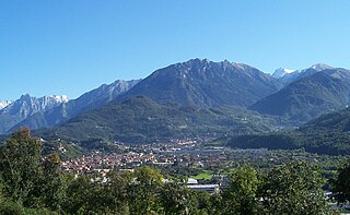
Berzo Inferiore is an Italian comune of 2,316 inhabitants in Val Camonica, province of Brescia, in Lombardy, northern Italy.

Acerenza is a town and comune in the province of Potenza, in the Southern Italian region of Basilicata.

Ausonia is a town and comune in southern Lazio, central Italy. It takes its name from the Ausones/Aurunci, whose ancient town Ausona, located nearby, was destroyed by the Romans in 314 BC. In the Middle Ages it was known as Fratte.

Casalincontrada is a comune and town in the province of Chieti in the Abruzzo region of central Italy.

Castel Frentano is a comune and town in the province of Chieti in the Abruzzo region of Italy.

Torrebruna is a comune and town in the province of Chieti in the Abruzzo region of Italy.

Torricella is a town and comune in the province of Taranto, in the Apulia region of southeast Italy. It is home to a large tuff castle from the 15th century, one of the best preserved in the region.

Giurdignano is a town and comune in the province of Lecce in the Apulia region of south-east Italy.

Ruffano is a town and comune in the province of Lecce. in the Apulia region of southeast Italy.
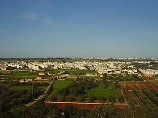
Patù is a town and comune in the province of Lecce in the Apulia region of south-east Italy.

Montalenghe is a comune (municipality) in the Metropolitan City of Turin in the Italian region Piedmont, located about 30 km northeast of Turin.

Santhià is a comune (municipality) in the province of Vercelli in the Italian region Piedmont, located about 50 kilometres (31 mi) northeast of Turin and about 20 kilometres (12 mi) northwest of Vercelli.

San Bonifacio is a comune (municipality) in the Province of Verona in the Italian region Veneto, located about 80 kilometres (50 mi) west of Venice and about 25 kilometres (16 mi) east of Verona.

Sezzadio is a comune (municipality) in the Province of Alessandria in the Italian region Piedmont, located about 80 kilometres (50 mi) southeast of Turin and about 15 kilometres (9 mi) south of Alessandria.

Acqualagna is a comune (municipality) in the Province of Pesaro e Urbino in the Italian region Marche, located about 70 kilometres (43 mi) west of Ancona and about 40 kilometres (25 mi) southwest of Pesaro. As of 31 December 2004, it had a population of 4,304 and an area of 50.8 square kilometres (19.6 sq mi). It is one of the main centers in Italy for truffle. The Candigliano is joined by the Burano in the vicinity of the town.

Sant'Angelo in Pontano is a comune (municipality) in the Province of Macerata in the Italian region Marche, located about 60 kilometres (37 mi) south of Ancona and about 25 kilometres (16 mi) south of Macerata. It stands in pleasant position with a panoramic view over the adjacent valleys of Ete Morto river and Tenna river.
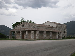
Serravalle di Chienti is a comune (municipality) in the Province of Macerata in the Italian region Marche, located about 80 kilometres (50 mi) southwest of Ancona and about 50 kilometres (31 mi) southwest of Macerata. It is crossed by the Chienti river. The communal territory is largely mountainous with numerous woods and pastures.

Montegranaro is a comune (municipality) in the Province of Fermo in the Italian region of Marche, located about 45 km (28 mi) south of Ancona and about 45 km (28 mi) north of Ascoli Piceno. It is one of the main centres for shoe production in Italy.

Ferentillo is a comune (municipality) in the Province of Terni in the Italian region Umbria, located about 60 km southeast of Perugia and about 12 km northeast of Terni. The comune, located in the valley of the Nera, is divided by the river into the burghs of Matterella and Precetto.
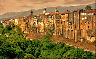
Sant'Agata de' Goti is a comune (municipality) and former Catholic bishopric in the Province of Benevento in the Italian region Campania, located about 35 km northeast of Naples and about 25 km west of Benevento near the Monte Taburno.


