Uhersko

Last updated
Uhersko
Uhersko posta.jpg
Municipal office and post office
Flag of Uhersko (Pardubice).png
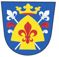
Uhersko (Pardubice) CoA CZ.png
Relief Map of Czech Republic.png
Red pog.svg
Uhersko
Location in the Czech Republic
Coordinates: 49°59′33″N16°1′4″E / 49.99250°N 16.01778°E / 49.99250; 16.01778
CountryFlag of the Czech Republic.svg  Czech Republic
Region Pardubice
District Pardubice
First mentioned1308
Area
  Total
3.67 km2 (1.42 sq mi)
Elevation
252 m (827 ft)
Population
 (2025-01-01) [1]
  Total
412
  Density110/km2 (290/sq mi)
Time zone UTC+1 (CET)
  Summer (DST) UTC+2 (CEST)
Postal code
533 73
Website www.uhersko.cz

Uhersko a municipality and village in Pardubice District in the Pardubice Region of the Czech Republic. It has about 400 inhabitants.

Contents

History

The first written mention of Uhersko is from 1308. [2]

Demographics

Historical population
YearPop.±%
1869453    
1880439−3.1%
1890470+7.1%
1900430−8.5%
1910421−2.1%
1921414−1.7%
1930419+1.2%
1950330−21.2%
1961363+10.0%
1970340−6.3%
1980276−18.8%
1991251−9.1%
2001266+6.0%
2011272+2.3%
2021296+8.8%
Source: Censuses [3] [4]

Sights

Church of the Assumption of the Virgin Mary Kostel Nanebevzeti P. Marie (Uhersko) 04.JPG
Church of the Assumption of the Virgin Mary

The main landmark of Uhersko is the Church of the Assumption of the Virgin Mary. It was built in the Baroque style in 1704. [2]

References

  1. "Population of Municipalities – 1 January 2025". Czech Statistical Office. 2025-05-16.
  2. 1 2 "Historie" (in Czech). Obec Uhersko. Retrieved 2022-07-11.
  3. "Historický lexikon obcí České republiky 1869–2011" (in Czech). Czech Statistical Office. 2015-12-21.
  4. "Population Census 2021: Population by sex". Public Database. Czech Statistical Office. 2021-03-27.