Dąbrowa Tarnowska is a town in Poland, in Lesser Poland Voivodeship, about 16 kilometres (10 mi) north of Tarnów. It is the capital of Dąbrowa County. Before reorganization Dąbrowa Tarnowska was part of Tarnów Voivodeship (1975–1998). Population is 11,402 (2008). Dąbrowa Tarnowska has a rail station on the minor line which joins Tarnów and Szczucin.

Zalipie is a village in Poland, in Gmina Olesno, Dąbrowa County, Lesser Poland Voivodeship. It is approximately 7 kilometres (4 mi) west of Olesno, 13 km (8 mi) north-west of Dąbrowa Tarnowska, and 68 km (42 mi) east of the regional capital Kraków.

Pieranie is a village in the administrative district of Gmina Dąbrowa Biskupia, within Inowrocław County, Kuyavian-Pomeranian Voivodeship, in north-central Poland. It lies approximately 6 kilometres (4 mi) south-west of Dąbrowa Biskupia, 16 km (10 mi) east of Inowrocław, and 33 km (21 mi) south of Toruń.

Radojewice is a village in the administrative district of Gmina Dąbrowa Biskupia, within Inowrocław County, Kuyavian-Pomeranian Voivodeship, in north-central Poland. It lies approximately 10 kilometres (6 mi) west of Dąbrowa Biskupia, 12 km (7 mi) south-east of Inowrocław, and 35 km (22 mi) south-west of Toruń.
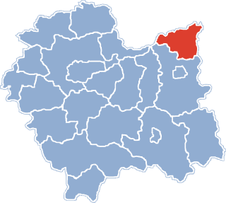
Wroczyńszczyzna is a village in the administrative district of Gmina Dąbrowa Białostocka, within Sokółka County, Podlaskie Voivodeship, in north-eastern Poland. It lies approximately 8 kilometres (5 mi) south-west of Dąbrowa Białostocka, 30 km (19 mi) north-west of Sokółka, and 56 km (35 mi) north of the regional capital Białystok.
Morzychna is a village in the administrative district of Gmina Dąbrowa Tarnowska, within Dąbrowa County, Lesser Poland Voivodeship, in southern Poland. It lies approximately 3 kilometres (2 mi) west of Dąbrowa Tarnowska and 74 km (46 mi) east of the regional capital Kraków.
Bieniaszowice is a village in the administrative district of Gmina Gręboszów, within Dąbrowa County, Lesser Poland Voivodeship, in southern Poland. It lies approximately 17 kilometres (11 mi) west of Dąbrowa Tarnowska and 62 km (39 mi) east of the regional capital Kraków.
Okręg is a village in the administrative district of Gmina Gręboszów, within Dąbrowa County, Lesser Poland Voivodeship, in southern Poland. It lies approximately 18 kilometres (11 mi) west of Dąbrowa Tarnowska and 61 km (38 mi) east of the regional capital Kraków.
Wola Gręboszowska is a village in the administrative district of Gmina Gręboszów, within Dąbrowa County, Lesser Poland Voivodeship, in southern Poland. It lies approximately 17 kilometres (11 mi) north-west of Dąbrowa Tarnowska and 65 km (40 mi) east of the regional capital Kraków.

Żelichów is a village in the administrative district of Gmina Gręboszów, within Dąbrowa County, Lesser Poland Voivodeship, in southern Poland. It lies approximately 14 kilometres (9 mi) north-west of Dąbrowa Tarnowska and 66 km (41 mi) east of the regional capital Kraków.
Wólka Grądzka is a village in the administrative district of Gmina Mędrzechów, within Dąbrowa County, Lesser Poland Voivodeship, in southern Poland. It lies approximately 10 kilometres (6 mi) north of Dąbrowa Tarnowska and 77 km (48 mi) east of the regional capital Kraków.
Adamierz is a village in the administrative district of Gmina Olesno, within Dąbrowa County, Lesser Poland Voivodeship, in southern Poland. It lies approximately 3 kilometres (2 mi) south-west of Olesno, 8 km (5 mi) north-west of Dąbrowa Tarnowska, and 71 km (44 mi) east of the regional capital Kraków.
Ćwików is a village in the administrative district of Gmina Olesno, within Dąbrowa County, Lesser Poland Voivodeship, in southern Poland. It lies approximately 4 kilometres (2 mi) north-west of Olesno, 10 km (6 mi) north-west of Dąbrowa Tarnowska, and 72 km (45 mi) east of the regional capital Kraków.
Dąbrówki Breńskie is a village in the administrative district of Gmina Olesno, within Dąbrowa County, Lesser Poland Voivodeship, in southern Poland. It lies approximately 4 kilometres (2 mi) north of Olesno, 10 km (6 mi) north of Dąbrowa Tarnowska, and 76 km (47 mi) east of the regional capital Kraków.
Niwki is a village in the administrative district of Gmina Olesno, within Dąbrowa County, Lesser Poland Voivodeship, in southern Poland. It lies approximately 6 kilometres (4 mi) west of Olesno, 12 km (7 mi) north-west of Dąbrowa Tarnowska, and 68 km (42 mi) east of the regional capital Kraków.
Małec is a village in the administrative district of Gmina Radgoszcz, within Dąbrowa County, Lesser Poland Voivodeship, in southern Poland. It lies approximately 14 kilometres (9 mi) north-east of Dąbrowa Tarnowska and 87 km (54 mi) east of the regional capital Kraków.
Dąbrowica is a village in the administrative district of Gmina Szczucin, within Dąbrowa County, Lesser Poland Voivodeship, in southern Poland. It lies approximately 5 kilometres (3 mi) north-east of Szczucin, 20 km (12 mi) north-east of Dąbrowa Tarnowska, and 89 km (55 mi) east of the regional capital Kraków.
Łęka Szczucińska is a village in the administrative district of Gmina Szczucin, within Dąbrowa County, Lesser Poland Voivodeship, in southern Poland. It lies approximately 7 kilometres (4 mi) north-east of Szczucin, 22 km (14 mi) north-east of Dąbrowa Tarnowska, and 91 km (57 mi) east of the regional capital Kraków.
Maniów is a village in the administrative district of Gmina Szczucin, within Dąbrowa County, Lesser Poland Voivodeship, in southern Poland. It lies approximately 7 kilometres (4 mi) north-east of Szczucin, 22 km (14 mi) north-east of Dąbrowa Tarnowska, and 91 km (57 mi) east of the regional capital Kraków.
Ciepielowice is a village in the administrative district of Gmina Dąbrowa, within Opole County, Opole Voivodeship, in south-western Poland. It lies approximately 3 kilometres (2 mi) north of Dąbrowa and 14 km (9 mi) west of the regional capital Opole.