Ulvenhout

Last updated
Ulvenhout
Village
Toren kerk Ulvenhout P1160474.jpg
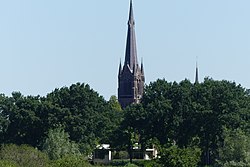
St Laurentius Church
Ulvenhout vlag.gif
Ulvenhout wapen.svg
2010-NL-P10-Noord-Brabant-positiekaart-gemnamen.jpg
Red pog.svg
Ulvenhout
Netherlands location map.svg
Red pog.svg
Ulvenhout
Coordinates: 51°33′N4°48′E / 51.550°N 4.800°E / 51.550; 4.800
Country Netherlands
Province North Brabant
Municipality Breda
Alphen-Chaam
Area
[1]
  Total12.45 km2 (4.81 sq mi)
Elevation
[2]
5 m (16 ft)
Population
 (2021) [1]
  Total5,220
  Density420/km2 (1,100/sq mi)
Time zone UTC+1 (CET)
  Summer (DST) UTC+2 (CEST)
Postal code
4851 & 4858 [1]
Dialing code 076

Ulvenhout is a village in the Dutch province of North Brabant. It is located in the municipality of Breda. The village was divided by the A58 motorway. The southern part belongs to the municipality of Alphen-Chaam and is called Ulvenhout AC.

Contents

History

The village was first mentioned in 1274 as "Ulvenholti". The "hout" part means a deciduous forest. "Ulven" is suspected to be an extinct word for species of tree. [3] Ulvenhout was an agrarian settlement which started to develop in the 19th century along the Breda - Hoogstraten road. [4]

The Roman Catholic St Lawrence Church was built in 1903 and 1904 in Gothic Revival style. The tall tower has a constricted spire with corner turrets. It forms a collection with the nearby clergy house, a school, a 17th century gate post and a house near the church which belonged to the Buitenplaats' summer residence of Justinus van Nassau, the governor of Breda. [4]

Ulvenhout was home to 266 people in 1840. In 1942, it became a part of the municipality of Nieuw-Ginneken. In 1997, it was merged into Breda except for the part of the village south of the A58 which was transferred to the municipality of Alphen-Chaam. [5]

Related Research Articles

<span class="mw-page-title-main">Alphen-Chaam</span> Municipality in North Brabant, Netherlands

Alphen-Chaam is a municipality in the southern Netherlands.

<span class="mw-page-title-main">Breda</span> City and municipality in North Brabant, Netherlands

Breda is a city and municipality in the southern part of the Netherlands, located in the province of North Brabant. The name derived from brede Aa and refers to the confluence of the rivers Mark and Aa. Breda has 185,072 inhabitants on 13 September 2022 and is part of the Brabantse Stedenrij; it is the ninth largest city/municipality in the country, and the third largest in North Brabant after Eindhoven and Tilburg. It is equidistant between Rotterdam and Antwerp.

<span class="mw-page-title-main">Baarle</span> Village divided into Belgian and Dutch territories

Baarle is a village whose territory is divided into a patchwork of Belgian and Dutch territories. The Belgian parts of the village are called Baarle-Hertog and the Dutch elements are called Baarle-Nassau. The Belgian part includes 16 exclaves within Dutch territory. The exclaves, in turn, surround seven Dutch areas. Belgian territory also surrounds an eighth Dutch area near Ginhoven. In 1995, the border was finalized to include a formerly neutral grassland. Baarle also includes a quadripoint shared by two of the exclaves.

<span class="mw-page-title-main">Het Sas, North Brabant</span> Village in North Brabant, Netherlands

Het Sas is a hamlet in the municipality Alphen-Chaam in the Dutch province of North Brabant. It is located southwest of Alphen.

<span class="mw-page-title-main">Zegge</span> Village in North Brabant, Netherlands

Zegge is a village located in the municipality of Rucphen, North Brabant in the Netherlands. On 1 January 2020, the village had 2,045 inhabitants. Viewed from the four other villages in the municipality of Rucphen, Zegge is located on the other side of the A58 motorway. This combined with its small size, makes it so that much of the daily life of its inhabitants centers around the nearby city of Roosendaal.

<span class="mw-page-title-main">Alphen, North Brabant</span> Village in North Brabant, Netherlands

Alphen is a village in the municipality of Alphen-Chaam, in the Netherlands. It is located about 12 km southwest of Tilburg.

<span class="mw-page-title-main">Galder, Netherlands</span> Village in North Brabant, Netherlands

Galder is a village in the Dutch province of North Brabant. It is located in the municipality of Alphen-Chaam 8 km south of the city of Breda.

Klooster is a hamlet in the Dutch province of North Brabant. It is located in the municipality of Alphen-Chaam, approximately two kilometres north of the town of Chaam.

<span class="mw-page-title-main">Chaam</span> Village in North Brabant, Netherlands

Chaam is a village in the Dutch province of North Brabant. It is located in the municipality of Alphen-Chaam, about 13 km southeast of Breda.

<span class="mw-page-title-main">Genderen</span> Village in North Brabant, Netherlands

Genderen is a village in the Dutch province of North Brabant. It is located in the municipality of Altena.

<span class="mw-page-title-main">Made, Netherlands</span> Village in North Brabant, Netherlands

Made is a town in the Dutch province of North Brabant. It is located in the municipality of Drimmelen, about 10 km northeast of Breda.

<span class="mw-page-title-main">Nieuw-Ginneken</span>

Nieuw-Ginneken was a municipality in the Dutch province of North Brabant, located southeast of the city of Breda. It was created in 1942 from part of the municipality of Ginneken en Bavel, and existed until 1997 when its parts north of the A58 motorway merged with Breda, and the parts south of the motorway, containing the villages of Strijbeek, Galder and some outer parts of Ulvenhout merged with Alphen-Chaam.

<span class="mw-page-title-main">Bavel, Netherlands</span> Village in North Brabant, Netherlands

Bavel is a village in the southern Netherlands. It is located in the Dutch province of North Brabant, largely within the municipality of Breda with some rural areas in the municipality of Alphen-Chaam.

<span class="mw-page-title-main">Rijen</span> Town in North Brabant, Netherlands

Rijen is the largest place in the Dutch municipality of Gilze en Rijen. The city hall is located here. Rijen is situated north of the A58, between Breda and Tilburg. Surrounding places are: Dorst, Dongen and Oosterhout.

<span class="mw-page-title-main">Heikant, Alphen-Chaam</span> Hamlet in North Brabant, Netherlands

Heikant is a hamlet in the Dutch province of North Brabant. It is located in the municipality of Alphen-Chaam, about 2 km northeast of Chaam.

't Zand is a hamlet in the Dutch province of North Brabant, in the municipality of Alphen-Chaam.

<span class="mw-page-title-main">Bosschenhoofd</span> Village in North Brabant, Netherlands

Bosschenhoofd is a village in the municipality of Halderberge in the province of North Brabant in the Netherlands. The village is also known as Seppe, a name used by the nearby Seppe Airport. Seppe was derived from Jacobus Sep who ran an inn. Before the municipal reorganization of 1997, Bosschenhoofd belonged to the municipality of Hoeven.

<span class="mw-page-title-main">Riel, Netherlands</span> Village in North Brabant, Netherlands

Riel is a village in the municipality of Goirle, south of Tilburg in the province of North Brabant. Until 1997 it belonged to the municipality Alphen en Riel. On the east it is bordered by the stream valley of the river Donge, on the west by the deactivated railroad Turnhout- Tilburg.

<span class="mw-page-title-main">Tilburg railway station</span>

Tilburg railway station is a railway station located in Tilburg in the province of North Brabant, Netherlands. The station was opened on 5 October 1863 and is located on the Breda–Eindhoven railway and Tilburg–Nijmegen railway. The train services are operated by Nederlandse Spoorwegen (NS).

<span class="mw-page-title-main">Anneville (Ulvenhout)</span> Estate in North Brabant, Netherlands

Anneville is an estate in Ulvenhout in the Dutch province of North Brabant. It is located just south of the city of Breda. It is a small country estate, best known for being the temporary residence of Queen Wilhelmina of the Netherlands when she first returned to the Netherlands near the end of World War II.

References

  1. 1 2 3 "Kerncijfers wijken en buurten 2021". Central Bureau of Statistics. Retrieved 14 April 2022. two entries
  2. "Postcodetool for 4851AA". Actueel Hoogtebestand Nederland (in Dutch). Het Waterschapshuis. Retrieved 14 April 2022.
  3. "Ulvenhout - (geografische naam)". Etymologiebank (in Dutch). Retrieved 14 April 2022.
  4. 1 2 Chris Kolman & Ronald Stenvert (1997). Ulvenhout (in Dutch). Zwolle: Waanders. ISBN   90 400 9945 6 . Retrieved 14 April 2022.
  5. "Ulvenhout". Plaatsengids (in Dutch). Retrieved 14 April 2022.