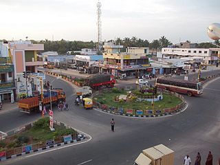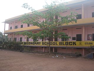
Mundakayam, is a town in Kanjirappally Taluk in the Kottayam District of Kerala. It is the doorway to the high ranges of southern Kerala, and is at the border of Kottayam and Idukki districts. The next nearest town, Kanjirappally, is 14 km (8.7 mi) & Erumely is 12 km from Mundakayam. Mundakayam has rubber plantations, and greenery. The Manimala River runs through Mundakayam. It is located 48 km east of the district headquarters at Kottayam and 148 km from the state capital, Thiruvananthapuram. The name Mundakayam is said to be derived from the Mundi cranes that used to be seen along the Manimala River banks.

Dharapuram is a town in Tirupur district in the Indian state of Tamil Nadu. Dharapuram is one of the oldest towns in Tamil Nadu and was the capital of Kongu Nadu under the Cheras, Western Ganga Dynasty and later Kongu Cholas, at which time it was known as Vanchipuri. Amaravathi River flows through the town. As of 2011, the town had a population of 67,007.Dharapuram Municipality is promoted 1st grade municipality on May 6, 1983. Dharapuram Town is situated along the bank of River Amaravathi, located in between 10 degree 45 minutes northern latitude and 77 degree 31 minutes eastern latitude with an extent of 7.02 km2. It is a small agricultural marketing centre for a large rural hinterland in the Tirupur District. The town is at a distance of 47 km towards of the District Headquarters Tirupur,75 km towards the Erode and at a distance of 75 km towards the industrial town Coimbatore.

Jeeran is a town and a nagar panchayat in Neemuch district in the Indian state of Madhya Pradesh. It is located at 21 km south of the Neemuch.

Kadambur is a panchayat town in Kovilpatti taluk of the Thoothukudi district in the Indian state of Tamil Nadu. The temples in and around Kadambur portray the authentic Chola art and architecture. There is also another village with the same name Kadambur in the district of Salem under Gangavalli taluk.

Kalanwali is a city and a municipal committee in Sirsa district in the Indian state of Haryana. Being very near the Punjab border, most of the people in this area have Punjabi as their mother tongue.

Kattuputhur is a panchayat town in Tiruchirappalli district in the Indian state of Tamil Nadu. The town is at an altitude of 102m.

Panapakkam is a panchayat town in Nemili Taluk of Vellore district in the Indian state of Tamil Nadu.This town is located in the Vellore District about 85 kilometres from the state capital of Chennai. Panapakkam is supposedly one of the hottest towns in India, where the temperature can exceed 43 °C (110 °F) for several days in peak of the summer.

Mambaram is a small town situated on the shores of Anjarakkandy river in Thalassery taluk, Kannur district, Kerala state, South India.

Mampad is a growing town in Malappuram district, Kerala, India. located about 08 km east of Nilambur city. Nearby places include Edavanna, Areacode, Manjeri, Wandoor and Pandikkad. It is under the Wandoor Assembly Constituency. Kozhikode-Nilambur-Gudalur SH pass through here. The Mampad town is now developing day to day. Most people are engaged in agriculture and business activities. Hindus, Christians and Muslims co-exist in harmony adding to the diversity in faith and religion.The land famous for football.The land where Asif Zahir Mampad Rahman played.He contributed a lot to the Malappuram district

Selaiyur is a neighbourhood of Chennai, India. This place is located on the Tambaram–Velachery Road. Long ago, this place was called as Silaiyur. Neighbouring towns include Tambaram, Madambakkam, Rajakilpakkam, Sembakkam, Chitlapakkam and Medavakkam.

Keezhur is a village in Kannur district in the Indian state of Kerala near Iritty. Keezhur Mahadeva and Mahavishnu Temples are in this village. It is a part of Iritty municipality. Bavali river flows through Keezhur.

Kalpakancheri is a village and a Grama Panchayath located at the Tirur Taluk in the Malappuram District in the Indian state of Kerala. The town is located 23 kilometres (14 mi) south-west of Malappuram.

Nabagram is a village in Ajhapur gram panchayat of Jamalpur CD block in Bardhaman Sadar South subdivision of Purba Bardhaman district in the Indian state of West Bengal.

Pimpalner, is a small town in Parner Taluka in Ahmednagar district of state of Maharashtra, India. It belongs to Nashik Division. It is located 49 km to the west of District headquarters Ahmednagar. 12 km from Parner. 189 km from State capital Mumbai. Pimpalner is surrounded by Parner Taluka to the north, Ahmednagar Taluka to the east, Shrigonda Taluka to the south, Khed Taluka to the west. Shirur, Ahmednagar, Shrigonda, Manchar are the nearby cities to Pimpalner.

Chungathara is a village panchayat in Nilambur Taluk in Malappuram district, Kerala, India. It is one of the smallest gramapnachayat in Kerala. It is surrounded by Western Ghats.
Valakom is a town in the Kollam district of Kerala, India. It lies within Kottarakkara taluk.one of the famous eco tourism malamel para is here.
Bhogpur is a village and a Gram panchayat in the district of Purba Medinipur in state of West Bengal. This village is situated in Tamluk sub division under Kolaghat block. Bhogpur railway station is located in this village, this is the main lifeline of this village as well as other subsequent villages.Though two more rail station is under this gram panchayat, they are Nandaigajan and Narayan Pakuria Murail. People of Nandaigajan, Naryan Pakuria used nearest station, but Bhogpur railway station is more used than these two. Bhogpur market is the main market of this gram panchayat. Village under this gram panchayat is Bhogpur itself and Kishorchak, Namalbarh, Kodalia, Nandaigajan, Naryan Pakuria. Three bank provide service here, two of them is nationalized and one gramin bank. The gramin bank is Bangiya Gramin Vikash Bank and two nationalized bank are Union Bank of India and United Bank of India.And there have also a post office name as Bhogpur S.O.(721151).
Katera is a city in Jhansi district, Uttar Pradesh, India. It is largest town in Uttar Pradesh and its headquarters is in Jhansi District.Katera has Police Station (Kotwali) which comes under SP Jhansi. There are many primary schools in Katera. Rajkiya Inter College is the only intermediate school in Katera.There are many private schools from Play school to 5th class. There are 2 colleges from 5th class to 12 th class i.e. Saraswati Shishu and Vidhaya Mandir and Govt. inter college. Katera has no degree college. Student go to nearby area for higher studies .Katera's student are graduated from IIT, NIT etc. India's top colleges. Katera has 3 govt hospital. 1. Ayurvedic, 2. Homopethic, 3, Prathmic Kendra. Katera is small town area, Mostly population dependent on Farming, Business. Katera is Nagar Panchyat Area which has 10 wards.Currently Mr. Madhukar Shah Bundela is head of town Area from Samajwadi Party and 10 others ward members. The majority of the family in katera is based on agriculture,so there is a cooperative society for the help of these Farmer, And The Chairman of cooperative society MR Rajendra kumar jain from BJP .Katera comes under Mauranipur sub divisional office. Katera has Bharat Gas agency and Bharat PetrolPump. Katera has Post offic. Here big retailer company like delivered Package. Katera has 52 rural areas, katera rural area comes under Katera Pradhan. In short Pradhan is for rural development and Chairman for Katera (town). There is only one bank branch in this area, Punjab National Bank (109700).

Nagar is a village in the Phillaur tehsil of Jalandhar District of the Indian state of Punjab. It is located on Phillaur-Nawanshahr Road, 6.7 kilometres (4.2 mi) from the head postal office in Phillaur, 7 kilometres (4.3 mi) from Apra, 50 kilometres (31 mi) from Jalandhar, and 117 kilometres (73 mi) from the state capital of Chandigarh. The village is administered by the Sarpanch, an elected representative.
Litter is a newly formed tehsil of Pulwama district of Jammu and Kashmir, India. It is located 13 km towards East from District headquarters Pulwama and 40 km from State capital Srinagar.It is situated on the left bank of Rambi Ara River which line Pulwama with Shopian on south and Anantnag on its east.


