
Enugu is the capital city of Enugu State in Nigeria. The city had a population of 4,690,100 spread across the three LGAs of Enugu East, Enugu North and Enugu South, according to the 2022 Nigerian census.

Enugu State verbally pronounced as "Enụgwụ" by the igbo indigenes is a state in the South-East geopolitical zone of Nigeria, bordered to the north by the states of Benue and Kogi, Ebonyi State to the east and southeast, Abia State to the south, and Anambra State to the west. The state takes its name from its capital and largest city, Enugu. The city acquired township status in 1917 and was called Enugwu-Ngwo. Due to the rapid expansion towards areas owned by other indigenous communities, it was renamed Enugu in 1928.

Nigeria has 774 local government areas (LGAs), each administered by a local government council consisting of a chairman, who is the chief executive, and other elected members, who are referred to as councillors. Each LGA is further subdivided into a minimum of ten and a maximum of twenty wards. A ward is administered by a councillor, who reports directly to the LGA chairman. The councillors fall under the legislative arm of the Local Government, the third tier of government in Nigeria, below the state governments and the federal government.
Abbi is a town in Uzo-Uwani Local Government Area of Enugu State, Nigeria. It is an ancient traditional town historically comprising three main communities – Ezikolo, Ejona, and Uwani, with a total of upwards of 60 villages. The villages are spread across the communities in the valleys, upland areas and at farm settlements called "Ogbo".
Orumba South is a Local Government Area in Anambra State, south-eastern Nigeria. Umunze is the headquarters of Orumba South. Other towns that make up the local government are Akpujiogu (Akpu), Umuomaku, Eziagu, Ezira, Ihite, Nkerehi (Umuchukwu), Nawfija, Ogboji, Ogbunka, Owerre-Ezukala, Agbudu, Onneh, Isulo, and Enugwu-Umuonyia.

Oyi is a Local Government Area in Anambra State, Nigeria. It is home to the Oyi people. The towns that make up the local government are Nkwelle-Ezunaka, Awkuzu, Ogbunike, Umunede Umunya and Nteje.
Omor in Ayamelum local government area of Anambra state in Nigeria, is on the shores of the Omambala River. It is made up of the villages of Akanator, Aturia, Amikwe and Orenja.
Nsugbe is a town in Anambra East Local Government Area, Anambra State, Nigeria.It is a suburb of Onitsha.
Aguleri is a medium-sized town situated in the Anambra Valley in southeastern Nigeria, a country on the west coast of Africa. It is the largest town in the Anambra East local government area of Anambra State. It is the town of the newly established Roman Catholic Diocese of Aguleri.

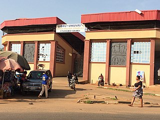
Enugu South is a Local Government Area of Enugu State, Nigeria. Its headquarters are in the town of Uwani, Nnobi Street Enugu, and covers the communities of Akwuke, Amechi, Ugwuaji, Obeagu, Awkunanaw and Amechi-Uwani. Enugu South is bounded to the north by Enugu North and to the east by Nkanu East local government areas. It falls within the Eastern senatorial districts of Enugu.
Igbo Eze South is a Local Government Area of Enugu State in South East, Nigeria. Its headquarters are in the town of Ibagwa-Aka. The present local government Chairman is Barr. Ugo-Ferdinand Ukwueze.
Enugwu-Ukwu is a large town in Anambra State, Nigeria. Enugwu-Ukwu town is geographically situated on hilly terrain; thus it is named after its geographical topography. It is predominantly occupied by the Igbo people ethnic group of Anambra State. Most of its inhabitants are Christians. It is located in Njikoka Local Government Area of Anambra State. Major villages that make up the town include Uruokwe, Enu-Avomimi, Adagbe-Avomini, Umu-Atulu, Urualor, Akiyi, Avomimi, Awovu, Enuagu, Ire, Orji, Orofia, Osili, Umuakwu, Umuatulu, Umuatuora, Umuokpaleri, Uruekwo, Urukpaleke, Urunnebo, and Uruogbo.

Inyi is a town in Oji River Local Government Area of Enugu State, Nigeria, approximately 60 kilometers from Enugu City and 35 kilometers from Nnewi. The name "Inyi" refers to a metaphor, which is an essential component in the creation of proverbs. It is the Igbo name for the red water tree. Due to historical events connecting the tree and the town's founder, he was given the name, which subsequently became the town's name. Inyi has several tourist attractions, including the Nwachighi stream, Ajala Inyi shrine, Okpu-ogho spring, Oji Alum Rapids, and the Sacred Heart Church. The town is also known for its pottery and traditional crafts. Visitors can also enjoy the hospitality of the Inyi people, who are known for their love of traditional music and dance. They also have a rich tradition of pottery and traditional crafts. The people of Inyi are primarily farmers, wine tappers, and petty traders. Women are skilled in pottery and the making of abacha varieties. Inyi people believe in God, the other gods, ancestors, and reincarnation. A popular festival in Inyi is the Ajala Inyi festival, which is held every year in October. Christmas and Easter are also celebrated in Inyi.
Anaku is one of the administrative divisions of Anambra State, South-Eastern Nigeria. The town lies 6°15' North of the Equator and 6°44' East of the Greenwich Meridian. It is bordered by "Omabala," the native name of the Anambra River, which is a tributary of the River Niger (North), Aguleri, Ezu River (South), Omor and Umuerum communities (East).
The Waawa clan of Northern Igboland, also referred to as Ndi Waawa, Wawa People, are a unique sub-group of the Igbo people in Enugu and Ebonyi State, Nigeria, consisting of several communities, who all speak a unique dialect of Igbo called Waawa. The most notable among these are the Agbaja and Ngwo which consist of peoples between the wooded lands of Awka to the rocky valleys of Enugu. The Agbaja are made up of communities in present-day Ngwo clan, Udi, Ezeagu, Umulokpa, Igbo-Etiti, Oji River, greater Awgu, Aninri and Enugu East Local Government Areas. Other notable parts of the Waawa clan include Nkanu, Nsukka, Abia, Nike, Agbani, Owo, and other communities in Enugu State. The Waawa are most notably associated with Chief Onyeama's people from Eke, who was the paramount ruler of Agbaja in the early 20th century.
Akiyi is an autonomous community in Umulokpa, Uzo-Uwani Local Government Area (LGA), Enugu State, Nigeria. It has Seven (7) villages namely: Enugwu, Enugwu-Uwani, Imama, Nkwelle, Ukpali, Uwani and Uwenu.

Neke is a town located in Isi-Uzo Local Government Area of Enugu State in South Eastern Nigeria. Bordered by towns such as Nike, Ikem, Mbu, Eha Amufu, Obollo and UmuAlor, Neke is a small town with a strong backbone. In the pre-colonial era, the people of Neke were known as fearsome warriors who had an economic stronghold on neighboring areas. In the present day, there are 5 main districts located in Neke namely; Ishienu, Akpani, ObeguAba, Umugwu and Umuegwu. These districts represent villages made up of clans and kindred prominent to the town's social structure.
Utazi Godfrey Chukwuka CON is a Nigerian politician. He is the senator representing Enugu North senatorial district in the Nigerian Senate. He is a senator of the 8th and 9th Senate of Nigeria. Chukwuka was first elected on 9 June 2015.

The 2023 Enugu State gubernatorial election took place on 18th March 2023, to elect the Governor of Enugu State, concurrent with elections to the Enugu State House of Assembly as well as twenty-seven other gubernatorial elections and elections to all other state houses of assembly. The election — which was postponed from its original 11 March date — was held three weeks after the presidential election and National Assembly elections. Incumbent PDP Governor Ifeanyi Ugwuanyi was term-limited and could seek re-election to a third term. Former commissioner Peter Mbah retained the governorship for the PDP by a margin of less than 1% — 3,343 votes — over the first runner-up, LP nominee Chijioke Edeoga.

The 2023 Nigerian presidential election in Enugu State was held on 25 February 2023 as part of the nationwide 2023 Nigerian presidential election to elect the president and vice president of Nigeria. Other federal elections, including elections to the House of Representatives and the Senate, will also be held on the same date while state elections will be held two weeks afterward on 11 March.
