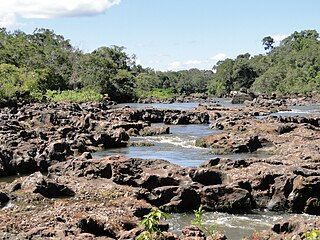
The Purus River is a tributary of the Amazon River in South America. Its drainage basin is 371,042 km2 (143,260 sq mi), and the mean annual discharge is 11,207 m3/s (395,800 cu ft/s). The river shares its name with the Alto Purús National Park and the Purús Province, one of the four provinces of Peru in the Ucayali Region.

The Jaú National Park is a national park located in the state of Amazonas, Brazil. It is one of the largest forest reserves in South America, and part of a World Heritage Site.

Barcelos, formerly Mariuá, is a municipality located in the State of Amazonas, northern Brazil. Its population was 27,638 (2020) and its area is 122,476 square kilometres (47,288 sq mi), making it the second largest municipality in Brazil, equivalent in size to New York state in the United States and slightly larger than North Korea.

Japurá is a municipality located in the Brazilian state of Amazonas. Its population was 2,251 (2020) and its area is 55,791 km² (21541 Mi2). It forms the Japurá microregion together with the municipality Maraã (to the east of the Japurá municipality). The southern border of both the municipality and the microregion is the Japurá River.

Jutaí is a municipality located in the Brazilian state of Amazonas. Its population is 13,886 (2020) and its area is 69,552 km², making it the fifth largest municipality in Amazonas by area and the ninth largest in Brazil.
The Cajari River is a river of Amapá state in Brazil. It is a tributary of the Amazon River.
The Aramá River is a river of Pará state in north-central Brazil. It is a right tributary of the Jacaré Grande River.
The Mapuá River is a river of Pará state in north-central Brazil. It is a left tributary of the Aramá River.

The Cautário River is a river of Rondônia state in western Brazil. It is a right tributary of the Guaporé River.

Mapinguari National Park is a national park in the states of Rondônia and Amazonas, Brazil. It covers a large area of Amazon rainforest. The boundaries have been adjusted several times.
The Puduari River is a river in the state of Amazonas, Brazil. It is a tributary of the Rio Negro.

The Rio Ouro Preto Extractive Reserve is an extractive reserve in the state of Rondônia, Brazil. Created in 1990, it was one of the first such reserves in Brazil. The residents extract rubber, nuts and other products in the dry season and farm or work outside the reserve in the rainy season, when large areas are flooded. Houses are built on stilts to avoid flooding and discourage animals from entering.
The Lago do Capanã Grande Extractive Reserve is an extractive reserve in the state of Amazonas.

The Ituxi Extractive Reserve is an extractive reserve in the state of Amazonas, Brazil.
The Médio Purus Extractive Reserve is an extractive reserve in the state of Amazonas, Brazil.
The Lago do Cuniã Extractive Reserve is an extractive reserve in the state of Rondônia, Brazil.
The Arapixi Extractive Reserve is an extractive reserve in the state of Amazonas, Brazil.
The Rio Unini Extractive Reserve is an extractive reserve in the state of Amazonas, Brazil.
The Rio Jutaí Extractive Reserve is an extractive reserve in the state of Amazonas, Brazil.
The Baixo Juruá Extractive Reserve is an extractive reserve in the state of Amazonas, Brazil. It contains an area of almost untouched Amazon rainforest inhabited by communities that rely on manioc farming, small-scale animal husbandry, fishing, hunting and gathering.


