This article needs additional citations for verification .(March 2013) |
In United Kingdom planning law, a unitary development plan (UDP) is a development plan prepared by a metropolitan district, London Borough or some unitary local authorities.
This article needs additional citations for verification .(March 2013) |
In United Kingdom planning law, a unitary development plan (UDP) is a development plan prepared by a metropolitan district, London Borough or some unitary local authorities.
UDPs contains policies equivalent to those in both a structure plan and a local plan. UDPs were introduced by the Local Government Act 1985 and were produced up to around 2004, when the Planning and Compulsory Purchase Act 2004 replaced them with Local Plans. By virtue of specific transitional provisions, some plans are still in effect as of 2020.
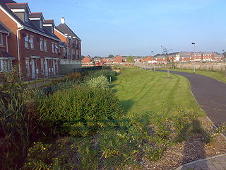
The unitary development plan was used at all stages of production and is reliant on criteria-based policies. Often contentious sites are proposed, which may generate significant opposition to the proposal. The existing system of UDPs makes it very difficult to provide a clearer framework.
An example statement describing the purpose of a UDP from Salford City Council: [1]
The unitary development plan (UDP) is a statutory document that sets out the council's planning policies that will be used to guide development, conservation, regeneration and environmental improvement activity in Salford.
A unitary authority is a local authority responsible for all local government functions within its area or performing additional functions that elsewhere are usually performed by a higher level of sub-national government or the national government.

New Zealand is divided into sixteen regions for local government purposes. Eleven are administered by regional councils, and five are administered by unitary authorities, which are territorial authorities that also perform the functions of regional councils. The Chatham Islands Council is not a region but is similar to a unitary authority, authorised under its own legislation.

Greater Manchester is a metropolitan county and combined authority area in North West England, with a population of 2.8 million; comprising ten metropolitan boroughs: Manchester, Salford, Bolton, Bury, Oldham, Rochdale, Stockport, Tameside, Trafford and Wigan. The county was created on 1 April 1974, as a result of the Local Government Act 1972, and designated a functional city region on 1 April 2011. Greater Manchester is formed of parts of the historic counties of Cheshire, Lancashire and the West Riding of Yorkshire.

The metropolitan counties are a type of county-level administrative division of England. There are six metropolitan counties, which each cover large urban areas, with populations between 1 and 3 million. They were created in 1974 and are each divided into several metropolitan districts or boroughs. With the abolition of metropolitan county councils in 1986, with most of their functions being devolved to the metropolitan boroughs, making the boroughs effectively unitary authorities, metropolitan counties no longer form a part of local government in England. Any remaining functions were taken over by joint boards.

Salford is a city and the core settlement of the wider City of Salford metropolitan borough in Greater Manchester, England. In 2011, Salford had a population of 103,886. It is also the second and only other city in the county after neighbouring Manchester. Salford is located in a meander of the River Irwell which forms part of its boundary with Manchester. The former County Borough of Salford, which also included Broughton, Pendleton and Kersal, was granted city status in 1926. In 1974 the wider Metropolitan Borough of the City of Salford was established with responsibility for a significantly larger region.

The subdivisions of England constitute a hierarchy of administrative divisions and non-administrative ceremonial areas.
A councillor is a member of a local government council in some countries.

The districts of England are a level of subnational division of England used for the purposes of local government. As the structure of local government in England is not uniform, there are currently four principal types of district-level subdivision. There are a total of 309 districts made up of 36 metropolitan boroughs, 32 London boroughs, 181 two-tier non-metropolitan districts and 58 unitary authorities, as well as the City of London and Isles of Scilly which are also districts, but do not correspond to any of these categories. Some districts are styled as cities, boroughs or royal boroughs; these are purely honorific titles and do not alter the status of the district or the powers of their councils. All boroughs and cities are led by a mayor who in most cases is a ceremonial figure elected by the district council, but—after local government reform—is occasionally a directly elected mayor who makes most of the policy decisions instead of the council.

The counties of England are areas used for different purposes, which include administrative, geographical, cultural and political demarcation. The term "county" is defined in several ways and can apply to similar or the same areas used by each of these demarcation structures. These different types of county each have a more formal name but are commonly referred to just as "counties". The current arrangement is the result of incremental reform.

A non-metropolitan county, or colloquially, shire county, is a county-level entity in England that is not a metropolitan county. The counties typically have populations of 300,000 to 1.8 million. The term shire county is, however, an unofficial usage. Many of the non-metropolitan counties bear historic names and most, such as Wiltshire and Staffordshire, end in the suffix "-shire". Of the remainder, some counties had the "-shire" ending but have lost it over time, such as Devon and Somerset.

Eccles is a town in Greater Manchester, England, 3 miles (4.8 km) west of Salford and 4 miles (6.4 km) west of Manchester, split by the M602 motorway and bordered by the Manchester Ship Canal to the south. The town is famous for the Eccles cake.

Directly elected mayors in England and Wales, informally known as Metro Mayors, are local government executive leaders who are directly elected by the residents of a local authority area. Examples of metro mayors include the mayor of London, the mayor of Greater Manchester, and the mayor of the Liverpool City Region.
A local development framework is the spatial planning strategy introduced in England and Wales by the Planning and Compulsory Purchase Act 2004 and given detail in Planning Policy Statements 12. In most parts of the two countries, maintaining the framework is the responsibility of English district councils and Welsh principal area councils.

A development plan sets out a local authority's policies and proposals for land use in their area. The term is usually used in the United Kingdom. A Local Plan is one type of development plan. The development plan guides and shapes day-to-day decisions as to whether or not planning permission should be granted, under the system known as development control. In order to ensure that these decisions are rational and consistent, they must be considered against the development plan adopted by the authority, after public consultation and having proper regard for other material factors.
A local planning authority (LPA) is the local government body that is empowered by law to exercise urban planning functions for a particular area. They exist in the United Kingdom and India.
Town and country planning in Wales is based on the land use planning system which applies in England. However, the system in Wales has some distinctive features which have arisen because substantial responsibility for town and country planning has been devolved to the Welsh Government (WAG). In particular, Wales now has a Spatial Plan and Welsh Ministers have a duty to under the Government of Wales Act 2006 to promote sustainable development.

The regions, formerly known as the government office regions, are the highest tier of sub-national division in England, established in 1994. Between 1994 and 2011, nine regions had officially devolved functions within government. While they no longer fulfil this role, they continue to be used for statistical and some administrative purposes. While the UK was a member of the European Union, they defined areas (constituencies) for the purposes of elections to the European Parliament. Eurostat also used them to demarcate first level Nomenclature of Territorial Units for Statistics (NUTS) regions within the European Union, which in 2021 were superseded by International Territorial Level (ITL) regions. The regions generally follow the boundaries of the former standard regions, established in the 1940s for statistical purposes.

A combined authority is a type of local government institution introduced in England outside Greater London by the Local Democracy, Economic Development and Construction Act 2009. Combined authorities are created voluntarily and allow a group of local authorities to pool appropriate responsibility and receive certain delegated functions from central government in order to deliver transport and economic policy more effectively over a wider area.

The Trafford Centre is a tram stop built for Greater Manchester's Metrolink light rail system, built to serve passengers boarding and alighting at the Trafford Centre on the Trafford Park Line. Previously known as intu Trafford Centre, the tram terminus received the name The Trafford Centre after intu ceased ownership of the shopping centre, the tram stop's namesake. The stop is located adjacent to Barton Dock Road between Ellesmere Circle and Bright Circle.

This is a list of confirmed or proposed future developments of the Manchester Metrolink light rail system.
| Legislation and policy | |
|---|---|
| Applications and Appeals | |
| Institutions | |
| Local development framework | |
| | This article relating to law in the United Kingdom, or its constituent jurisdictions, is a stub. You can help Wikipedia by expanding it. |
| | This article relating to Town and country planning in the United Kingdom is a stub. You can help Wikipedia by expanding it. |