Steinburg is a district in Schleswig-Holstein, Germany, administered from Itzehoe. It is bounded by the districts of Dithmarschen, Rendsburg-Eckernförde, Segeberg and Pinneberg, and by the Elbe River.
Pinneberg is a district in Schleswig-Holstein, Germany. It is bounded by the districts of Steinburg and Segeberg, the city of Hamburg and the state of Lower Saxony. The island of Heligoland is also part of the district.
Herzogtum Lauenburg is the southernmost Kreis, or district, of Schleswig-Holstein, Germany. It is bordered by the district of Stormarn, the city of Lübeck, the state of Mecklenburg-Vorpommern, the state of Lower Saxony, and the city state of Hamburg. The district of Herzogtum Lauenburg is named after the former Duchy of Saxe-Lauenburg.
Stade is a district (Landkreis) in Lower Saxony, Germany. It has its seat in Stade and is part of the Hamburg Metropolitan Region.

Harburg is a borough of the city of Hamburg, Germany. It is also the name of a quarter in this borough, which used to be the capital of the district in Lower Saxony. The borough of Harburg lies on the southern banks of the river Elbe and covers parts of the port of Hamburg as well as residential and rural areas. It had a population of 163,771 as of 2016.

The Wadden Sea National Parks in Denmark, Germany and the Netherlands are located along the German Bight of the North Sea. In Germany and Denmark they also mark the area of the UNESCO World Heritage Site of the Wadden Sea. Divided from each other by administrative borders, they form a single ecological entity. The purpose of the national parks is the protection of the Wadden Sea ecoregion.

Bouches-de-l'Elbe was a department of the First French Empire in present-day Germany that survived for three years. It was named after the mouth of the river Elbe. It was formed in 1811, when the region, originally belonging partially to Bremen-Verden, to Hamburg, Lübeck and Saxe-Lauenburg, was annexed by France. Its territory is part of the present-day German states of Lower Saxony, Schleswig-Holstein and Hamburg. Its capital was Hamburg.
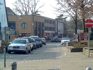
Rissen is a quarter of the city of Hamburg in Germany. It is located in the borough of Altona and is the westernmost quarter in the Hamburg, bordering the German federal state of Schleswig-Holstein in the west, north, and northeast and the Elbe river to the south. In 2016, the population was 15,000.

The Köhlbrand Bridge is a cable-stayed bridge in Hamburg, Germany, which connects the harbor area on the island of Wilhelmsburg between the Norderelbe and Süderelbe branches of the Elbe river with motorway 7. It bridges the Süderelbe, here called Köhlbrand, before it unites with the Norderelbe again. The bridge was opened on 9 September 1974.

Wilhelmsburg is a quarter (Stadtteil) of Hamburg, Germany within the borough (Bezirk) of Hamburg-Mitte. It is situated on several islands between the Northern and Southern branches of the Elbe river, together with the other quarters of Steinwerder, Veddel and Kleiner Grasbrook. The latter almost exclusively consists of facilities of the port of Hamburg. In 2016 the population was 55,074.
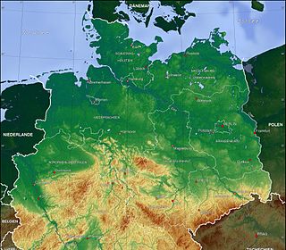
The North German Plain or Northern Lowland is one of the major geographical regions of Germany. It is the German part of the North European Plain. The region is bounded by the coasts of the North Sea and the Baltic Sea to the north, Germany's Central Uplands to the south, by the Netherlands to the west and Poland to the east.

The Zollenspieker Ferry is a ferry across the Elbe river in Germany. It crosses between Zollenspieker, a part of the quarter Kirchwerder of the Bergedorf borough of the city-state of Hamburg, and Hoopte, part of the town Winsen (Luhe), in the state of Lower Saxony, and is about 30 kilometres (19 mi) south-east of Hamburg city centre.

Kleiner Grasbrook (help·info) is a quarter (Stadtteil) of Hamburg, Germany within the borough (Bezirk) of Hamburg-Mitte. It is situated on the homonymous island between the Northern and Southern branches of the Elbe river, together with the other quarters of Steinwerder, Veddel and Wilhelmsburg. It almost exclusively consists of facilities of the port of Hamburg. The four quarters are technically all islands of their own, as they are all separated by their own dams. In 2016 the population was 1,218.
Transport in Hamburg comprises an extensive, rail system, subway system, airports and maritime services for the more than 1.8 million inhabitants of the city of Hamburg and 5.3 million people in the Hamburg Metropolitan Region.

Köhlbrand is an anabranch of the Unterelbe river in the Port of Hamburg, Germany. It has a width of approximately 325 metres (1,066 ft).

The Niederelbe is a 108 kilometers long section of the river Elbe, from western Hamburg downstream to its mouth into the North Sea near Cuxhaven. Starting at Mühlenberger Loch near Finkenwerder, Hamburg, it gradually widens from 2 km (1.2 mi) to 18 km (11 mi). Once passing the Hamburg state border, the Niederelbe also forms the border between the states of Lower Saxony and Schleswig-Holstein.
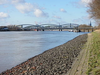
The Norderelbe is one of the two big anabranches of the Unterelbe river in the area which is now the Port of Hamburg, Germany. The other anabranch is the Süderelbe. Together they form the island of Wilhelmsburg.
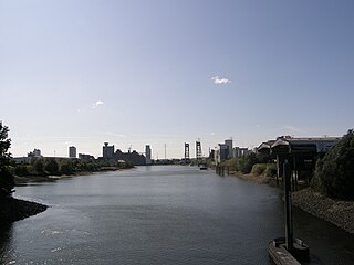
The Reiherstieg is an anabranch of the river Elbe in the Port of Hamburg, Germany.
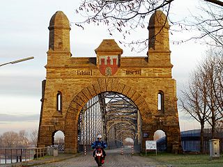
The Süderelbe is the biggest anabranch of the Unterelbe river in the area which is now the Port of Hamburg, Germany. Its natural flow path was redirected through the Köhlbrand.


