Nordhausen is a city in Thuringia, Germany. It is the capital of the Nordhausen district and the urban centre of northern Thuringia and the southern Harz region; its population is 42,000. Nordhausen is located approximately 60 km north of Erfurt, 80 km west of Halle, 85 km south of Braunschweig and 60 km east of Göttingen.

Heilbad Heiligenstadt is a spa town in Thuringia, Germany. It is the capital of the Eichsfeld district.
Stadtroda is a town of 6,653 people (2017), located in Thuringia, Germany. Stadtroda lies on the river Roda, a tributary of the Saale. The former municipalities Bollberg and Quirla were merged into Stadtroda in January 2019.
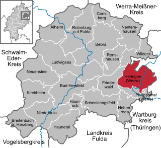
Heringen (Werra) is a small town in Hersfeld-Rotenburg district in eastern Hesse, Germany lying right at the boundary with Thuringia.

Artern is a town in the Kyffhäuserkreis district, Thuringia, Germany. The former municipalities Heygendorf and Voigtstedt were merged into Artern in January 2019.

Rudolstadt is a town in the German federal state Thuringia, within the Thuringian Forest, to the southwest, and to Jena and Weimar to the north.

Schleiz is a town in the district of Saale-Orla-Kreis in Thuringia, Germany. The former municipality Crispendorf was merged into Schleiz in January 2019, and Burgk in December 2019.

Bad Salzungen is a town in Thuringia, Germany. It is the capital of the Wartburgkreis district.

Geisa is a town in the Wartburgkreis district, in Thuringia, Germany. It is situated in the Rhön Mountains, 26 km northeast of Fulda. The near border with Hesse was the border between West Germany and the GDR during the Cold War. Thus, Geisa was in the East German border restriction area of the former inner German border, which meant that until reunification access to the town was limited. The town is the westernmost municipality in what was formerly East Germany.

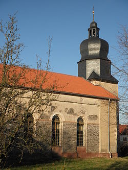
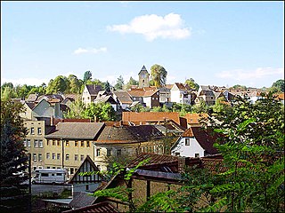
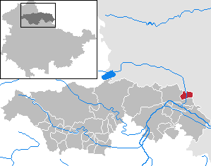
Heringen is a town in the district of Nordhausen, in Thuringia, Germany. It is situated on the small river Helme, 8 km southeast of Nordhausen.
Neumark is a town in the Weimarer Land district, in Thuringia, Germany. It is situated 20 km northeast of Erfurt, and 12 km northwest of Weimar. Neumark is the second-least populous town (Stadt) in Germany, and is the least populous in what was formerly East Germany.

Themar is a town in the district of Hildburghausen, in Thuringia, Germany. It is situated on the river Werra, 11 km northwest of Hildburghausen, and 14 km southwest of Suhl.

Weißensee is a town in the district of Sömmerda, in Thuringia, Germany. It is situated 6 km northwest of Sömmerda, and 25 km north of Erfurt. The former municipality Herrnschwende was merged into Weißensee in January 2019.
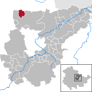
Mönchpfiffel-Nikolausrieth is a municipality on the river Helme in the district Kyffhäuserkreis, in Thuringia, Germany. The municipality was created in 1956 by the merging of the villages Monchpfiffel and Nikolausrieth.

The Helme is a river in central Germany that is about 65 kilometres (40 mi) long and which forms a left-hand, western tributary of the Unstrut in the states of Thuringia and Saxony-Anhalt.

The Hornungskuppe is a wooded hill, 439 m above sea level (NHN), in the Thuringian Zipfel on the border of Hesse and Thuringia in Germany. It is part of the natural region of the Seulingswald.
Nordhausen I is an electoral constituency represented in the Landtag of Thuringia. It elects one member via first-past-the-post voting. Under the current constituency numbering system, it is designated as constituency 3. It comprises the entirety of the district of Nordhausen with the exception of the city of Nordhausen, which compromises the constituency of Nordhausen II.
Unstrut-Hainich-Kreis I is an electoral constituency represented in the Landtag of Thuringia. It elects one member via first-past-the-post voting. Under the current constituency numbering system, it is designated as constituency 8. It covers the northwestern part of Unstrut-Hainich-Kreis.

Höngeda is a village and quarter of the town of Mühlhausen in Thuringia, central Germany.

Grabe is a village and a quarter of the town of Mühlhausen in Thuringia, central Germany. It consists of the settlements Kleingrabe and Großgrabe.