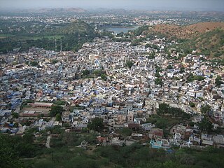
Vadia | |
---|---|
city | |
Coordinates: 21°51′54″N73°31′11″E / 21.8651°N 73.5198°E Coordinates: 21°51′54″N73°31′11″E / 21.8651°N 73.5198°E | |
Country | |
State | Gujarat |
District | Narmada |
Population (2001) | |
• Total | 4,479 |
Languages | |
• Official | Gujarati, Hindi |
Time zone | IST (UTC+5:30) |
<!-- PIN --> | 391120 |
Vehicle registration | GJ |
Website | gujaratindia |
Vadia is a census town in Narmada district in the Indian state of Gujarat.
A census town is a type of town that satisfies certain characteristics, depending on the country in which it is located.
Narmada district is an administrative district in the state of Gujarat in India. The district headquarters are located at Rajpipla. The district is bounded by Vadodara district in the north, by Maharashtra state in the east, by Tapi district in the south and by Bharuch district in the west. The district occupies an area of 2,755 km² and has a population of 5,90,379. It was 10.44% urban as of 2011.
India, also known as the Republic of India, is a country in South Asia. It is the seventh largest country by area and with more than 1.3 billion people, it is the second most populous country as well as the most populous democracy in the world. Bounded by the Indian Ocean on the south, the Arabian Sea on the southwest, and the Bay of Bengal on the southeast, it shares land borders with Pakistan to the west; China, Nepal, and Bhutan to the northeast; and Bangladesh and Myanmar to the east. In the Indian Ocean, India is in the vicinity of Sri Lanka and the Maldives, while its Andaman and Nicobar Islands share a maritime border with Thailand and Indonesia.
As of 2001 India census, Vadia had a population of 4479. Males constitute 59% of the population and females 41%. Vadia has an average literacy rate of 84%, higher than the national average of 59.5%: male literacy is 90%, and female literacy is 76%. In Vadia, 6% of the population is under 6 years of age. [1]
Aantaliya is a census town in Navsari district of the Indian state, Gujarat.
Chanasma is a small town and a municipality in Patan district in the state of Gujarat, India In Chanasma approximately 25000 People's And Chanasma Village and Also Taluka Center. Chanasma also Gujarat Vidhansabha Seat 117 number. Chanasma Have a Primary to Colleges Education.
Chanod is a census town in Valsad district in the state of Gujarat, India.
Chiloda (Naroda) is a census town in Gandhinagar district in the state of Gujarat, India.
Devsar is a census town in Navsari district in the state of Gujarat, India.
Gariadhar is a city and a municipality in Bhavnagar district in the state of Gujarat, India.
Jalalpore is a city and a Municipality in Navsari district in the Indian state of Gujarat. Jalalpore comes under Surat Metropolitan Region
Karachiya is a census town in Vadodara district in the Indian state of Gujarat.
Kheralu is a city and a municipality in Mehsana district in the Indian state of Gujarat. It is a little north of Mahesana Proper town and it is approximately half the size of Mehsana.
Mahuvar is a census town in Navsari district in the Indian state of Gujarat.
Nandesari is a census town in Vadodara district in the Indian state of Gujarat.
Nandesari INA is a town and an industrial notified area in Vadodara district in the Indian state of Gujarat.
Prantij is a town and a municipality in Sabarkantha district in the Indian state of Gujarat.
Sachin INA is a town and an industrial notified area in Surat district in the Indian state of Gujarat.
Sarigam is a town and an industrial notified area in Umbergaon Taluka of Valsad district in the Indian state of Gujarat.
Singarva is a census town in Ahmedabad district in the Indian state of Gujarat.
Surendranagar Dudhrej is a municipality in Surendranagar district in the Indian state of Gujarat. mainly Dudhrej municipality is directly connected with wadhwan city and wadhwan municipality.
Vijalpor is a city and a municipality in Navsari district in the Indian state of Gujarat. The city is under Surat Metropolitan Region. The town is located at a distance of 7 km south of Navsari City off Udhana-Nasik Highway.
Simalwara is a census town in Dungarpur district in the Indian state of Rajasthan. It is the administrative headquarters for Simalwara Tehsil.
This article about a location in Narmada district, Gujarat, India is a stub. You can help Wikipedia by expanding it. |