| Vajreshwari | |
|---|---|
| Village | |
| Coordinates: 19°29′16″N73°01′41″E / 19.487753°N 73.02809°E Coordinates: 19°29′16″N73°01′41″E / 19.487753°N 73.02809°E | |
| Country | |
| State | Maharashtra |
| District | Thane district |
| Government | |
| • Body | Gram panchayat |
| Languages | |
| • Official | Marathi |
| Time zone | IST (UTC+5:30) |
| PIN | 401204 |
| Telephone code | 02522 |
| Nearest city | Mumbai |
| Website | maharashtra |
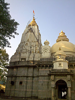
Vajreshwari also known as Vajrabai is a village situated near the Tansa River in the Bhiwandi taluk of Thane district, Maharashtra, India. It is famous for the Vajreshwari Temple and hot water springs. [1] [2]
The Tansa River is a small river near Mumbai, India and is one of Mumbai's water sources via Tansa Lake. It is embanked by one of the largest masonry dams in the world, built in 1892. The embankment is nearly 2 miles long, 118 ft (36 m) high, and 30 metres thick at the base. The dam has 1.31 cubic kilometres capacity of water retention. The dam has about 38 spillway gates.

Thane District ([]) is a district in the Indian state of Maharashtra in Konkan Division. At the 2011 Census it was the most populated district in the nation, with 11,060,148 inhabitants; however, in August 2014 the district was split into two with the creation of a new Palghar district, leaving the reduced Thane district with a 2011 Census population of 8,070,032. The headquarters of the district is the city of Thane. Other major cities in the district are Navi Mumbai, Kalyan-Dombivli, Mira-Bhayander, Bhiwandi, Ulhasnagar, Ambarnath, Badlapur, Murbad and Shahapur.

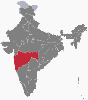
Maharashtra is a state in the western peninsular region of India occupying a substantial portion of the Deccan plateau. It is the second-most populous state and third-largest state by area in India. Spread over 307,713 km2 (118,809 sq mi), it is bordered by the Arabian Sea to the west, the Indian states of Karnataka and Goa to the south, Telangana and Chhattisgarh to the east, Gujarat and Dadra and Nagar Haveli to the north west, and Madhya Pradesh to the north. It is also the world's second-most populous subnational entity. It was formed by merging the western and south-western parts of the Bombay State, Berar and Vidarbha, and the north-western parts of the Hyderabad State and splitting Saurashtra by the States Reorganisation Act. It has over 112 million inhabitants and its capital, Mumbai, has a population around 18 million making it the most populous urban area in India. Nagpur hosts the winter session of the state legislature. Pune is known as 'Oxford of the East' due to the presence of several well-known educational institutions.
The village used to be called Vadvali but was later renamed Vajreswari in respect of the Goddess Vajreshwari, the presiding deity of the Vajreshwari Temple. The village consists mainly of the local Marathi community and the tribes living in the nearby forest. The village Vajreshwari is believed to have been formed as a result of volcanic eruption.[ citation needed ]


