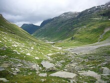
The Val Curciusa is an alpine valley in Graubünden, Switzerland. In the region of the San Bernardino Pass, it provides a connection between the Rheinwald valley and the Misox valley.

The Val Curciusa is an alpine valley in Graubünden, Switzerland. In the region of the San Bernardino Pass, it provides a connection between the Rheinwald valley and the Misox valley.
Val Curciusa leads south from Nufenen in the direction of the Misox valley, ending at the Bocchetta di Curciusa, a mountain pass, which is visible directly from San Bernardino when looking southeast. The valley is about 9 km long and is drained by the Areua Brook, which flows into the Hinterrhein at Nufenen.
Although the valley drains to the north part, about 85 percent of the area, until about 2 km from the confluence of the Areua Brook and the Posterior Rhine, belongs to the municipality of Mesocco south of the watershed.
Although the valley opens out in the German-speaking Hinterrhein valley at Nufenen, the inhabitants speak Italian, which is why the valley has an Italian name. A marked trail leads from the village of San Bernardino in a steep climb via Bocchetta di Curciusa pass (2,419 m), into Curciusa Alta, the upper part of the valley. In this area, the trail is hardly visible. The European Watershed runs across the Bocchetta di Curciusa.

The Curciusa Alta gained national notoriety through a Pump Reservoir Project, which was withdrawn in 1999 for "economic reasons" shortly before a federal court was to decide on an application for environmental protection. [1]
Val Curciusa is one of the few valleys in Switzerland, in which there is neither a reservoir nor an access road. It is only accessible on foot and surprises with a Wild West atmosphere on the second-highest part of the valley, the Curciusa Bassa, where not only cattle but also horses are allowed to graze in summer. In the highest part of the valley, the Curciusa Alta, the side valley Val Rossa branches off to the west.
The section below Curciusa Bassa is calle Alpe di Rog. Here, a trail branches off to the east, across Areua pass into Italy. Another trail branches off to the west, into Val Vignun.
The highest peaks on the eastern side of the valley are the Pizzo Tambo, to south of the Areua Pass and the Guggernüll, to the north of the Pass. The highest peaks on the western side, are the Piz de la Lumbreida, to the south of the trail into Val Vignun and the Einshorn north of that trail.

The Adula Alps, also known as the West Graubünden and Misox Alps, are a western Alpine mountain group, the part of the Lepontine Alps from the Lukmanier and St Gotthard Passes to the Splügen Pass.

The main chain of the Alps, also called the Alpine divide is the central line of mountains that forms the drainage divide of the range. Main chains of mountain ranges are traditionally designated in this way, and generally include the highest peaks of a range. The Alps are something of an unusual case in that several significant groups of mountains are separated from the main chain by sizable distances. Among these groups are the Dauphine Alps, the Eastern and Western Graians, the entire Bernese Alps, the Tödi, Albula and Silvretta groups, the Ortler and Adamello ranges, and the Dolomites of South Tyrol, as well as the lower Alps of Vorarlberg, Bavaria, and Salzburg.

The river Ticino is the most important perennial left-bank tributary of the Po. It has given its name to the Swiss canton through which its upper portion flows.

The Engadin or Engadine is a long high Alpine valley region in the eastern Swiss Alps in the canton of Graubünden in southeasternmost Switzerland with about 25,000 inhabitants. It follows the route of the Inn from its headwaters at Maloja Pass in the southwest running roughly northeast until the Inn flows into Austria, little less than one hundred kilometers downstream. The En/Inn subsequently flows at Passau into the Danube, making it the only Swiss river to drain into the Black Sea. The Engadine is protected by high mountain ranges on all sides and is famous for its sunny climate, beautiful landscapes and outdoor activities.

Piz Bernina is the highest mountain in the Eastern Alps, the highest point of the Bernina Range, and the highest peak in the Rhaetian Alps. It rises 4,048.6 m (13,283 ft) and is located south of Pontresina and near the major Alpine resort of St. Moritz, in the Engadin valley. It is also the most easterly mountain higher than 4,000 m (13,000 ft) in the Alps, the highest point of the Swiss canton of Graubünden, and the fifth-most prominent peak in the Alps. Although the summit lies within Switzerland, the massif is on the border with Italy. The "shoulder" known as La Spedla is the highest point in the Italian Lombardy region.
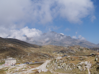
San Bernardino Pass is a high mountain pass in the Swiss Alps connecting the Hinterrhein and the Mesolcina (Misox) valleys between Thusis and Bellinzona. Located in the far eastern side of the Western Alps it is not to be confused with the Great St Bernard Pass and the Little St Bernard Pass. The top of the pass represents both the Italo-German language frontier and the watershed between the Po basin and the Rhine basin. Marscholsee is within the pass at an elevation of 2,053 m (6,736 ft).

The Vorderrhein is one of the two sources of the Rhine. Its catchment area of 1,512 square kilometres is located predominantly in the canton of Graubünden (Switzerland). The Vorderrhein is about 76 kilometres (47 mi) long, thus more than 5% longer than the Hinterrhein. The Vorderrhein, however, has an average water flow of 53.8 m3/s (1,900 cu ft/s), which is less than the flow of the Hinterrhein. According to the Atlas of Switzerland of the Swiss Federal Office of Topography, the source of the Vorderrhein—and thus of the Rhine—is located north of the Rein da Tuma and Lake Toma.
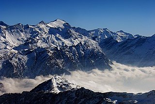
The Rheinwaldhorn is the highest point in the Swiss canton of Ticino at 3,402 metres above sea level. It lies on the border between the cantons of Graubünden and Ticino, in the Adula massif, part of the St. Gotthard massif of the Adula Alps in southern Switzerland.

San Bernardino is a mountainous village in the canton of Grisons in Switzerland. It is the southern entry point to the San Bernardino tunnel, which complemented the road over the San Bernardino Pass in 1967, opening a new all-year-round road to crossing the Alps.
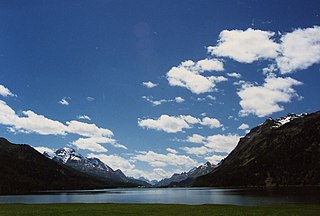
Piz Lunghin is a mountain in the Swiss canton of Graubünden, located in the Albula range, overlooking the Maloja Pass. It is considered as the "roof of Europe" as the peak is nearby the triple watershed of the Lunghin pass. Water running off this mountain can head towards the Mediterranean, the North Sea and the Black Sea, respectively by the rivers Po, Rhein, and Danube.

The Biellese Alps are a sub-range of the Pennine Alps located between Piemonte and Aosta Valley (Italy).
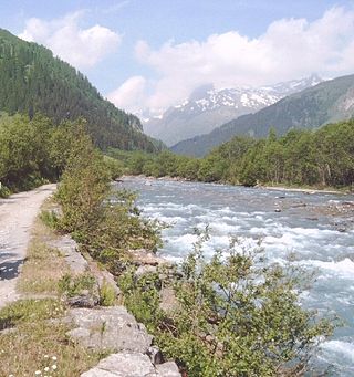
The Hinterrhein is one of the two initial tributaries of the Rhine rising in the canton of Graubünden in Switzerland.

The Zapporthorn or Pizzo Zapport is a mountain of the Swiss Lepontine Alps, overlooking San Bernardino Pass in Graubünden. Its summit is the tripoint between the valleys of Hinterrhein, Calanca and Mesolcina. The summit is located approximately two kilometres east from the Ticino border.

Piz Fora is a mountain in the Bernina Range (Alps), on the border of Italy and Switzerland. The mountain has an elevation of 3,363 metres (11,033 ft) and is the tripoint between the valleys of Val Fedoz, Val Fex and Val Malenco.

The Einshorn is a mountain of the Lepontine Alps, overlooking Hinterrhein in the Swiss canton of Graubünden.
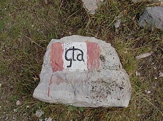
The Grande Traversata delle Alpi (GTA) is a long-distance hiking trail in the Italian region of Piedmont. In about 1,000 kilometres (620 mi) and 55 day hikes, it runs through the arc formed by the western Alps from the Pennine Alps through the Graian and Cottian Alps to the Maritime and Ligurian Alps. There are a number of transverse valleys along the route. Day hikes typically connect high-lying valley communities with each other via historic pass routes.
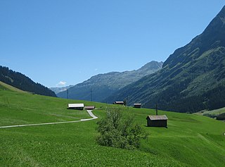
The Rheinwald is a valley in the Canton of Grisons in Switzerland, the first section of the Hinterrhein valley. The river Hinterrhein flows through three valleys in the Grisons, the Rheinwald, the Schams and the Domleschg.

The Rein da Medel is the longest headwater of the Rhine. It is located in the Swiss cantons of Ticino and Graubünden and flows through the valleys Val Cadlimo and Val Medel. Rein da Medel is the local Sursilvan, name in Graubünden, which is commonly used to denote the ticinese part as well.

The Schams is a section of the Hinterrhein valley in the Swiss canton of Graubünden.

The Val Vignun is an alpine valley in the Swiss Canton of Graubünden. It also forms a connection between the Misox valley and the Rheinwald valley, parallel to the San Bernardino Pass.