A municipality is usually a single administrative division having corporate status and powers of self-government or jurisdiction as granted by national and regional laws to which it is subordinate.

Villajoyosa, in Valencian: La Vila Joiosa, meaning "The Joyful Town", and officially Villajoyosa/La Vila Joiosa, is a coastal town and municipality in the south of the Valencian Community, Spain, by the Mediterranean Sea. It is the historic and administrative capital of Marina Baixa county, and is located in the province of Alicante. The town is known locally simply as La Vila.

The town of Rota is a Spanish municipality located in the Province of Cádiz, Andalusia. Its surface area is 84 km2 and is bordered by the towns of Chipiona, Sanlúcar de Barrameda and El Puerto de Santa María. It is located near the city of Jerez de la Frontera and is 36 kilometers away from the provincial capital, Cadiz. It had in the year 2009 28,516 inhabitants, with a density of 339 inhabitants / km2. It belongs to two associations, the Association of Municipalities of Cadiz Bay along with the municipalities of Cadiz, Jerez de la Frontera, El Puerto de Santa María, San Fernando, Chiclana and Puerto Real; and the Association of Municipalities of the Lower Guadalquivir that comprises municipalities of Northwest Coast of Andalusia.
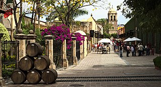
Santiago de Tequila is a Mexican town and municipality located in the state of Jalisco about 60 km from the city of Guadalajara. Tequila is best known as being the birthplace of the drink that bears its name, "tequila," which is made from the blue agave plant, native to this area. The heart of the plant contains natural sugars and was traditionally used to make a fermented drink. After the Spanish arrived, they took this fermented beverage and distilled it, producing the tequila known today. The popularity of the drink and the history behind it has made the town and the area surrounding it a World Heritage Site. It was also named a "Pueblo Mágico" in 2003 by the Mexican federal government.

San Roque is a town and municipality in the Colombian department of Antioquia. Part of the subregion of Northeastern Antioquia, it is located 1,475 m above sea level. The municipality was founded by Francisco Martinez de Ospina on the 8 February 1880. The town is located between the Nare River and the Nus River. The town was created due to the presence of gold in the areas around the town. The town is located 121 km north of Medellín. The people of this town celebrate most of the traditional festivals that are celebrated in Colombia.

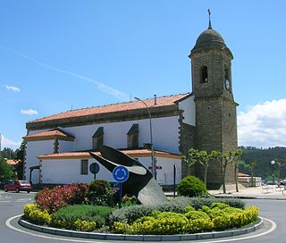
Orio is a fishing town located in the province of Gipuzkoa in the Basque Autonomous Community, northern Spain, with the town nucleus lying on the river Oria, roughly one mile away from its mouth by the Bay of Biscay. Orio had a population of 5,901 inhabitants as of 2016.

Mañaria is an elizate, town and municipality located in the province of Biscay, in the Basque Country, Spain. Mañaria is part of the comarca of Durangaldea and has a population of 459 inhabitants as of 2006 according to the Spanish National Statistics Institute.
Sopela, formerly known as Sopelana, is a town and municipality located in the province of Biscay, in the autonomous community of Basque Country, northern Spain. The town is roughly 820 hectares in size, located in the comarca Mungialdea on the north east side of Bilbao and due east of the Nervión river estuary. In the municipality, other former towns like Larrabasterra were annexed to make Sopela larger. The population is 13,878 people, as recorded in the 2019 census. The area of Sopela is situated among green hills and beaches. This makes it a very attractive suburb of Greater Bilbao, with a short commute of 35 minutes on the metro.
Castilblanco is a municipality located in the province of Badajoz, Extremadura, Spain. According to the 2005 census (INE), the municipality has a population of 1146 inhabitants.

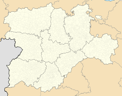
Cubillo del Campo is a municipality located in the province of Burgos, Castile and León, Spain.

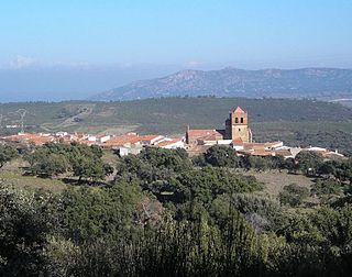
Tosantos is a municipality and town located in the province of Burgos, Castile and León, Spain. According to the 2004 census (INE), the municipality has a population of 60 inhabitants. Tosantos is located on the Camino de Santiago de Compostela, a 1200-year-old pilgrimage route that runs through France and Northern Spain to the Spanish city of Santiago. The hamlet has a pilgrim hostel which is open from April through October and hosts up to 50 pilgrims a night.

Berrocalejo de Aragona is a municipality located in the province of Ávila, Castile and León, Spain. According to the 2004 census (INE), the municipality had a population of 52 inhabitants. The towns current economy is 80% Activity, 15% Constructive Activity, and 5% Establishments and Services The current mayor is Emilio Navas Arroyo. The small town is now attempting to make its presence known by others using its new website and "virtual town hall".
Santa Cruz de Grío is a municipality located in the province of Zaragoza, Aragon, Spain. According to the 2010 census, the municipality has a population of 164 inhabitants.

Tabuenca is a municipality located in the province of Zaragoza, Aragon, Spain. According to the 2010 census the municipality has a population of 412 inhabitants. Its postal code is 50547.

Villanueva de Gállego is a municipality located in the province of Zaragoza, Aragon, Spain. According to the 2004 census (INE), the municipality has a population of 3,662 inhabitants.

Zuera is a municipality located in the province of Zaragoza, Aragon, Spain. According to the 2010 census, the municipality has a population of 7,510 inhabitants. The name is proposed coming from the Basque: 'Zubi', meaning: 'Bridge', or the Arabic: 'Zahra', meaning: 'Bright', referred to Venus, also known as Ishtar, present in old names as: 'Ahura Mazda'='the Light Great, Magna'.

Valdevacas de Montejo is a municipality located in the province of Segovia, Castile and León, Spain. According to the 2004 census (INE), the municipality has a population of 29 inhabitants.

Pahuatlán, officially Pahuatlán del Valle, is a town and municipality located in the northwest of the state of Puebla in central Mexico. The municipality is part of the Sierra Norte region of the state, a steep mountainous area which receive significant moisture from the Gulf of Mexico, and borders the states of Hidalgo and Veracruz.
Higuera, also known as Higuera de Albalat, is a Spanish municipality of the Province of Cáceres, in the autonomous community of Extremadura. The municipality covers an area of 40.54 square kilometres (15.65 sq mi) and as of 2011 had a population of 115 people.

Poll Islet,, is an Australian island in the center of the Torres Strait Islands. It lies in the southern part of The Three Sisters island group and is located 5.2 kilometres (3.2 mi) south off Sue Island, the middle and only inhabited island in The Three Sisters. It is within the Guijar Islet locality in the Torres Strait Island Region local government area.