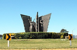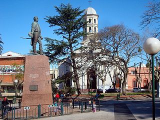
Montevideo is the capital and largest city of Uruguay. According to the 2011 census, the city proper has a population of 1,319,108 in an area of 201 square kilometers (78 sq mi). Montevideo is situated on the southern coast of the country, on the northeastern bank of the Río de la Plata.

Minas is the capital of the Lavalleja Department in Uruguay. As of the census of 2011, it is the twelfth-most populated city in the country.

Rivera is the capital of Rivera Department of Uruguay. The border with Brazil joins it with the Brazilian city of Santana do Livramento, which is only a block away from it, at the north end of Route 5. Together, they form an urban area of around 200,000 inhabitants. As of the census of 2011, it is the sixth most populated city of Uruguay.

The Estadio Gran Parque Central is the stadium of Club Nacional de Football. It is located in Montevideo, Uruguay, near Nacional headquarters, in the La Blanqueada neighbourhood.

Pocitos is an upscale seaside barrio of Montevideo, Uruguay. It borders Buceo to the east, Parque Batlle to the north, Tres Cruces, Cordón and Parque Rodó to the west and Punta Carretas to the south.

Tala is a town in the north of the Canelones Department of southern Uruguay.

Tourism in Uruguay is an important part of the nation's economy.

Punta Carretas is a barrio of Montevideo, Uruguay.

Ciudad de la Costa is a city in Canelones Department of Uruguay, on the banks of the Río de la Plata between the streams Arroyo Carrasco and Arroyo Pando. It is considered an extension of the metropolitan area of Montevideo which it borders to the west, while to the east it borders Costa de Oro. It was declared a city on 19 October 1994 and given its current name. At the 2011 census, it was the second most populated city of Uruguay between Montevideo and Salto.

Pando is a city in the Canelones Department of Uruguay. It is an important commercial and industrial centre which has become part of the wider Montevideo metropolitan area.

Santa Lucía is a city in the Canelones Department of southern Uruguay.

San Ramón is a small city in the north of Canelones Department, in southern Uruguay.
General Seregni is a town in the Canelones Department of southern Uruguay.

Empalme Olmos is a village in the Canelones Department of southern Uruguay.

Salinas is a city and resort of the Costa de Oro in the Canelones Department of southern Uruguay.

San Jacinto is a small city in the Canelones Department of southern Uruguay, and is also the name of the municipality to which the city belongs.
Santa Rosa is a small city in the Canelones Department of southern Uruguay.
Sauce is a small city and municipality in the Canelones Department of southern Uruguay.

In mid-January 2022, the Southern Cone had a severe heat wave, which made the region for a while the hottest place on earth, with temperatures exceeding those of the Middle East. This extreme weather event was associated with the Atlantic anticyclone, a particularly intense La Niña phenomenon in the Pacific Ocean, and the regional effects of climate change.


