Valley of Fire Road

Last updated

Valley of Fire Road

Valley of Fire Road
Map of the Valley of Fire Road in red
Route information
Maintained by NDOT
Length23.5 mi [1]  (37.8 km)
HistoryExisted as SR 40 c.1935-1976; Designated scenic byway in 1995
Known for Valley of Fire State Park
RestrictionsState park entry fee required
Major junctions
West endI-15.svg I-15 northeast of Las Vegas
East endNorthshore Road in Lake Mead Nat'l Rec Area
Location
Country United States
State Nevada
Counties Clark
Highway system
  • Nevada State Highway System

The Valley of Fire Road (also called the Valley of Fire Highway) is a road in northeastern Clark County, Nevada serving the Valley of Fire State Park. The roadway was previously designated State Route 40 (SR 40), and the segment within the state park is currently designated a Nevada Scenic Byway.

Contents

Route description

Valley of Fire Road Valley of Fire State Park, Nevada.JPG
Valley of Fire Road

The western terminus of the Valley of Fire Road is at the Interstate 15 (I-15) exit 75, located at the former Crystal townsite within the Moapa River Indian Reservation approximately 33 miles (53 km) northeast of downtown Las Vegas. From there, the two-lane highway travels southeasterly about seven miles (11 km) through open desert terrain towards the Muddy Mountains. The road begins to follow more a more hilly and curvaceous path as it meanders through the mountains. Around the 12-mile mark, the road officially enters the Valley of Fire State Park boundary and the scenic route begins, with the state park's west entrance station coming approximately two miles (3.2 km) east of there. Beyond the fee station, Valley of Fire Road traverses the southern reaches of the state park, passing nearby to various campgrounds, trails, the visitor center, and other points of interest. The mountainous landscape adjoining the highway becomes much more colorful, reflective of the terrain featured in the park. Valley of Fire Road spends roughly ten miles (16 km) in the park before passing the east entrance station near Elephant Rock, where the scenic byway designation ends. The roadway reaches its eastern terminus two miles (3.2 km) east of there, at an intersection with Northshore Road within the Lake Mead National Recreation Area approximately nine miles (14 km) south of Overton. [1] [2]

Payment of a state park entrance fee is required to travel on Valley of Fire Road between the west and east entrance stations. As of June 2021, the day use entrance fee is US$10 per vehicle and US$15 per non-Nevada vehicle. [3]

History

The Valley of Fire Road was designated SR 40 c. 1935-1976 Nevada 40.svg
The Valley of Fire Road was designated SR 40 c. 1935-1976

A county road appearing in an approximately parallel alignment of the Valley of Fire Road appears on official state highway maps as early as 1933. However, the road proceeded much more easterly from U.S. Route 91 (US 91) and SR 6 at Crystal to connect to SR 12 near St. Thomas, bypassing north of the Valley of Fire. [4] This roadway was marked as State Route 40 by 1935, and was shown along a route connecting Crystal more directly to Overton on SR 12, [5] a distance of roughly 30 miles (48 km). [6] By 1941, SR 40 was moved to a new alignment that resembles the present-day alignment of the Valley of Fire Road—the new routing was an unimproved, 23-mile (37 km) roadway traversing the southern side of the Valley of Fire State Park. [7] The road was finally paved by 1964. [8]

In 1976, the Nevada Department of Transportation (NDOT) began an effort to renumber its state highways. In this process, the SR 40 designation along Valley of Fire Road was proposed to be combined with SR 12 into a new State Route 169. This new highway designation was first seen on state highway maps in 1978. [9] This action ultimately was not carried out, leaving the Valley of Fire Road without a state route number by 1982. [10] However, as of 2020, the portion of Valley of Fire Road within the state park boundaries is still maintained by NDOT as a state park road. [11]

A 10.5-mile (16.9 km) section of the Valley of Fire Road—the portion between the west and east entrances to the state park—was designated a Nevada Scenic Byway on June 30, 1995. [12]

Major intersections

The entire route is in Clark County.

Locationmi [1] kmDestinationsNotes
Crystal 0.00.0I-15.svg I-15  Las Vegas, Mesquite Western terminus; I-15 exit 75
Valley of Fire State Park 14.523.3West entrance fee station
18.930.4Mouse's Tank RoadServes Valley of Fire Visitor Center and White Domes
21.534.6East entrance fee station / Elephant Rock
Lake Mead Nat'l Rec Area 23.537.8Northshore Road – Overton, Lake Mead Eastern terminus
1.000 mi = 1.609 km; 1.000 km = 0.621 mi

See also

Related Research Articles

<span class="mw-page-title-main">Interstate 515</span> Highway in Nevada

Interstate 515 (I-515) is a 14.444-mile-long (23.245 km) spur route of I-15 in the US state of Nevada that runs from the junction of I-11, I-215, and State Route 564 (SR 564) at the Spaghetti Bowl Interchange in Henderson to the junction of I-15, U.S. Route 93 (US 93), and US 95 at the Las Vegas Spaghetti Bowl Interchange in Downtown Las Vegas. The freeway connects traffic headed from Boulder City and Henderson to Downtown Las Vegas via a direct, high-speed route, and it runs concurrently with both US 93 and US 95 along its entire length.

<span class="mw-page-title-main">California State Route 140</span> Highway in California

State Route 140 is a state highway in the U.S. state of California, 102 miles (164 km) in length. It begins in the San Joaquin Valley at Interstate 5 near Gustine, and runs east into Sierra Nevada, terminating in Yosemite National Park.

<span class="mw-page-title-main">Interstate 11</span> Interstate Highway in the U.S. state of Nevada

Interstate 11 (I-11) is an Interstate Highway that currently runs for 22.8 miles (36.7 km) on a predominantly northwest–southeast alignment in the US state of Nevada, running concurrently with US Route 93 (US 93) between the Arizona state line and Henderson. The freeway is tentatively planned to run from Nogales, Arizona, to the vicinity of Reno, Nevada, generally following the current routes of I-19, I-10, US 93, and US 95. Planners anticipate upgrading two existing highway segments to carry future I-11: US 93 in Arizona from Wickenburg to the Nevada state line on the Mike O'Callaghan–Pat Tillman Memorial Bridge over the Colorado River, and US 95 in Nevada from the Las Vegas Valley to Tonopah. An exact alignment for I-11 has yet to be determined outside of these sections; however, a number of corridor alternatives have been identified for further study and refinement.

<span class="mw-page-title-main">Nevada State Route 157</span> Highway in Nevada

State Route 157, also known as Kyle Canyon Road, is a U.S. state highway in Clark County, Nevada. The highway connects the Las Vegas area to the recreational areas of Mount Charleston in the Spring Mountains.

<span class="mw-page-title-main">Nevada State Route 28</span> State highway in Nevada, United States

State Route 28 (SR 28) is a 16.3-mile (26.2 km) state highway in Douglas County, Carson City, and Washoe County in western Nevada, United States, that runs along the northeastern shore of Lake Tahoe. SR 28 connects U.S. Route 50 (US 50) in Douglas County with California State Route 28 at Crystal Bay. SR 28 has been part of the Nevada scenic byway system since June 1994 and the National Scenic Byway system since September 1996.

<span class="mw-page-title-main">California State Route 88</span> Highway in California

State Route 88 (SR 88), also known as the Carson Pass Highway, is a state highway in the U.S. state of California. It travels in an east–west direction from Stockton, in the San Joaquin Valley, to the Nevada state line, where it becomes Nevada State Route 88, eventually terminating at U.S. Route 395 (US 395). The highway is so named as it crests the Sierra Nevada at Carson Pass. The highway corridor predates the era of the automobile; the path over Carson pass was previously used for the California Trail and the Mormon Emigrant Trail. The mountainous portion of the route is included in the State Scenic Highway System.

<span class="mw-page-title-main">California State Route 190</span> Highway in California

State Route 190 is a state highway in the U.S. state of California that is split into two parts by the Sierra Nevada. The western portion begins at Tipton at a junction with State Route 99 and heads east towards Porterville before ending at Quaking Aspen in the Sequoia National Forest. The eastern portion begins at US 395 at Olancha, heads east through Death Valley National Park, and ends at State Route 127 at Death Valley Junction. The 43.0-mile (69.2 km) portion over the Sierra Nevada remains unconstructed, and the California Department of Transportation (Caltrans) has no plans to build it through the wilderness areas. SR 190 is a National Scenic Byway known as the Death Valley Scenic Byway.

<span class="mw-page-title-main">Arizona State Route 67</span> State highway in Arizona, United States

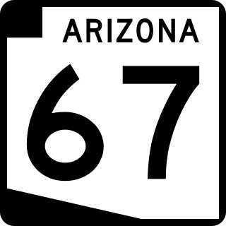
State Route 67 is a 43.4 mi (69.8 km) long, north–south state highway in northern Arizona. Also called the Kaibab Plateau – North Rim Parkway, SR 67 is the sole road that links U.S. Route 89A at Jacob Lake to the North Rim of Grand Canyon National Park. Along the route, the road heads through the national park as well as Kaibab National Forest and traverses extensive coniferous forests. The section inside the national park is maintained by the National Park Service (NPS), whereas the section north of the entrance, completely within Kaibab National Forest, is owned by the Arizona Department of Transportation (ADOT). The road was built in the late 1920s and improved through the 1930s. In 1941, the road received its number, and was given its designation as the parkway in the 1980s. The parkway has received designations as a National Forest Scenic Byway as well as a National Scenic Byway.

<span class="mw-page-title-main">Nevada State Route 169</span>

State Route 169 is a state highway in Clark County, Nevada, United States. It connects the northern reaches of Lake Mead National Recreation Area to Interstate 15 (I-15) via Moapa Valley and the communities of Overton and Logandale. It is also called Northshore Road, Moapa Valley Boulevard, and Logandale Road.

<span class="mw-page-title-main">Nevada State Route 208</span>

State Route 208 is a 37.893-mile (60.983 km) state highway in Douglas and Lyon counties in Nevada, United States. It connects U.S. Route 395 north of Topaz Lake to U.S. Route 95 Alternate in Yerington. The road serves as the primary transportation corridor of Smith Valley and is Main street in Yerington. The route was originally a portion of State Route 3.

<span class="mw-page-title-main">U.S. Route 50 in Nevada</span> Section of U.S. Highway in Nevada, United States

U.S. Route 50 (US 50) is a transcontinental highway in the United States, stretching from West Sacramento, California, in the west to Ocean City, Maryland, on the east coast. The Nevada portion crosses the center of the state and was named "The Loneliest Road in America" by Life magazine in July 1986. The name was intended as a pejorative, but Nevada officials seized it as a marketing slogan. The name originates from large desolate areas traversed by the route, with few or no signs of civilization. The highway crosses several large desert valleys separated by numerous mountain ranges towering over the valley floors, in what is known as the Basin and Range province of the Great Basin.

<span class="mw-page-title-main">Russell Road (Las Vegas)</span> Highway in Nevada

Russell Road is a section line road within the Las Vegas Valley of Clark County, Nevada. It is no longer a continuous road through the valley, as Harry Reid International Airport interrupts its right of way. The eastern section terminates at the eastern edge of the airport, with the road resuming at Las Vegas Boulevard on the western edge of the airport. The intersection of Russell Road and Las Vegas Boulevard is often considered to mark the southern terminus of the Las Vegas Strip.

<span class="mw-page-title-main">Nevada State Route 488</span> Highway in Nevada

State Route 488 is an east–west state highway in White Pine County, Nevada. The route covers Lehman Caves Road connecting the town of Baker to Great Basin National Park. The route existed as State Route 74 prior to 1976. SR 488 has been designated a Nevada Scenic Byway.

<span class="mw-page-title-main">Nevada State Route 439</span> Highway in Nevada

State Route 439 (SR 439) is a four-lane state highway in Lyon, Storey and Washoe Counties in Nevada. Better known as USA Parkway, the route connects U.S. Route 50 (US 50) in Silver Springs to Interstate 80 (I-80) in Clark via the Tahoe Reno Industrial Center (TRIC). The northern portion of USA Parkway was initially constructed by the industrial center's developers; however, the Nevada Department of Transportation (NDOT) agreed to assume control of the road after Tesla announced plans to build its Gigafactory at TRIC in 2014. NDOT opened the extension of SR 439 south to US 50 in Lyon County on September 8, 2017.

<span class="mw-page-title-main">Nevada State Route 431</span> Highway in Nevada

State Route 431, commonly known as the Mount Rose Highway, is a 24.413-mile-long (39.289 km) highway in Washoe County, Nevada, that connects Incline Village at Lake Tahoe with Reno. The highway, a Nevada Scenic Byway, takes its name from Mount Rose, which lies just off the highway. Prior to 1976, the highway existed as State Route 27.

<span class="mw-page-title-main">U.S. Route 395 in California</span> Highway in California

U.S. Route 395 (US 395) is a United States Numbered Highway, stretching from Hesperia, California to the Canadian border in Laurier, Washington. The California portion of US 395 is a 557-mile (896 km) route which traverses from Interstate 15 (I-15) in Hesperia, north to the Oregon state line in Modoc County near Goose Lake. The route clips into Nevada, serving the cities Carson City and Reno, before returning to California.

<span class="mw-page-title-main">Nevada State Route 445</span> Highway in Nevada

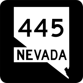
State Route 445 is a 41.890-mile-long (67.415 km) state highway in Washoe County, Nevada. The route follows Pyramid Way, a major thoroughfare in the city of Sparks, and connects the Reno metropolitan area to Pyramid Lake. The route is designated a Nevada Scenic Byway.

References

  1. 1 2 3 Google (September 4, 2017). "Overview Map of Valley of Fire Road" (Map). Google Maps . Google. Retrieved September 4, 2017.
  2. Nevada Department of Transportation (January 2017). General Highway Map: Clark County, Nevada (zone 2) (Map). c. 1:95,040. Carson City: Nevada Department of Transportation. Retrieved September 4, 2017.
  3. Nevada Division of State Parks (n.d.). "Valley of Fire State Park". Nevada State Parks. Nevada Division of State Parks. Retrieved June 19, 2021.
  4. Nevada State Highway Department (1933). Official Road Map of Nevada (Map). Scale not given. Carson City: Nevada State Highway Department. Retrieved September 4, 2017 via University of Nevada, Reno, Library.
  5. Nevada State Highway Department (1935). Official Road Map of the State of Nevada (Map). Sacle not given. Carson City: Nevada State Highway Department. Retrieved September 4, 2017 via University of Nevada, Reno, Library.
  6. Nevada State Highway Department (1936). Official Road Map of the State of Nevada (Map). Scale not given. Carson City: Nevada State Highway Department. Retrieved September 4, 2017 via University of Nevada, Reno, Library.
  7. Nevada Department of Highways (1941). Official Road Map of the State of Nevada (Map). Scale not given. Carson City: Nevada Department of Highways. Retrieved September 4, 2017 via University of Nevada, Reno, Library.
  8. Nevada State Highway Department; Rand McNally (1963). Official Highway Map of Nevada (Map) (1963-64 ed.). Scale not given. Carson City: Nevada State Highway Department. Retrieved September 4, 2017 via University of Nevada, Reno, Library.
  9. Nevada State Highway Department (1978). Official Highway Map of Nevada (Map) (1978-79 ed.). Scale not given. Carson City: Nevada State Highway Department. § F6. Retrieved September 4, 2017 via University of Nevada, Reno, Library.
  10. Nevada Department of Transportation (1982). Official Highway Map of Nevada (Map). Scale not given. Carson City: Nevada Department of Transportation. § F6. Retrieved September 4, 2017 via University of Nevada, Reno, Library.
  11. Nevada Department of Transportation (January 2020). "State Maintained Highways of Nevada: Descriptions and Maps" . Retrieved July 4, 2020.
  12. Nevada Department of Transportation (n.d.). "Nevada's Scenic Byways". Nevada Department of Transportation. Archived from the original on December 20, 2014. Retrieved September 4, 2017.

Route map:

Template:Attached KML/Valley of Fire Road
KML is not from Wikidata