
Sogn og Fjordane is a county in western Norway, bordering Møre og Romsdal, Oppland, Buskerud, and Hordaland. The county administration is in the village of Hermansverk in Leikanger municipality. The largest town in the county is Førde.

Nore og Uvdal is a municipality in Buskerud county, Norway. It is part of the traditional region of Numedal. The administrative centre of the municipality is the village of Rødberg.

Guovdageaidnu (Northern Sami) or Kautokeino (Norwegian) is a municipality in Finnmark county, Norway. The administrative centre of the municipality is the village of Guovdageaidnu/Kautokeino. Other villages include Láhpoluoppal and Máze.

Hasvik is a municipality in Finnmark county, Norway. The administrative centre of the municipality is the village of Breivikbotn. Other villages in the municipality include Breivik, Hasvik, and Sørvær. The population of Hasvik has generally been in steady decline due to problems within the fishing industry. Hasvik is an island municipality with no road connections to the rest of Norway. Hasvik Airport is served with regular connections to Tromsø and Hammerfest, and there is a two-hour ferry crossing to the village of Øksfjord on the mainland, providing access by car.

Nord-Fron is a municipality in Oppland county, Norway. It is part of the traditional region of Gudbrandsdal. The administrative centre of the municipality is the village of Vinstra. The old municipality of Fron was divided into Nord-Fron and Sør-Fron in 1851. In 1966, they were merged back together again, but that only lasted until 1977 when they separated once again.

Stord is a municipality in Hordaland county, Norway. It is located in the traditional district of Sunnhordland. Stord is sometimes called "Norway in miniature" since it has such a variety of landscapes: coastline, fjords, forests, agricultural land, and mountain areas. The administrative centre of the municipality is the town of Leirvik, which is also the largest town in the municipality and the whole region of Sunnhordland. Leirvik was declared a town in 1997. Other population centres in the municipality include the large village of Sagvåg and the smaller villages of Litlabø and Grov.

Samnanger is a municipality in the Midhordland region of Hordaland county, Norway. The administrative centre of the municipality is the village of Tysse. Other main villages in the municipality include Haga and Bjørkheim in Nordbygda. The municipality is located about 20 kilometres (12 mi) east of the city of Bergen, Norway's second largest city. It surrounds the inner part of the Samnangerfjorden and the surrounding valleys. There are mountains that surround the municipality. The development of hydroelectric power plants started here in 1909.

Fyresdal is a municipality in Telemark county, Norway. It is part of the traditional region of Vest-Telemark. The administrative centre of the municipality is the village of Moland. The municipality of Moland was established on 1 January 1838. In 1879, the name was changed to Fyresdal.

Sykkylven is a municipality in Møre og Romsdal county, Norway. It is part of the Sunnmøre region. The administrative centre is the village of Aure. Other villages in the municipality include Ikornnes, Straumgjerde, and Tusvik.

Valle (help·info)is a municipality in Aust-Agder county, Norway. It is located in the traditional district of Setesdal. The administrative centre of the municipality is the village of Valle. Other villages in Valle include Besteland, Brokke, Homme, Hovet, Rygnestad, Rysstad, and Uppstad.

Bykle is a municipality in Aust-Agder county, Norway. It is located in the traditional district of Setesdal. The administrative centre of the municipality is the village of Bykle. Other villages in Bykle municipality include Berdalen, Bjåen, Breive, Hoslemo, Hovden, and Nordbygdi. Bykle was established as a municipality on 1 January 1902 when it was separated from the municipality of Valle.

Aurland is a municipality in the county of Sogn og Fjordane, Norway. It is located on the south side of the Sognefjorden in the traditional district of Sogn. The administrative center is the village of Aurlandsvangen. Other villages include Bakka, Flåm, Undredal, and Gudvangen.

Lærdal is a municipality in the southeastern part of Sogn og Fjordane county, Norway. It is located on the south side of the Sognefjorden in the traditional district of Sogn. The administrative center of the municipality is the village of Lærdalsøyri. The old Filefjell Kongevegen road passes through Lærdal on its way to Valdres and later to Oslo.

Evenes is a municipality in Nordland county, Norway. It is part of the traditional district of Ofoten. The administrative centre of the municipality is the village of Bogen. Other villages in Evenes include Liland, Tårstad, Dragvik, and the village of Evenes.

Skånland is a municipality in Troms county, Norway. It is part of the Central Hålogaland region, just southeast of the city of Harstad. The administrative centre of the municipality is the village of Evenskjer. Other villages include Grovfjord, Renså, Sandstrand, and Tovik.

Geiranger is a small tourist village in Sunnmøre region of Møre og Romsdal county in the western part of Norway. It lies in Stranda at the head of the Geirangerfjorden, which is a branch of the large Storfjorden. The nearest city is Ålesund. Geiranger is home to some of the most spectacular scenery in the world, and has been named the best travel destination in Scandinavia by Lonely Planet. Since 2005, the Geirangerfjord area has been listed as a UNESCO World Heritage Site. The Seven Sisters waterfall is located just west of Geiranger, directly across another waterfall called "The Suitor." Norwegian County Road 63 passes through the village. Geiranger Church is the main church for the village and surrounding area.
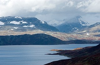
Tyin is a lake in the southwest part of the Jotunheimen mountain range in Norway. The lake lies in Vang municipality in Oppland county, although a small portion extends into Årdal municipality in Sogn og Fjordane county. The western border follows, for a large part, the border between Vang and Årdal. In area it is 33.02 km². The lake serves as a reservoir for the Tyin Hydroelectric Power Station and the water level is regulated between 1082.84 and 1072.50 m above sea level. The volume is 0.313 km³.

Indre Sula is a mountain in the municipality of Surnadal in Møre og Romsdal county, Norway. It is part of the Trollheimen mountain range, and it lies just north of Todalsøra and the Todalsfjorden.

Benadi is a village in the North-Western region of Karnataka state near Maharashtra Border in India. It is located in the Chikodi taluka of Belgaum district in Karnataka. Before it was a part of Bombay State and Princely state of Kolhapur. It is famous for its excellent quality of tobacco production. It is a part of Twin Village Aadi-Benadi. People who has origin from this village are known as Benadikar.

Todalsøra or Todalen is a village in Surnadal Municipality in Møre og Romsdal county, Norway. The rather isolated village is located at the end of the Todalsfjorden, about 22 kilometres (14 mi) south of Surnadalsøra and the municipal center of Skei. The mountain Vassnebba lies just to the west and the mountains Indre Sula and Ytre Sula lie just to the north. There is only one road connecting the village to the rest of Norway. The village of Ålvund in Sunndal Municipality lies 9 kilometres (5.6 mi) to the west, although there is no direct connections by road between the two villages. Todalen Church is located in this village.


