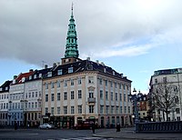
Sankt Annæ Plads is a public square which marks the border between the Nyhavn area and Frederiksstaden neighborhoods of central Copenhagen, Denmark. It is a long narrow rectangle which extends inland from the waterfront, at a point just north of the Royal Danish Playhouse at the base of the Kvæsthus Pier, now known as Ofelia Plads, until it meets Bredgade. A major renovation of the square was completed in 2016.The Garrison Church is located on the south side of the square. Amaliegade, one of the two axes on which Frederiksstaden is centered, extends from the square.

Borgergade is a street in central Copenhagen, Denmark. It runs from Gothersgade to Store Kongensgade. As one of relatively few streets in central Copenhagen, the street, in its western part, is dominated by modern buildings. The eastern part passes through the Nyboder district.

Dronningens Tværgade is a street in central Copenhagen, Denmark, which runs from Bredgade to Rosenborg Castle Garden. The street originally formed a link between the King's Garden and the Queen's Garden. With the Odd Fellows Mansion on Bredgade and the central pavilions of the east fringe of the castle garden located at each their end, the street has axial qualities. These are accentuated by the Dronningegården Estate, a Functionalist housing complex from the 1940s, which forms an urban space around the intersection with Adelgade.

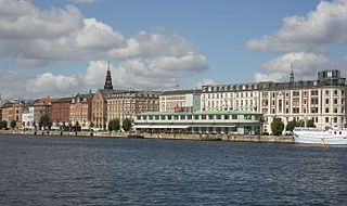
Havnegade is a waterfront promenade in central Copenhagen, Denmark, which runs along the Inner Harbour between Knippelsbro and the mouth of the Nyhavn canal. Most of the street is lined with buildings from the 1860s and 1870s that were constructed as part of the redevelopment of the Gammelholm naval dockyards. It is the only place along Copenhagen's main harbourfront where residential buildings of that age face the water, although older warehouses and other industrial buildings elsewhere have been converted into residential use. The Modernist Bank of Denmark building is located at the western end of the street.

Holmens Kanal is a short street in central Copenhagen. Part of the main thoroughfare of the city centre, it extends from Kongens Nytorv for one block to a junction with a statue of Niels Juel where it turns right towards Holmens Bro while the through traffic continues straight along Niels Juels Gade. The street was originally a canal, hence the name, but was filled in the 1860s. Today it is dominated by bank and government buildings.

Højbro is a bridge in central Copenhagen, Denmark. It connects the small island Slotsholmen with its Christiansborg Palace to the rest of the city centre at the square Højbro Plads which is named after it. The current bridge at the site is from 1878 and was designed by Vilhelm Dahlerup.

The Gustmeyer House is a historic property on Ved Stranden, opposite Christiansborg Palace on Slotsholmen, in central Copenhagen, Denmark. It was built in 1797 to a Neoclassical design by Johan Martin Quist. The Nobel Prize-winning physicist Niels Bohr was born in the building. McKinsey & Company is now based in the building.

Ploug House is a listed Neoclassical property on the corner of Højbro Plads and Ved Stranden in central Copenhagen, Denmark. It dates from the building boom which followed after the Copenhagen Fire of 1795 but takes its name from the poet, publisher and politician Carl Ploug who lived there in the 1860s and 1870s and also published the newspaper Fædrelandet from the premises.

Torvegade is the central thoroughfare of Christianshavn in Copenhagen, Denmark, linking the city centre by way of Knippel Bridge with Amagerside Copenhagen at Christmas Møllers Plads. The street crosses Christianshavn Canal at Christianshavns Torv, the central square of the neighbourhood. The last section of the street runs on the embankment that across Stadsgraven.

Store Kongensgade is the longest street in central Copenhagen, Denmark. It extends northeast from Kongens Nytorv to Esplanaden, running parallel to Bredgade, where it breaks left, continuing northwest to Grønningen.

Pilestræde is a street in central Copenhagen, Denmark. It is a side street to the pedestrianized shopping street Strøget and commonly associated with the newspaper publishing house Berlingske Media, which has its headquarters in the street.

Slotsholmsgade is a street which runs along the rear side of Børsen on Slotsholmen in central Copenhagen, Denmark. Located next to the Danish parliament building Christiansborg, most of the buildings in the street house government offices. Several of them date from the 17th and 18th century and are listed.

Nikolaj Plads is a public square located at the foot of the former St Nicolas' Church, just off Strøget, in the Old Town of Copenhagen, Denmark. Most of the buildings that line the square date from the rebuilding of the surrounding neighbourhood in the years after the Copenhagen Fire of 1795. The square is a quiet alternative to the much busier squares Amagertorv and Højbro Plads. The former church houses an exhibition space and a restaurant with outdoor service and a small playground is also located at the site.

Admiralgade is a street in the Old Town of Copenhagen, Denmark. It runs from Nikolaj Plads in the north to Holmens Kanal in the south.

Christmas Møllers Plads is a major junction located in front of the embankment to Christianshavn on northern Amager in Copenhagen, Denmark. It links Torvegade, the main thoroughfare of Christianshavn, with Vermlandsgade, Amagerbrogade, Amagerfælledvej and Ved Stadsgraven-Amager Boulevard. Its name commemorates the Conservative politician Christmas Møller who had been active in the resistance movement during World War II and later served as Minister of Foreign Affairs.

Ved Stranden 8 is a Neoclassical property located at the corner of Ved Stranden and Boldhusgade, opposite Christiansborg Palace, in central Copenhagen, Denmark. The building was listed on the Danish registry of protected buildings and places in 1932.

Laksegade is a street in central Copenhagen, Denmark. It runs from Kongens Nytorv in the northeast to Admiralgade in the southwest from where it continues as Boldhusgade to Ved Stranden.

Admiralgade 28 is a Neoclassical building situated at the corner of Admiralgade and Boldhusgade in the Old Town of Copenhagen, Denmark. Constructed in 1798–99 by the prolific master builders Philip Lange and Lauritz Laurberg Thrane as part of the rebuilding of the city following the Copenhagen Fire of 1795., it is now part of a large complex of ministerial buildings which comprises the entire block. The building was listed in the Danish registry of protected buildings and places in 1950. Copenhagen's Student Association (Studenterforeningen) was based in the building from 1824 to 1831 and again from 1742 to 1863. Other notable former residents include the music retailers and publishers CCarl Christian Lose den ældre, merchant and Cherry Heering-manufacturer Peter Heering and the graphical studio Pacht & Crone.

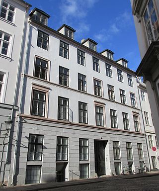
Admiralgade 22 is a Neoclassical apartment building situated close to Nikolaj Plads in Copenhagen, Denmark. It was constructed in 1845–46 for a wholesale merchant named Harboe for whom Ved Stranden 16 on the other side of the block was also heightened by one storey. The two buildings was at the same time divided into two separate properties. Admiralgade 22 was listed in the Danish registry of protected buildings and places in 1959. The scope of the heritage listing was extended in 1988. Notable former residents include the ballet dancer Adolph Stramboe.

Christian (Christen) Nielsen Lindbach (1738–1815) was a Danish master goldsmith. His works are represented in a number of Danish museum collections and churches. He is also remembered for contributing to the rebuilding of Copenhagen after the Great Fire of 1795.


