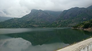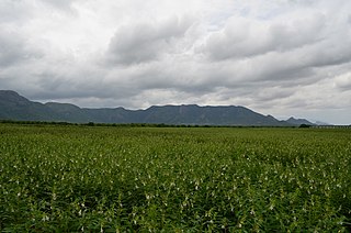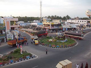
Namakkal is a special grade municipality and the headquarters of Namakkal district in the Indian state of Tamil Nadu. It is the first ISO 14001-2004 certified municipality in Asia for environmental management, specifically the provision and maintenance of water supply, solid waste and sewage management, town planning, lighting and other social services. Namakkal is known as the Egg City due to its large egg production and Transport city.

Athoor is a town in the Dindigul district of India between Dindigul and Bathalagundua about 3 km west of Sempatti. It is one of the legislative assemblies of Tamil Nadu. Rice cultivation is the major occupation.

Dindigul is a city in the Indian state of Tamil Nadu. It is the administrative headquarters of the Dindigul district. Dindigul is located 420 km (260 mi) southwest from the state capital, Chennai, 100 km (62 mi) away from Tiruchirappalli, 66 km (41 mi) away from Madurai and 72 km away from the Tex City of Karur. The city is known for its locks and biriyani. Parts of Dindigul Districts like Palani, Oddanchatram, Vedasandur, Nilakottai, Kodaikanal, Natham, Athoor.

Palani (Tamil: [paɻani], is a town and a taluk headquarters in Dindigul district of the western part of Tamil Nadu state in India. It is located about 106 kilometres south-east of Coimbatore and 122 kilometres north-west of Madurai, 67 kilometres from Kodaikanal. The Palani Murugan Temple or Arulmigu Dhandayuthapani Swamy Temple, dedicated to Lord Murugan is situated on a hill overlooking the town. The temple is visited by more than 7 million pilgrims each year. As of 2011, the town had a population of 70,467 which makes it the second largest town in the district after Dindigul.

Karur District is one of the 38 districts in the Indian state of Tamil Nadu. The main town in Karur District is the city of Karur, which is also the district headquarters. The district has a population of 1,064,493 with a sex-ratio of 1,015 females for every 1,000 males, according to 2011 census.

Pollachi is a town and a taluk headquarters in Coimbatore district, Tamil Nadu state, India. Located about 40 km to the south of Coimbatore, it is the second largest town in the district after Coimbatore. Pollachi is a popular Marketplace for jaggery, vegetables and cattle. As of 2011, the town had a population of 90,180.

Theni District is one of the 38 districts of Tamil Nadu state in India. Well protected by the scenic hill locks, the district is located besides Madurai district. The town of Theni is the district headquarters. The district is divided into two natural divisions: The hilly areas are constituted by parts of the five taluk's Theni, Bodinayakanur, Periyakulam, Uthamapalayam and Andipatti with thick vegetation and perennial streams from the hills on the western side and Cumbum valley which lies in Uthamapalayam taluk. As of 2011, Theni district had a population of 1,245,899 with a sex ratio of 980 females for every 1,000 males.

Aravakurichi is a panchayat town and a Taluk headquarters in Karur district in the state of Tamil Nadu, India. Aravakurichi is well known in Tamil Nadu as a major market for Moringa oleifera vegetable. People belongs to Hinduism, Islam and Christianity lives here in Good intentions and Friendly. Aravakurichi is one of the biggest taluk consists of More than 40 revenue Villages.

Batlagundu is a town in Nilakottai block in Dindigul district in the Madurai Region state of Tamil Nadu, India. The name Vetrilaikkundru later transformed and changed to Vathalagundu. The town is the major gateway to Kodaikanal. Subramaniya Siva was a writer, Indian Freedom Fighter, and activist born in Batlagundu. Batlagundu is the fifth-largest town in the Dindigul district. The town is located in such a way connecting three main districts of South Tamil Nadu. Batlagundu has most of the voters in Nilakottai Constituency.

Dharapuram officially Tharaapuram is a town in Tirupur district in the Indian state of Tamil Nadu. Dharapuram is one of the oldest towns in Tamil Nadu and was the capital of Kongu Nadu under the Cheras, Western Ganga Dynasty and later Kongu Cholas, at which time it was known as Vanchipuri. Amaravathi River flows through the town. As of 2011, the town had a population of 67,007. Dharapuram Municipality is promoted 1st grade municipality on 6 May 1983 Dharapuram was Part of Coimbatore district in the beginning and later it moves to Erode district up to 2009. Dharapuram Town is situated along the banks of River Amaravathi, located in between 10 degree 45 minutes northern latitude and 77 degree 31 minutes eastern latitude with an extent of 7.02 km2. It is a small agricultural marketing centre for a large rural hinterland in the Tirupur District. The town is 50 km towards of the District Headquarters Tirupur, 75 km towards the Erode and 72 km towards the industrial town Coimbatore. The nearest airport is Coimbatore International Airport located 70 km from Dharapuram. Dharapuram was the capital of Noyyal South District before the formation of Coimbatore District.

Thiruthavathurai (Lalgudi) is a town in Tiruchirapalli district in the Indian state of Tamil Nadu. The town of Lalgudi heads the Lalgudi taluk, Lalgudi division, Lalgudi Educational District, Lalgudi DSP and Lalgudi Constituency.

Udumalai, also known as Udumalaipettai and Udumalpet, is a town in Tiruppur district in the Indian state of Tamil Nadu. It is famous for spinning mills. It is the headquarters of Udumalaipettai taluk and as of 2011, the town had a population of 61,133. Udumalpet town is under Udumalpet Legislative Assembly constituency.
Andipatti taluk is a taluk of Theni district of the Indian state of Tamil Nadu. The headquarters of the taluk is the town of Andipatti.

Thirumalaigoundenvalasu is a village and a panchayat in the oddanchatram Taluk of Dindigul district in the South Indian state of Tamil Nadu.

Poovaipalayam, also called "Sithakkaattur" is a village in Dindigul district, Tamil Nadu, India. It is 8 km from the nearest town, Vedasandur, and 22 km from the district headquarters, Dindigul. The villagers are primarily farmers who grow drumsticks, onion, chili peppers, gooseberry, tomato, eggplants, tobacco, and lentils. The villagers belong to the Kongu Vellala Gounder community. Poovaipalayam is under Oddancatram taluk and in the same constituency.
Kallimathayam is a Village Panchayat under Thoppampatti Union of Oddanchatram taluk, on Oddanchatram-Dharapuram Road, Dindigul district, Tamil Nadu. "Kallimanthayam is located 17.6 km distance from its Taluk Main Town Thoppampatti. Kallimanthayam is 40.7 km far from its District Main City Dindigul." Its PIN code is 624616. "It is bounded by Konrangi Keeranur in the west, Kolinjivadi in the north, Idaiyakottai in the east and Tangachiyammapatti in the south." Kallimandhayam has eighteen small villages attached to it for administrative purposes.
Semmanipatti, also called Semminipatti or Chemminipatti, is a village in the Indian state of Tamil Nadu. Situated at a distance of 29 kilometres (18 mi) North of Madurai and 3 kilometres (1.9 mi) south of Vadipatti on the National Highway.

Sirugudi is a village located in Natham Taluk in dindigul District, Tamil Nadu State, India. Sirugudi is located 12.6 km distance from its Taluk Main Town Natham. It is 48 km far from its District Main City Dindigul. It is 413 km far from its State Capital City Chennai.

Sendamangalam is a Taluk in the Indian state of Tamil Nadu is situated in Namakkal District.
Pandrimalai is a village panchayat located in the Dindigul district of Tamil Nadu, India. The latitude 10.3627476 and longitude 77.99234 are the geocoordinate of the Pandrimalai. Chennai is the state capital for Pandrimalai village. It is located around 393.6 kilometer away from Pandrimalai. The other nearest state capital from Pandrimalai is Thiruvananthapuram and its distance is 226.6 km. The other surrounding state capitals are Thiruvananthapuram 226.6 km., Pondicherry 266.4 km., Bangalore 294.4 km.,


