Vergara, Uruguay

Last updated
Vergara
City
Vergara, Uruguay.jpg
Bandera de Vergara.png
Escudo de la Ciudad de Vergara.png
Uruguay location map.svg
Red pog.svg
Vergara
Location in Uruguay
Coordinates: 32°57′0″S53°56′0″W / 32.95000°S 53.93333°W / -32.95000; -53.93333
CountryFlag of Uruguay.svg  Uruguay
Department Flag of Treinta y Tres Department.svg  Treinta y Tres
Population
 (2011 Census)
  Total3,810
Time zone UTC -3
Postal code
33002
Dial plan +598 4458 (+4 digits)

Vergara is a small city in the Treinta y Tres Department of eastern Uruguay.

Contents

Geography

It is located between Route 18, which passes to the northwest, and on Route 91, which passes to the southeast, and about 54 kilometres (34 mi) northeast of Treinta y Tres, the capital city of the department. The stream Arroyo Parao flows along the northeast limits of the town.

History

Between 1877 and 1887, José Fernandes Vergara, of whom the city is named after, bought from his sister-in-law Luisa Ignacia Saravia the fields intended for the founding of the town. At the time, it was known as Parao, since it was on the right bank of the Arroyo Parao. In April 1891, after surveyor Manuel Coronel divided the land, Vergara made the first sales. [1]

Between 1890 and 1900, immigrants from different European countries began to arrive in the area, but especially from Italy. At the same time, existing ranch hands were displaced due to the construction of fencing around fields. [2]

On 10 March 1903, the group of houses here was declared a "Pueblo" (village) by the Act of Ley Nº 2.788. [3] On 13 December 1994, its status was elevated to "Ciudad" (city) by the Act of Ley Nº 16.668 [4]

Population

In 2011, Vergara had a population of 3,810. [5]

YearPopulation
19632,837
19752,826
19853,379
19963,983
20043,985
20113,810

Source: Instituto Nacional de Estadística de Uruguay [3]

Places of worship

Related Research Articles

<span class="mw-page-title-main">Treinta y Tres</span> Capital city in Uruguay

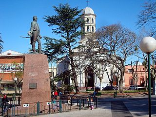
Treinta y Tres is the capital city of the Treinta y Tres Department in eastern Uruguay. It is known for its role in the development of folk music.

<span class="mw-page-title-main">Lavalleja Department</span> Department of Uruguay

Lavalleja is a department of Uruguay. Its capital is Minas. It is located in the southeast of the country, bordered to the north by the department of Treinta y Tres to the east with Rocha, to the south with Canelones and Maldonado, and to the west to Florida.

Rivera Department is a department of the northern region of Uruguay. It has an area of 9,370 km2 (3,620 sq mi) and a population of 103,493. Its capital is the city of Rivera. It borders Brazil to the north and east, Cerro Largo Department to the southeast, Tacuarembó Department to the south and west and Salto Department to the northwest.

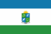
Treinta y Tres is a department of Uruguay. Its capital is Treinta y Tres. It is located in the east of the country, bordering the departments of Cerro Largo to the north, Durazno and Florida to the west, Lavalleja and Rocha to the south, while to its east is the lake Laguna Merín separating it from the southernmost end of Brazil. With a total population of 50,504, it is the second-least populated department in Uruguay and the third-least densely populated, behind Durazno and Flores.

<span class="mw-page-title-main">Pan de Azúcar, Uruguay</span> City Municipality in Maldonado, Uruguay

Pan de Azúcar is a city in the southwest of the Maldonado Department in Uruguay. It takes its name from a nearby hill, topped by a huge cross.

La Floresta is a city and resort on the Costa de Oro of the Canelones Department in Uruguay.

<span class="mw-page-title-main">Pando, Uruguay</span> City & Municipality in Canelones, Uruguay

Pando is a city in the Canelones Department of Uruguay. It is an important commercial and industrial centre which has become part of the wider Montevideo metropolitan area.

<span class="mw-page-title-main">Tarariras</span> City in Colonia, Uruguay

Tarariras, is a small city in the south of the Colonia Department of southern Uruguay.

Tupambaé is a village (pueblo) in the Cerro Largo Department of eastern Uruguay.

<span class="mw-page-title-main">Cerro Chato</span> Town in Uruguay

Cerro Chato is a town in central Uruguay that is divided in three parts belonging to Durazno Department, Florida Department, and Treinta y Tres Department.

<span class="mw-page-title-main">José Pedro Varela, Uruguay</span> City in Lavalleja, Uruguay

José Pedro Varela is a small city in the north of Lavalleja Department of southeastern Uruguay. It is named after the sociologist and politician José Pedro Varela.

Minas de Corrales is a town in the Rivera Department of northeastern Uruguay.

Cebollatí is a village in the Rocha Department of eastern Uruguay. It is the northernmost settlement of the department.

Libertad is a small city in the San José Department of southern Uruguay. Its main commercial street is 25 de Agosto and its central square is Plaza Treinta y Tres Orientales.

<span class="mw-page-title-main">General Enrique Martínez</span> Village in Treinta y Tres Department, Uruguay

General Enrique Martínez, also known as La Charqueada, is a village in the Treinta y Tres Department of eastern Uruguay.

Santa Clara de Olimar is a small town in Treinta y Tres Department in eastern Uruguay.

<span class="mw-page-title-main">Route 8 (Uruguay)</span> Road in Uruguay

Route 8 is a national route of Uruguay. In 1975, it was assigned the name Brigadier General Juan Antonio Lavalleja, a national hero of Uruguay. It connects Montevideo with Aceguá in the northeast.

<span class="mw-page-title-main">Estación Rincón</span> Village in Treinta y Tres Department, Uruguay

Estación Rincón or Rincón is a village in the Treinta y Tres Department of Uruguay.

Villa Sara is a suburb of Treinta y Tres, capital city of the Treinta y Tres Department in eastern Uruguay.

Paso de Carrasco or Paso Carrasco is a city in the Canelones Department of Uruguay.

References

  1. "Vergara, ayer, - Memorias Vergarenses". web.archive.org. 2016-01-20. Retrieved 2024-05-14.
  2. "Vergara, ayer, - Memorias Vergarenses". web.archive.org. 2016-01-20. Retrieved 2024-05-14.
  3. 1 2 "Statistics of urban localities (1963–2004)" (PDF). INE. 2012. Archived from the original (PDF) on 13 November 2009. Retrieved 6 September 2012.
  4. "Ley Nº 16.668". República Oriental del Uruguay, Poder Legislativo. 1964. Archived from the original on 28 March 2016. Retrieved 6 September 2012.
  5. "Censos 2011 Cuadros Trenta y Tres". INE. 2012. Archived from the original on 10 October 2012. Retrieved 25 August 2012.