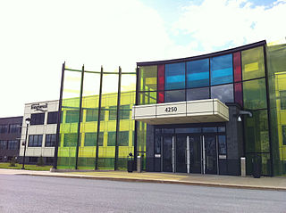
Longueuil is a city in the province of Quebec, Canada. It is the seat of the Montérégie administrative region and the central city of the urban agglomeration of Longueuil. It sits on the south shore of the Saint Lawrence River directly across from Montreal. The population as of the Canada 2021 Census totalled 254,483, making it Montreal's second largest suburb, the fifth most populous city in Quebec and twentieth largest in Canada.
Riverview is a neighbourhood in Ottawa, Ontario, Canada. It is southeast of the downtown adjacent to the Rideau River, its location on which is its namesake. The 2021 Census population of Riverview is 13,113.
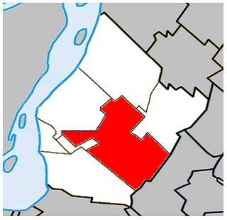
Saint-Hubert is a borough in the city of Longueuil, located in the Montérégie region of Quebec, Canada. It had been a separate city prior to January 1, 2002, when it along with several other neighbouring south shore municipalities were merged into Longueuil. Saint-Hubert had a population of 78,336 in 2006. The area of the borough is 65.98 km2 (25.48 sq mi). Longueuil's city hall is now located in Saint-Hubert. Saint-Hubert is located about 14 kilometres (8.7 mi) from downtown Montreal.
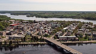
Shawinigan is a city located on the Saint-Maurice River in the Mauricie area in Quebec, Canada. It had a population of 49,620 as of the 2021 Canadian census.
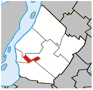
Greenfield Park is a former city in southwestern Quebec, Canada. It is currently a borough of the city of Longueuil. It covers an area of 4.78 square kilometres (1.85 sq mi), with a population of 16,733 at the 2016 census of Canada. Greenfield Park is the only borough of Longueuil that has an officially bilingual status. It is primarily a post-WWI suburban area. Like the other two boroughs, most of the buildings in Greenfield Park are single-family homes. Nearly all of the land in Greenfield Park is built on, making it Longueuil's most densely populated borough.

Saint-Lambert is a city in southwestern Quebec, Canada, located on the south shore of the St. Lawrence River, opposite Montreal. It is part of the Urban agglomeration of Longueuil of the Montérégie administrative region.

Saint-Lambert was a federal electoral district in the Canadian province of Quebec. It was first represented in the House of Commons of Canada in 1997. Its population in 2006 was 94,541. It has been replaced by Brossard—Saint-Lambert.

Brossard is a municipality in the Montérégie region of Quebec, Canada and is part of the Greater Montreal area. According to the 2021 census, Brossard's population was 91,525. It shares powers with the urban agglomeration of Longueuil and was a borough of the municipality of Longueuil from 2002 to 2006.

Taschereau Boulevard is a major suburban boulevard located on the south shore of Montreal, Quebec, Canada. It is a section of Quebec Route 134 and runs from Longueuil to Candiac. It is named after the prominent Quebec family, which included former Premier Louis-Alexandre Taschereau. At 17.5 km (10.9 mi), it is one of the longest commercial arteries in Canada. It serves the heart of an area with an estimated population of 400,000.

Chinatown is a neighborhood located in the area of De la Gauchetière Street in Montreal, Quebec, Canada. The neighbourhood contains many Asian restaurants, food markets, and convenience stores as well being home to many of Montreal's East Asian community centres, such as the Montreal Chinese Hospital and the Montreal Chinese Community and Cultural Centre.

Route 134 is a highway in the province of Quebec, running from Candiac on the South Shore of the Saint Lawrence River to Montreal, crossing the river on Jacques Cartier Bridge. On the South Shore, Route 134 is named Taschereau Boulevard, after the prominent Quebec family that included former premier Louis-Alexandre Taschereau. From Jacques Cartier Bridge to the end of the highway at Sherbrooke Street in Montreal, the highway is a one-way pair formed by Papineau Avenue and De Lorimier Avenue.
Windsor, Ontario, has a very diverse population, and this diversity is shown in its many neighbourhoods. Windsor has twenty in all, ranging from rural farmland to densely built-up areas.

The Riverside School Board is an English-language school board in the province of Quebec and provides educational services and programs to all students who have a certificate of eligibility for English education in Quebec. They are responsible for anglophone public schools on South Shore (Montreal). Riverside consistently places among the top five and has one of the lowest dropout rates of the 72 public school boards in Quebec, both English and French. It is the birthplace of the French immersion program and offers the International Baccalaureate program in many of their elementary and high Schools.
Service de sécurité incendie de l'agglomération de Longueuil (SSIAL) is responsible for fire and rescue operations in Longueuil, Brossard, Saint-Lambert, Saint-Bruno-de-Montarville and Boucherville, Quebec, Canada.

The Montreal and Southern Counties Railway Company was an electric interurban streetcar line that served communities between Montreal and Granby from 1909 until 1956. A second branch served the city of Longueuil. Operated by the Canadian National Railway (CN), the M&SCRC ran trams on tracks in the street in Montreal and closer South Shore communities, and on separate right of way in rural areas.

The urban agglomeration of Longueuil was created on January 1, 2006 as a result of the de-amalgamation process brought upon by the Charest government. It encompasses all the boroughs that were merged into the previous city of Longueuil and still retains the same area as that mega-city.
Préville is a neighbourhood in Saint-Lambert, Quebec and a former city. Excised from part of the Cité de Jacques-Cartier's territory on March 11, 1948, Préville existed as a city in its own right until it was absorbed into Saint-Lambert in 1969.
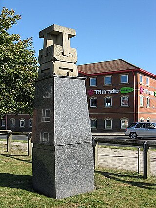
Teesdale Business Park is a major business park on the former site of Head Wrightsons' Teesdale works in Thornaby-on-Tees, North Yorkshire, England. The park was redeveloped by the Teesside Development Corporation. The area is immediately north of Thornaby railway station.


