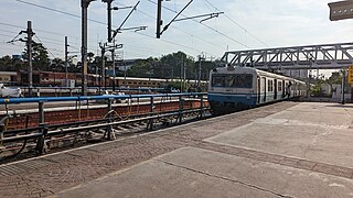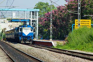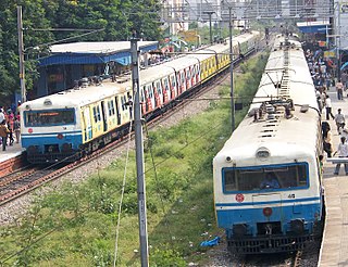
The Hyderabad Multi-Modal Transport System, commonly abbreviated as MMTS, is a suburban rail system in Hyderabad, India. A joint venture of the Government of Telangana and the South Central Railway, it is operated by the latter. The 90-kilometre (56 mi) system caters to the city of Hyderabad and the neighbouring suburban areas connecting Hyderabad, Secunderabad, Falaknuma, Lingampally, Medchal and Umdanagar with a total of 133 MMTS services. Currently 86 MMTS services are being operated due to the effect of COVID-19.
Malakpet is one of the neighbourhoods in the old city area of Hyderabad, Telangana, India. This is further divided into two parts, Old Malakpet and New Malakpet and is traditionally considered part of old city. This circle (6) comes under Charminar Zone of Greater Hyderabad Municipal Corporation. There are seven wards in this circle namely Saidabad (24), Moosrambagh (25), Old Malakpet (26), Akberbagh (27), Azampura (28), Chawani (29) and Dabeerpura (30).

Amberpet is one of the oldest suburbs of Hyderabad, India. Amberpet lies adjacent to the famous Osmania University. It is also a Mandal in Hyderabad District. Its area stretches from Kachiguda to Ramanthapur in the East, and from 6 NO TO MALAKPET in the South. One of the oldest area of, Hyderabad, India.
Vidyanagar is a Locality of Hyderabad, Telangana, India. It formed Ward No. 86 of Greater Hyderabad Municipal Corporation.
Shivam Road is a major commercial and residential area in Amberpet, Hyderabad, Telangana, India. This area is named after the Shivam Temple which houses a large shiva lingam, with the foundation stone laid by Satya Sai Baba.
Tilaknagar is a suburb in Hyderabad, Telangana, India. It lies adjacent to the government-run Fever Hospital and railway track. It has a residential and growing commercial area. It also has many schools, medical and grocery stores and a few temples. The City Central Library is located a few km from here.
Adikmet is an urban locality in Hyderabad, India. Mainly a residential area, it is very close to Osmania University's campus. The neighbourhood has a hanuman temple and is located near the road from Nallakunta to Tarnaka.

Sanjeevaiah Park railway station is a railway station in Hyderabad, Telangana, India. It is located adjacent to the Sanjeevaiah Park on the banks of the Hussain Sagar lake.

Nature Cure Hospital railway station is a railway station in Hyderabad, Telangana, India that is used for MMTS trains. It is named so because it is located next to the government run nature cure hospital, which is now a part of Vemana Yoga Research Institute. Localities like Balkampet, Ameerpet, Sanjeeva Reddy Nagar, Punjagutta are accessible from this station. Begumpet and Fateh Nagar are the MMTS Railway stations present on either side of this station on the Lingampally to Falaknuma line.

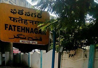
Fateh Nagar railway station is an Indian railway station in the Fateh Nagar area of Hyderabad. It serves mainly the MMTS trains.
Borabanda railway station is a railway station in Hyderabad, Telangana, India. Localities like Mothi Nagar, Rajeev Nagar and Erragadda are accessible from this station.This railway station is nearby allapur.

Jamia Osmania railway station is a railway station in Hyderabad, Telangana, India. Localities like Barkatpura and Ramnagar are accessible from this station.

Malakpet railway station is a railway station in Hyderabad, Telangana, India. Localities like Chaderghat, Nalgonda 'X' Roads, Dilsukhnagar and Kothapet are accessible from this station.
Dabirpura railway station is a railway station in Hyderabad, Telangana, India. Localities like Chanchalguda, Saidabad, Printing Press and Purani Haveli are accessible from this station.

Necklace Road railway station is a railway station in Hyderabad, Telangana, India. Localities like Minister Road, Raj Bhavan, Somajiguda and Necklace Road are accessible from this station.
Bagh Lingampally is a commercial and residential neighbourhood of Hyderabad, Telangana, India. It has become one of the many major centres of Hyderabad. Lingampalli.It was earlier known as Lingampalli Bagh, which contained a royal palace with a compound of 55 acres, with 130 acres around it. Lingampalli Bagh was given as a wedding present by the 5th Nizam, Nawab Afzal-ud-Dowla Bahadur when his daughter Shehzadi Haseen unnisa married Nawab Khursheed Jah Bahadur, H.E. Paigah Amir Nawab Sir Khursheed Jah Bahadur, the second greatest Paigah nobleman of Hyderabad Deccan. A little portion of the palace remains today...in what is Ambedkar College inside Lingampalli Bagh. The bagh was acquired by the Housing Board A.P., in the sixties. Furthermore, the palace had a tunnel leading to Golconda Fort. This was a property belonging to the Nizams and was given to Haseen Unnisa Begum, wife of Sir Khursheed Jah, by her father Nawab Afzal-ud-Dowla, Asaf Jah V, at the time of her wedding. She was also the sister of H.H Nawab Mahboob Ali Khan, Asaf Jah VI. This locality was also home to one of the Nobility of Hyderabad, Khan Bahadur Abdulkareem Lal Khan, Former Kotwal in the 7th Nizams Government. This area used to be full of fruit gardens belonging to them, from where the prefix ‘Bagh' is derived. The place had a small village called Lingampally which had a tank where queens would bathe. The locality has gained importance due to its proximity to RTC X Roads, Chikkadpally, Barkatpura, Himayathnagar, Nallakunta and Koti. This suburb is a mixture of the Old and New City cultures of Hyderabad. There is a vegetable market on Saturdays.
Nallakunta is a neighbourhood in Hyderabad, in the state of Telangana, India.

Khairatabad railway station is located in Hyderabad, Telangana, India. Localities like Somajiguda, Saifabad and Banjara Hills are accessible from this station.

ECIL X Roads or ECIL Cross Roads is a major commercial center in Hyderabad, Telangana, India. It is an important intersection located between some of the densest residential areas in Secunderabad, including Kushaiguda and Moula Ali. The suburb is named after ECIL Factory located nearby on the road to Cherlapally. A TSRTC Bus Terminal is located beside the crossroads. The roads intersecting here are the Trimulgherry-ECIL road and the Tarnaka-Kushaiguda road that starts at Tarnaka Crossroads on the Inner Ring Road. Radhika Crossroads is another major intersection located just a kilometre away on the Trimulgherry-ECIL road and Moula Ali-Dammaiguda road.


