
Medchal is an outer suburb of Hyderabad in the Medchal–Malkajgiri district of the Indian state of Telangana. It is the mandal headquarters of Medchal mandal in Keesara revenue division of the district. It also forms a part of Hyderabad Metropolitan Development Authority. Chamakura Malla Reddy is the MLA of Medchal Assembly Constituency.

Khairatabad is a neigbbourhood in Hyderabad, Telangana, India. It is a mandal in the Secunderabad Revenue division of Hyderabad District. This is a Zone in the Greater Hyderabad Municipal Corporation. There are five circles in this zone namely Mehdipatnam (12), Karwan (13), Goshamahal (14), Khairatabad (17) and Jubilee Hills (18). There are four wards under this Khairatabad circle, they are Khairtabad (91), Somajiguda (97), Ameerpet (98) and Sanathnagar (100).

Sanjeevaiah Park railway station is a railway station in Hyderabad, Telangana, India. It is located adjacent to the Sanjeevaiah Park that is on the banks of the Hussain Sagar lake.
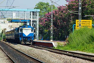
Nature Cure Hospital railway station is a railway station in Hyderabad, Telangana, India that is used for MMTS trains. It is named so because it is located next to the government run nature cure hospital, which is now a part of Vemana Yoga Research Institute. Localities like Balkampet, Ameerpet, Sanjeeva Reddy Nagar, Punjagutta are accessible from this station. Begumpet and Fateh Nagar are the MMTS Railway stations present on either side of this station on the Lingampally to Falaknuma line.
Borabanda railway station is a railway station in Hyderabad, Telangana, India. Localities like Mothi Nagar, Rajeev Nagar and Erragadda are accessible from this station.This railway station is nearby allapur.
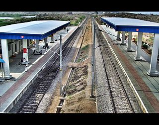
Hi-Tech City railway station in Hyderabad, Telangana, India located on the Wadi–Hyderabad Deccan section of South Central Railway. Jawaharlal Nehru Technological University, Hyderabad and localities like Kukatpally, Madhapur and are accessible from this station.

Jamia Osmania railway station is a railway station in Hyderabad, Telangana, India. Localities like Barkatpura and Ramnagar are accessible from this station.

Vidyanagar railway station is a railway station in Hyderabad, Telangana, India. Localities like Shanker Mutt, RTC X Roads, Chikkadpally, Shivam Road, Tilaknagar, Adikmet, DD Colony,CE colony,new Nallakunta, Bagh Amberpet Nallakunta and Amberpet are accessible from this station.

Malakpet railway station is a railway station in Hyderabad, Telangana, India. Localities like Chaderghat, Nalgonda 'X' Roads, Dilsukhnagar and Kothapet are accessible from this station.
Dabirpura railway station is a railway station in Hyderabad, Telangana, India. Localities like Chanchalguda, Saidabad, Printing Press and Purani Haveli are accessible from this station.
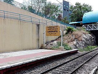
Lakdikapul railway station is a railway station located in Hyderabad, Telangana, India. Localities like Red Hills, Public Gardens and Masab Tank are accessible from this station.

Necklace Road railway station is a railway station in Hyderabad, Telangana, India. Localities like Minister Road, Raj Bhavan, Somajiguda and Necklace Road are accessible from this station.
Lallaguda railway station in Hyderabad, Telangana, India, located on the Manmad–Kachiguda section of South Central Railway. Localities like Lallaguda and Tukaramgate are accessible from this station.It also has a special type of stairs for bicycle and disabled people.It also has a bridge underneath it for vehicles to pass without stopping.

Dayanandnagar railway station is a railway station in New Safilguda, Malkajgiri, Telangana, India. Localities like Dayanandnagar, Radhakrishna(RK)Nagar, Uttam Nagar, Goutham nagar are accessible from this station. The station is used by several people for their morning walks or jogs.
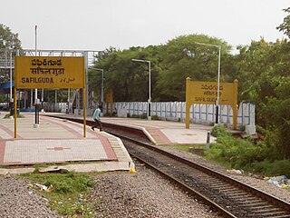
Safilguda railway station is a railway station in Hyderabad, Telangana, India. Localities including Safilguda, Old Neredmet and Anandbagh are accessible from this station.
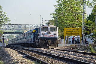
Ramakistapuram Gate railway station is a railway station in Hyderabad, Telangana, India near Ramakrishnapuram Lake, Neredmet, from which localities like R K Puram, Trimulgherry, Sainikpuri, AS Rao Nagar and Kapra are accessible.
Serilingampally is an Assembly legislative constituency of Telangana. It is one of 14 constituencies in Ranga Reddy district. It is part of Chevella Lok Sabha constituency. It is also one of the 24 constituencies of Greater Hyderabad Municipal Corporation.
Khairtabad Assembly constituency is a constituency of Telangana Legislative Assembly, India. It is one of 15 constituencies in Capital city of Hyderabad. It is part of Secunderabad Lok Sabha constituency.

Khairatabad Ganesh is an idol of the Hindu god Ganesha that is installed during the annual festival of Ganesh Chaturthi at Khairatabad locality of Hyderabad, India. Constructed annually and known for its height and the laddu held in the figure's hand, the idol is worshipped during the 10-day festival where thousands of devotees visit every day. On the 11th day, the idol is immersed in the nearby Hussain Sagar lake.

The Khairatabad metro station is located on the Red Line of the Hyderabad Metro, India. This station was opened to public on 2017. It is near to Cement Corporation of India, Khairtabad railway station, ICICI Bank, Institute of engineers Limited, Dr Babasaheb Ambedkar Statue, Prasads I Max Road, Vegetable Market, Raj Bhavan Road, Administrative Staff College of India and Hanuman Temple.


