Além Paraíba is a city in the southeastern Zona da Mata region of Minas Gerais, Brazil. The name indicates its position on the far bank of the Rio Paraíba do Sul. It was known as São José d'Além Parahyba until 1923.

Santo Tirso is a city and municipality located in the north of Porto Metropolitan Area, 25 km from central Porto, Portugal. In the region, the Ave Valley, there is a large center of textile industry. The population in 2011 was 71,530, in an area of 136.60 km².

Vila do Conde is a municipality in the Norte Region of Portugal. The population in 2011 was 79,533, in an area of 149.03 km². The urbanized area of Vila do Conde, which includes the parishes of Vila do Conde, Azurara and Árvore, represent 36,137 inhabitants. Vila do Conde is interlinked to the north with Póvoa de Varzim, forming a single urban agglomeration which is a part of the Porto Metropolitan Area. The town is on the Portuguese Way of the Camino de Santiago.

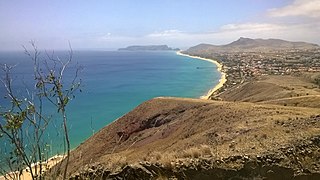
Porto Santo Island is a Portuguese island 43 kilometres (27 mi) northeast of Madeira Island in the North Atlantic Ocean; it is the northernmost and easternmost island of the archipelago of Madeira, located in the Atlantic Ocean west of Europe and Africa.

The Porto Metropolitan Area is a metropolitan area in northern Portugal centered on the City of Porto, Portugal's second largest city. The metropolitan area, covering 17 municipalities, is the second largest urban area in the country and one of the largest in the European Union, with a population in 2021 of 1,737,395 in an area of 2,040.31 km².
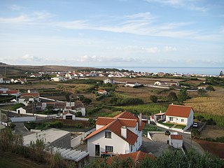
Vila do Porto is the single municipality, the name of the main town and one of the civil parishes on the island of Santa Maria, in the Portuguese archipelago of Azores. Its nearest neighbor, administratively, is the municipality of Povoação on the southern coast of São Miguel, and it is physically southwest of the islets of the Formigas. The population in 2021 was 5,408, in an area of 96.89 km2 (37.41 sq mi).

The Porto Metro, part of the public transport system of Porto, Portugal, is a light rail network that runs underground in central Porto and above ground into the city's suburbs. Metro do Porto S.A. was founded in 1993, and the first line of the system opened in 2002.
Grande Porto or Greater Porto is a former Portuguese NUTS3 subregion, integrating the NUTS2 region of Norte, in Portugal. It was abolished at the January 2015 NUTS 3 revision.

Porto Santo Airport is an airport located in Vila Baleira, the capital of Porto Santo Island, Madeira.

The Madeira islands and Funchal have an extensive public transportation system. Travel between the two main islands is by plane or by ferries, the latter also allowing for the transportation of vehicles. Visiting the interior of the islands is now easy, due to major road developments, known as the Vias rápidas, on the islands during Portugal's economic boom.
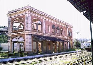
The Municipal Library of Porto is a library located in the civil parish of Bonfim, municipality of Porto in the Portuguese district of the same name.

Filipa Moniz Perestrelo was a Portuguese noblewoman from Porto Santo Island, in Madeira, Portugal. She married Christopher Columbus in 1479 at Vila Baleira on the island.

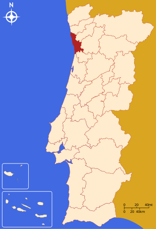
The District of Porto is located on the north-west coast of Portugal. The district capital is the city of Porto, the second largest city in the country. It is bordered by the Aveiro and Viseu districts to the south, Braga district to the north and Vila Real district to the east.
Vila Nova is a neighbourhood (bairro) in the city of Porto Alegre, the state capital of Rio Grande do Sul, in Brazil. It was created by Law 2022 from December 7, 1959.
Praia de Porto Santo is a beach located near the town Vila Baleira, on the island of Porto Santo, Portugal.


