Villa Sant'Antonio Sant'Antoni | |
---|---|
Comune | |
Comune di Villa Sant'Antonio | |
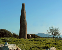
Menhir Monte Corru | |
Coordinates: 39°52′N8°54′E / 39.867°N 8.900°E Coordinates: 39°52′N8°54′E / 39.867°N 8.900°E | |
Country | Italy |
Region | Sardinia |
Province | Province of Oristano (OR) |
Area | |
• Total | 19.2 km2 (7.4 sq mi) |
Population (Dec. 2004) | |
• Total | 441 |
• Density | 23/km2 (59/sq mi) |
Time zone | CET (UTC+1) |
• Summer (DST) | CEST (UTC+2) |
Postal code | 09080 |
Dialing code | 0783 |
Villa Sant'Antonio (Sant'Antoni in Sardinian language) is a comune (municipality) in the Province of Oristano in the Italian region Sardinia, located about 70 kilometres (43 mi) north of Cagliari and about 25 kilometres (16 mi) east of Oristano. As of 31 December 2004, it had a population of 441 and an area of 19.2 square kilometres (7.4 sq mi). [1]
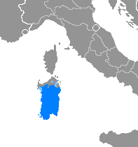
Sardinian or Sard is the primary indigenous Romance language spoken by the Sardinians on most of the island of Sardinia. Many Romance linguists consider it the closest genealogical descendant to Latin. However, it also incorporates a Pre-Latin substratum, as well as a Byzantine Greek, Catalan, Spanish and Italian superstratum due to the political membership of the island, which became a Byzantine possession followed by a significant period of self-rule, fell into the Iberian sphere of influence in the late Middle Ages, and eventually into the Italian one in the 18th century.
The comune is a basic administrative division in Italy, roughly equivalent to a township or municipality.
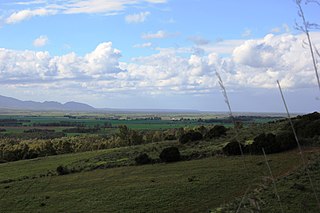
The province of Oristano is a province in the autonomous island region of Sardinia in Italy. Its capital is the city of Oristano. It has an area of 3,040 square kilometres (1,170 sq mi), a total population of 160,746 (2016), and a population density of 53.7 people per square kilometer. There are 87 municipalities (comuni) in the province).
Villa Sant'Antonio borders the following municipalities: Albagiara, Assolo, Asuni, Mogorella, Ruinas, Senis.
Albagiara, is a comune (municipality) in the Province of Oristano in the Italian region Sardinia, located about 70 kilometres (43 mi) northwest of Cagliari and about 30 kilometres (19 mi) southeast of Oristano.
Assolo is a comune (municipality) in the Province of Oristano in the Italian region Sardinia, located about 70 kilometres (43 mi) north of Cagliari and about 30 kilometres (19 mi) southeast of Oristano. As of 31 December 2004, it had a population of 479 and an area of 16.3 square kilometres (6.3 sq mi).
Asuni is a comune (municipality) in the Province of Oristano in the Italian region Sardinia, located about 70 kilometres (43 mi) north of Cagliari and about 30 kilometres (19 mi) east of Oristano. As of 31 December 2004, it had a population of 416 and an area of 21.2 square kilometres (8.2 sq mi).
Sulbiate is a comune (municipality) in the Province of Monza and Brianza in the Italian region Lombardy, located about 25 kilometres (16 mi) northeast of Milan.
Anguillara Veneta is a comune (municipality) in the Province of Padua in the Italian region Veneto, located about 45 kilometres (28 mi) southwest of Venice and about 30 kilometres (19 mi) south of Padua. The city is known for being the town of origin of the Bolsonaro family, a proeminent Brazilian political clan.
Villa Estense is a comune (municipality) in the Province of Padua in the Italian region Veneto, located about 60 kilometres (37 mi) southwest of Venice and about 30 kilometres (19 mi) southwest of Padua. As of 31 December 2004, it had a population of 2,407 and an area of 16.0 square kilometres (6.2 sq mi).
Folignano is a comune (municipality) in the Province of Ascoli Piceno in the Italian region Marche, located about 90 kilometres (56 mi) south of Ancona and about 6 kilometres (4 mi) southeast of Ascoli Piceno. As of 31 December 2004, it had a population of 9,214 and an area of 14.8 square kilometres (5.7 sq mi).
Montresta is a comune (municipality) in the Province of Oristano in the Italian region Sardinia, located about 140 kilometres (87 mi) northwest of Cagliari and about 50 kilometres (31 mi) north of Oristano. As of 31 December 2004, it had a population of 594 and an area of 23.8 square kilometres (9.2 sq mi).
Ghilarza is a comune (municipality) in the Province of Oristano in the Italian region Sardinia, located about 100 kilometres (62 mi) north of Cagliari and about 30 kilometres (19 mi) northeast of Oristano.
Mogorella, Mogoredda in sardinian language, is a comune (municipality) in the Province of Oristano in the Italian region Sardinia, located about 80 kilometres (50 mi) northwest of Cagliari and about 25 kilometres (16 mi) east of Oristano.
Nurachi is a comune (municipality) in the Province of Oristano in the Italian region Sardinia, located about 100 kilometres (62 mi) northwest of Cagliari and about 9 kilometres (6 mi) northwest of Oristano. As of 31 December 2004, it had a population of 1,671 and an area of 15.9 square kilometres (6.1 sq mi).
Palmas Arborea is a comune (municipality) in the Province of Oristano in the Italian region Sardinia, located about 80 kilometres (50 mi) northwest of Cagliari and about 6 kilometres (4 mi) southeast of Oristano. As of 31 December 2004, it had a population of 1,366 and an area of 39.3 square kilometres (15.2 sq mi).
Pau is a comune (municipality) in the Province of Oristano in the Italian region Sardinia, located about 70 kilometres (43 mi) northwest of Cagliari and about 20 kilometres (12 mi) southeast of Oristano. As of 31 December 2004, it had a population of 330 and an area of 14.1 square kilometres (5.4 sq mi).
Ruinas is a comune (municipality) in the Province of Oristano in the Italian region Sardinia, located about 80 kilometres (50 mi) north of Cagliari and about 25 kilometres (16 mi) east of Oristano.
San Vero Milis is a comune (municipality) in the Province of Oristano in the Italian region Sardinia, located about 100 kilometres (62 mi) northwest of Cagliari and about 13 kilometres (8 mi) north of Oristano. As of 31 December 2004, it had a population of 2,506 and an area of 72.2 square kilometres (27.9 sq mi).
Senis is a comune (municipality) in the Province of Oristano in the Italian region Sardinia, located about 70 kilometres (43 mi) north of Cagliari and about 30 kilometres (19 mi) southeast of Oristano. As of 31 December 2004, it had a population of 546 and an area of 16.0 square kilometres (6.2 sq mi).
Siamaggiore is a comune (municipality) in the Province of Oristano in the Italian region Sardinia, located about 90 kilometres (56 mi) northwest of Cagliari and about 7 kilometres (4 mi) northeast of Oristano.
Siamanna is a comune (municipality) in the Province of Oristano in the Italian region Sardinia, located about 80 kilometres (50 mi) northwest of Cagliari and about 15 kilometres (9 mi) east of Oristano.
Villaurbana is a comune (municipality) in the Province of Oristano in the Italian region Sardinia, located about 80 kilometres (50 mi) northwest of Cagliari and about 15 kilometres (9 mi) east of Oristano.
Villa Verde, Bàini in sardinian language, is a comune (municipality) in the Province of Oristano in the Italian region Sardinia, located about 70 kilometres (43 mi) northwest of Cagliari and about 25 kilometres (16 mi) southeast of Oristano.
Wikimedia Commons has media related to Villa Sant'Antonio . |
This Sardinia location article is a stub. You can help Wikipedia by expanding it. |