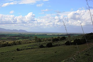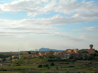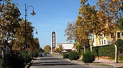
Posada, also previously known as Feronia or Pausata, is a comune (municipality) in the Province of Nuoro in the Italian region Sardinia. The city sits on the coast of the Tyrrhenian Sea. As of 31 December 2004, it had a population of 2,394 and an area of 33.52 square kilometres (12.94 sq mi).

Oristano is an Italian city and comune, and capital of the Province of Oristano in the central-western part of the island of Sardinia. It is located on the northern part of the Campidano plain. It was established as the provincial capital on 16 July 1974. As of December 2017, the city had 31,671 inhabitants.

The province of Oristano is a province in the autonomous island region of Sardinia in Italy. Its capital is the city of Oristano. It has an area of 3,040 square kilometres (1,170 sq mi), a total population of 160,746 (2016), and a population density of 53.7 people per square kilometer. There are 87 municipalities (comuni) in the province).

Bosa is a town and comune in the province of Oristano, part of the Sardinia region of Italy. Bosa is situated about two-thirds of the way up the west coast of Sardinia, on a small hill, about 3 kilometres inland on the north bank of the Temo River. The town has maintained a population of around 8,000 people for a significant amount of time, but has an urban character that has differentiated it from other locations in Sardinia. Agriculture and fishing play an important part in the city economy, thanks to the river valley near the coast surrounded by hills and highland plateaus.

Predappio is a town and comune in the province of Forlì-Cesena, in the region of Emilia-Romagna in Italy, with a population of 6,135 as of 1 January 2021. The town is best known for being the birthplace of Benito Mussolini, dictator of Italy from 1922 to 1943. Mussolini is buried at Predappio, and his mausoleum is a local tourist destination, as well as a site of pilgrimage for Italian fascists.

Castelsardo is a town and comune in Sardinia, Italy, located in the northwest of the island within the Province of Sassari, at the east end of the Gulf of Asinara.

Flussio is a comune (municipality) in the Province of Oristano in the Italian region Sardinia, located about 130 kilometres (81 mi) northwest of Cagliari and about 40 kilometres (25 mi) north of Oristano. As of 31 December 2004, it had a population of 492 and an area of 6.9 square kilometres (2.7 sq mi).

Montresta is a comune (municipality) in the Province of Oristano in the Italian region Sardinia, located about 140 kilometres (87 mi) northwest of Cagliari and about 50 kilometres (31 mi) north of Oristano. As of 31 December 2004, it had a population of 594 and an area of 23.8 square kilometres (9.2 sq mi).

Sagama is a comune (municipality) in the Province of Oristano in the Italian region Sardinia, located about 130 kilometres (81 mi) northwest of Cagliari and about 40 kilometres (25 mi) north of Oristano. As of 31 December 2004, it had a population of 201 and an area of 11.6 square kilometres (4.5 sq mi).

Cabras is a comune (municipality) in the Province of Oristano in the Italian region of Sardinia, located about 90 kilometres (56 mi) northwest of Cagliari and about 6 kilometres (4 mi) northwest of Oristano.

Ghilarza is a comune (municipality) in the Province of Oristano in the Italian region Sardinia, located about 100 kilometres (62 mi) north of Cagliari and about 30 kilometres (19 mi) northeast of Oristano.

Marrubiu is a comune (municipality) in the Province of Oristano in the Italian region Sardinia, located about 70 kilometres (43 mi) northwest of Cagliari and about 15 kilometres (9 mi) south of Oristano.

Palmas Arborea is a comune (municipality) in the Province of Oristano in the Italian region Sardinia, located about 80 kilometres (50 mi) northwest of Cagliari and about 6 kilometres (4 mi) southeast of Oristano. As of 31 December 2004, it had a population of 1,366 and an area of 39.3 square kilometres (15.2 sq mi).
Pau is a comune (municipality) in the Province of Oristano in the Italian region Sardinia, located about 70 kilometres (43 mi) northwest of Cagliari and about 20 kilometres (12 mi) southeast of Oristano. As of 31 December 2004, it had a population of 330 and an area of 14.1 square kilometres (5.4 sq mi).

Scano di Montiferro is a comune (municipality) in the Province of Oristano in the Italian region Sardinia, located about 120 kilometres (75 mi) northwest of Cagliari and about 35 kilometres (22 mi) north of Oristano.
Siamaggiore is a comune (municipality) in the Province of Oristano in the Italian region Sardinia, located about 90 kilometres (56 mi) northwest of Cagliari and about 7 kilometres (4 mi) northeast of Oristano.

Terralba is a comune (municipality) and former Latin Catholic bishopric in the Province of Oristano in the Italian island region Sardinia, located about 70 kilometres (43 mi) northwest of Cagliari and about 20 kilometres (12 mi) south of Oristano.

Villaurbana is a comune (municipality) in the Province of Oristano in the Italian region Sardinia, located about 80 kilometres (50 mi) northwest of Cagliari and about 15 kilometres (9 mi) east of Oristano.
Villa Verde, Bàini in sardinian language, is a comune (municipality) in the Province of Oristano in the Italian region Sardinia, located about 70 kilometres (43 mi) northwest of Cagliari and about 25 kilometres (16 mi) southeast of Oristano.
Zeddiani is a comune (municipality) in the Province of Oristano in the Italian region Sardinia, located about 100 kilometres (62 mi) northwest of Cagliari and about 9 kilometres (6 mi) north of Oristano. As of 31 December 2004, it had a population of 1,154 and an area of 11.9 square kilometres (4.6 sq mi).


