Villanueva del Rosario, Andalusia

Last updated • 3 min readFrom Wikipedia, The Free Encyclopedia
Villanueva del Rosario
Aldea Las Carboneras.JPG
Escudo de Villanueva del Rosario.svg
Spain location map with provinces.svg
Red pog.svg
Villanueva del Rosario
Location in Spain.
Coordinates: 37°00′N4°21′W / 37.000°N 4.350°W / 37.000; -4.350
Sovereign state Flag of Spain.svg  Spain
Autonomous community Flag of Andalucia.svg  Andalusia
Province Flag Malaga Province.svg Málaga
Area
  Total44.6 km2 (17.2 sq mi)
Elevation
697 m (2,287 ft)
Population
 (2018) [1]
  Total3,373
  Density76/km2 (200/sq mi)
Time zone UTC+1 (CET)
  Summer (DST) UTC+2 (CEST)
Website www.villanuevadelrosario.com

Villanueva del Rosario is a town and municipality in the province of Málaga in the autonomous community of Andalusia in southern Spain. It is located off the motorway from Málaga to Granada and Seville. It is situated in the northeast of the province. It belongs to the comarca of Nororma.

Contents

The white washed pueblo sits at the base of the Cerro de la Cruz, with rolling countryside on the other three sides. Famous for the quality of its olive oil, the countryside is naturally populated with olive trees and wheat fields in between.

The population is approximately 3,500. The feria is celebrated during the first week in August, and is known as "La Veladilla del Carmen". There is another feria in October to celebrate the patron called the "La Virgen del Rosario". Festivities however start earlier in the year on April 25 when the population, in common with other agricultural communities celebrate "La Romeria de San Marcos" who is the patron saint of the countryside. The pueblo acts as a base for potholers who can explore the caverns in the Sierra, or for cycling, horse riding or walking holidays. Several properties are available for 'rural tourism'.

History

The original village dates back to 1812 when it obtained its independence from Archidona, protected by Royal Decree from the Courts of Cádiz, and was called Puebla del Saucedo. The inhabitants of Archidona opposed this both bitterly and violently so that eventually the new village had to turn to the Council of the King's Chambers where the dispute was finally settled in 1827. Three years later the village changed its name to Villanueva del Rosario.

The area was originally inhabited by Romans, who were followed by Arabic and Visigoth settlements by the river bank. It is said that the important Roman city of Ulisis was situated here on the area known as Peñon de Solis. It is rumoured that treasure lies below the peak but no one has ever found it. Many Roman roads are still in existence, and a number of object including coins, bracelets, glass and ceramic fragments, have been found in the area. The town centre was founded in the eighteenth century, it is said due to the abundance of willow trees (which still exist), and encouraged the settlement of Saucedo. Today the residents are still known as Saucedaños. The two Copper Age archaeological sites in the municipality can be found at the Finca Tardón and the other is in the Peñon del Oso mountain area.

Places to visit

The Copper Era sites and the Visigoth necropolis (burial grounds) are found in the hills, but most of them have been robbed or partially destroyed. The shrine built in honour of the villages patron saint "La Virgen del Rosario" is situated above the village on the way to "El Nacimiento", a spring at the base of the mountain which supplies the village with drinking water. Continuing upwards the Hondoneros is reached high on the Sierra los Camarolos and Sierra Gorda, where many different species of flora and fauna can be found.

Related Research Articles

<span class="mw-page-title-main">Mijas</span> Place in Andalusia, Spain

Mijas is a municipality in the Province of Málaga, in the autonomous community of Andalusia. Located on the southeastern coast of Spain, Mijas belongs to the region of Costa del Sol Occidental. Its center is a typical Andalusian white-washed village, Mijas Pueblo, located on a mountainside about 430 metres or 1,476 feet above sea level, in the heart of the Costa del Sol region.

<span class="mw-page-title-main">White Towns of Andalusia</span> Series of whitewashed towns in southern Spain

The White Towns of Andalusia, or Pueblos Blancos, are a series of whitewashed towns and large villages in the northern part of the provinces of Cádiz and Málaga in southern Spain, mostly within the Sierra de Grazalema Natural Park.

<span class="mw-page-title-main">Manilva</span> Place in Andalusia, Spain

Manilva is a municipality which lies on the coast at the southwesternmost edge of the province of Málaga on its border with the Province of Cádiz in the autonomous community of Andalusia in Spain. It belongs to the comarca of Costa del Sol Occidental.

<span class="mw-page-title-main">Álora</span> Municipality in Andalusia, Spain

Álora is a town and municipality in southern Spain in the province of Málaga, in the autonomous community of Andalusia. Located c. 40 km from Málaga, on the right bank of the river Guadalhorce and on the Córdoba-Málaga railway, within the comarca of Valle del Guadalhorce. It is a typical pueblo blanco, a whitewashed village nestled between three rocky spurs topped by the ruins of the castle.

<span class="mw-page-title-main">Antequera</span> Municipality in Andalusia, Spain

Antequera is a city and municipality in the Comarca de Antequera, province of Málaga, part of the Spanish autonomous community of Andalusia. It is known as "the heart of Andalusia" because of its central location among Málaga, Granada, Córdoba, and Seville. The Antequera Dolmens Site is a UNESCO World Heritage site.

<span class="mw-page-title-main">Montefrío</span> Municipality in Granada, Spain

Montefrio is a municipality in the province of Granada. The ruins of a Moorish castle sit near the highest point. Being built midway between the Sierra de Priego and Sierra Parapanda, and commanding the open valley between these ranges, it became one of the chief frontier fortresses of the Moors in the 15th century.

<span class="mw-page-title-main">Olvera</span> Place in Cádiz, Andalusia

Olvera is a town in the province of Cádiz, Andalusia, Spain. According to the 2005 census, the city has a population of 8,585 inhabitants.

<span class="mw-page-title-main">Alcalá del Valle</span> Municipality in Andalusia, Spain

Alcalá del Valle is a city located in the province of Cádiz, Spain. According to the 2006 census, the city has a population of 5,355.

<span class="mw-page-title-main">Alhaurín el Grande</span> Municipality in Andalusia, Spain

Alhaurín el Grande is a town located in the province of Málaga in the autonomous community of Andalusia in southern Spain.

<span class="mw-page-title-main">Guadalhorce</span> River in Spain

The Guadalhorce is the principal river of the Province of Málaga in southern Spain.

La Carlota is a municipality of small settlements, in the southern half of Spain near Córdoba. In 2005 it had 11,488 inhabitants, and in 2018 just over 14,000, all living in a predominantly rural area measuring some 80 square kilometres (31 sq mi).
<span class="mw-page-title-main">Casares, Málaga</span> Municipality in Andalusia, Spain

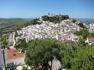
Casares is a town and municipality in Spain, located in Málaga province, in the autonomous community of Andalusia.

<span class="mw-page-title-main">Archidona</span> Municipality in Andalusia, Spain

Archidona is a town and municipality in the province of Málaga, part of the autonomous community of Andalusia in southern Spain. It is the center of the comarca of Nororiental de Málaga and the head of the judicial district that bears its name. It earned the title of city in 1901.

<span class="mw-page-title-main">Cártama</span> Place in Andalusia, Spain

Cártama is a town and municipality in the province of Málaga, part of the autonomous community of Andalusia, southern Spain. The municipality is situated approximately 17 km (11 mi) from Málaga. It is one of the most extensive towns in the province, covering c. 150 km2 (58 sq mi). Cártama has a population of approximately 15,000 residents.

<span class="mw-page-title-main">Navas de San Juan</span> Place in Andalusia, Spain

Navas de San Juan is a Spanish village of the province of province of Jaén, Spain. According to the 2005 census (INE), the city has a population of 5,030 inhabitants. It is the biggest village in the region of El Condado. The river called Guadalimar runs for its municipal area.

<span class="mw-page-title-main">Sierra Suroeste</span> Comarca in Extremadura, Spain

Sierra Suroeste is a comarca located in southwestern province of Badajoz in the autonomous community of Extremadura, western Spain. Its capital and largest city is Jerez de los Caballeros.

<span class="mw-page-title-main">Rociana del Condado</span> Place in Andalusia, Spain

Rociana del Condado is a town located in the province of Huelva, Andalusia, Spain.

<span class="mw-page-title-main">Arenas, Málaga</span> Municipality in Andalusia, Spain

Arenas is a municipality in the province of Málaga located in the autonomous community of Andalusia in southern Spain. It is situated in the comarca of Axarquía. By way of road it is located 12 kilometers from Vélez-Málaga, 50 km from Málaga and 577 km from Madrid. It is located northwest of the Axarquia, between the sierras of Tejeda and Almijara and the Castle of Bentomiz.

<span class="mw-page-title-main">Viñuela</span> Place in Andalusia, Spain

La Viñuela is a municipality in the province of Málaga in the autonomous community of Andalusia in southern Spain. It belongs to the comarca of La Axarquía. The village of La Viñuela is situated 45 kilometres (28 mi) from the provincial capital of Málaga and 19 kilometres (12 mi) from the coast at Torre del Mar. The village sits at a height of 162 metres (531 ft) above sea level. Inhabitants are called viñoleros. One of its hamlets is Los Romanes.
<span class="mw-page-title-main">Towns of the Costa del Sol</span>

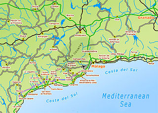
This article shows a list of towns in the Costa del Sol in Andalusia, Spain.

References

  1. Municipal Register of Spain 2018. National Statistics Institute.