Vine Street, London

Last updated

Sign at the western end of Vine Street VineStreetSign.JPG
Sign at the western end of Vine Street

Vine Street is a street in Westminster, London, running from Swallow Street, parallel to Regent Street and Piccadilly. It is now a dead end that was shortened from a longer road in the early 18th century owing to the building of Regent Street.

Contents

From the 18th to 20th century, it was home to Vine Street watchhouse (later Police Station), which grew into one of the busiest police stations in the world. The Marquess of Queensberry was charged with libel against Oscar Wilde here in 1895. There was also a court house on the street in the 18th and early 19th century. The street's association with law has led to it being grouped with Bow Street and Marlborough Street on the standard British Monopoly board.

Geography

The street is approximately 70 feet (21 m) long and is a dead end, running east and parallel to Piccadilly near Piccadilly Circus. It consists mainly of the rear facades of buildings facing onto other streets. It connects to Swallow Street at its western end and an alleyway, Piccadilly Place halfway along. At the eastern end, the Man in the Moon Passage provides foot access to Regent Street. The nearest tube station is Piccadilly Circus. [1] [2]

History

The street is named after The Vine, an 18th-century public house, [3] which in turn may have been named after a vineyard that existed at this location in Roman times. [4] It was documented on ratebooks as Little Swallow Street in 1675. [5] It was laid out around 1686 and originally ran further, along what is now the Man in the Moon Passage. [6] [3] John Rocque's Map of London, 1746 shows Vine Street extending from Piccadilly northeast to Warwick Street. In 1720, the main properties on the street were a brewery and a carpenter's yard. [5] Around 1751–52, a court house was built at the western end of the street, on the corner of what is now Piccadilly Place. It closed in 1836 following the reorganisation of the court system around Westminster and was subsequently occupied by the lawyer Edward Gaffin. [5] The following century the street gained a famous Met Police Station.

Vine Street was split into two sections following the construction of Regent Street between 1816 and 1819. The Man in the Moon Passage was created at this time, named after a former pub at this location. The northern section towards Warwick Street was renamed Great Vine Street, and then a branch of Warwick Street itself. It ceased to exist after the reconstruction of the Regent Street Quadrant in 1920. [5]

In 1853, Charles Moreign purchased several small houses at the end of Vine Street so they could be redeveloped into St James's Hall, Piccadilly. A rear entrance to the hall backed onto the street. The hall was demolished in 1905 and replaced by the Piccadilly Hotel, which also backs onto Vine Street. [5] [7]

Events and incidents

The Dutch artist Peter Scheemakers moved into a house on the western edge of Vine Street around 1741. He stayed there until 1769, when he returned to Antwerp. [5]

On 2 September 1791, composer Frantisek Kotzwara died at prostitute Susannah Hill's house at No. 5 Vine Street from erotic asphyxiation following a sexual act that involved tying his neck to a doorknob. Hill was charged with Kotzwara's murder but later acquitted. [8]

The street and police station station are mentioned in the Pogues' song "The Old Main Drag" on their 1985 album Rum Sodomy & the Lash . [9] It refers to the station and street's unpopularity with some of London owing to their distrust of the police force. [10] Because of its relatively hidden location and proximity to Piccadilly Circus, the street suffers from crime, which has led to Westminster City Council gating off the Man in the Moon Passage so service vehicles can access connecting buildings safely. [6]

The street features as a property with a purchase price of £200 on the British Monopoly board. It is one of a group of three, coded orange, with connections to law, and is named after the police station. The other two orange properties, Bow Street and Marlborough Street, which are both valued at £180, are named after the Bow Street Runners and Marlborough Street Magistrates Court respectively. [11] Since the Man in the Moon is now closed, students on a Monopoly board pub crawl drink in one of the nearby pubs, such as those on Swallow Street, instead. [12]

Related Research Articles

<span class="mw-page-title-main">Charing Cross Road</span> Street in central London

Charing Cross Road is a street in central London running immediately north of St Martin-in-the-Fields to St Giles Circus, which then merges into Tottenham Court Road. It leads from the north in the direction of Charing Cross at the south side of Trafalgar Square. It connects via St Martin's Place and the motorised east side of the square.

<span class="mw-page-title-main">West End of London</span> Area of Central London, England

The West End of London is a district of Central London, London, England, west of the City of London and north of the River Thames, in which many of the city's major tourist attractions, shops, businesses, government buildings and entertainment venues, including West End theatres, are concentrated.

<span class="mw-page-title-main">Mayfair</span> Area of central London, England

Mayfair is an area in London, England and is located in the City of Westminster. It is in Central London and part of the West End. It is between Oxford Street, Regent Street, Piccadilly and Park Lane and one of the most expensive districts in the world.

<span class="mw-page-title-main">Park Lane</span> Road in London

Park Lane is a dual carriageway road in the City of Westminster in Central London. It is part of the London Inner Ring Road and runs from Hyde Park Corner in the south to Marble Arch in the north. It separates Hyde Park to the west from Mayfair to the east. The road has a number of historically important properties and hotels and has been one of the most sought after streets in London, despite being a major traffic thoroughfare.

<span class="mw-page-title-main">Piccadilly</span> Road in the City of Westminster, London, England

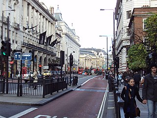
Piccadilly is a road in the City of Westminster, London, England, to the south of Mayfair, between Hyde Park Corner in the west and Piccadilly Circus in the east. It is part of the A4 road that connects central London to Hammersmith, Earl's Court, Heathrow Airport and the M4 motorway westward. St James's is to the south of the eastern section, while the western section is built up only on the northern side. Piccadilly is just under 1 mile (1.6 km) in length, and it is one of the widest and straightest streets in central London.

<span class="mw-page-title-main">Piccadilly Circus</span> Road junction and public place in London, England

Piccadilly Circus is a road junction and public space of London's West End in the City of Westminster. It was built in 1819 to connect Regent Street with Piccadilly. In this context, a circus, from the Latin word meaning "circle", is a round open space at a street junction.

<span class="mw-page-title-main">Regent Street</span> Shopping street in London

Regent Street is a major shopping street in the West End of London. It is named after George, the Prince Regent and was laid out under the direction of the architect John Nash and James Burton. It runs from Waterloo Place in St James's at the southern end, through Piccadilly Circus and Oxford Circus, to All Souls Church. From there Langham Place and Portland Place continue the route to Regent's Park.

<span class="mw-page-title-main">Oxford Circus</span> Road junction in London, England

Oxford Circus is a road junction connecting Oxford Street and Regent Street in the West End of London. It is also the entrance to Oxford Circus tube station.

<span class="mw-page-title-main">Oxford Street</span> Major road in the City of Westminster in London

Oxford Street is a major road in the City of Westminster in the West End of London, running from Tottenham Court Road to Marble Arch via Oxford Circus. It marks the notional boundary between the areas of Fitzrovia and Marylebone to the north, with Soho and Mayfair to its immediate south. It is Europe's busiest shopping street, with around half a million daily visitors, and as of 2012 had approximately 300 shops. It is designated as part of the A40, a major road between London and Fishguard, though it is not signed as such, and traffic is regularly restricted to buses and taxis.

<span class="mw-page-title-main">Bond Street</span> Street in the West End of London

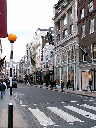
Bond Street in the West End of London links Piccadilly in the south to Oxford Street in the north. Since the 18th century the street has housed many prestigious and upmarket fashion retailers. The southern section is Old Bond Street and the longer northern section New Bond Street, a distinction not generally made in everyday usage.

<span class="mw-page-title-main">Bow Street</span> Street in London, England

Bow Street is a thoroughfare in Covent Garden, Westminster, London. It connects Long Acre, Russell Street and Wellington Street, and is part of a route from St Giles to Waterloo Bridge.

<span class="mw-page-title-main">Pall Mall, London</span> Street in Central London

Pall Mall is a street in the St James's area of the City of Westminster, Central London. It connects St James's Street to Trafalgar Square and is a section of the regional A4 road. The street's name is derived from pall-mall, a ball game played there during the 17th century, which in turn is derived from the Italian pallamaglio, literally "ball-mallet".

<span class="mw-page-title-main">St James's</span> Human settlement in England

St James's is a central district in the City of Westminster, London, forming part of the West End. The area was once part of the northwestern gardens and parks of St. James's Palace. During the Restoration in the 17th century, the area was developed as a residential location for the British aristocracy, and around the 19th century was the focus of the development of their gentlemen's clubs. Once part of the parish of St Martin in the Fields, much of it formed the parish of St James from 1685 to 1922. Since the Second World War the area has transitioned from residential to commercial use.

<span class="mw-page-title-main">Great Marlborough Street</span> Street near Soho, London

Great Marlborough Street is a thoroughfare in Soho, Central London. It runs east of Regent Street past Carnaby Street towards Noel Street.

<span class="mw-page-title-main">Coventry Street</span> London street, within the City of Westminster

Coventry Street is a short street in the West End of London, connecting Piccadilly Circus to Leicester Square. Part of the street is a section of the A4, a major road through London. It is named after the politician Henry Coventry, secretary of state to Charles II.

<span class="mw-page-title-main">Little Venice</span> District in London, England

Little Venice is an affluent residential district in West London, England, around the junction of the Paddington Arm of the Grand Union Canal, the Regent's Canal, and the entrance to Paddington Basin. The junction, also known as Little Venice and Browning's Pool, forms a triangular shape basin designed to allow long canal boats to turn around. Many of the buildings in the vicinity are Regency white painted stucco terraced town houses and taller blocks (mansions) in the same style. The area is 2.5 miles (4.0 km) west-north-west of Charing Cross and immediately north-west of Paddington.

<span class="mw-page-title-main">Swallow Street</span>

Swallow Street is a small street in the West End of London, running north from Piccadilly. It is about 341 feet (104 m) long.

This is a list of the etymology of street names in the London district of Mayfair, in the City of Westminster. It utilises the generally accepted boundaries of Mayfair viz. Marble Arch/Cumberland Gate and Oxford Street to the north, Regent Street to the east, Piccadilly to the south and Park Lane to the west.

This is a list of the etymology of street names in the London district of Soho, in the City of Westminster. The following utilises the generally accepted boundaries of Soho viz. Oxford Street to the north, Charing Cross Road to the east, Shaftesbury Avenue to the south and Regent Street to the west.

<span class="mw-page-title-main">Vine Street Police Station</span>

Vine Street Police Station was a Metropolitan Police station at No. 10 Vine Street in central London.

References

Notes

    Citations

    1. Westminster 2004, p. 15.
    2. "Vine Street, London". Google Maps. Retrieved 14 January 2016.
    3. 1 2 "Vine Street". Conveyancing Data Services. 24 March 2015. Retrieved 15 April 2015.
    4. Moore 2003, p. 147.
    5. 1 2 3 4 5 6 F H W Sheppard, ed. (1963). Swallow Street to Glasshouse Street. Survey of London. Vol. 31–32, St James Westminster, Part 2. London: British History Online. pp. 57–67. Retrieved 15 July 2015.
    6. 1 2 Westminster 2004, p. 39.
    7. "Vine Street, Westminster". Hidden London. Retrieved 19 June 2014.
    8. Moore 2003, pp. 147–148.
    9. Manning 2009, p. 168.
    10. McLaughlin 2012, p. 372.
    11. Moore 2003, p. 135.
    12. Moore 2003, p. 148.

    Sources

    51°30′34″N0°08′14″W / 51.50941°N 0.13729°W / 51.50941; -0.13729