
U.S. Route 501 is a spur of U.S. Route 1. It runs 355 miles (571 km) from Buena Vista, Virginia at U.S. Route 60 to Myrtle Beach, South Carolina at U.S. Route 17 Business. It passes through the states of Virginia, North Carolina and South Carolina. From Durham to Laurinburg, a 108-mile (174 km) section of US 501 overlaps U.S. Route 15. Sections of US 15-501 also share routings with U.S. Route 1 in sections near Sanford, North Carolina and Aberdeen, North Carolina.

U.S. Route 258 is a spur of US 58 in the U.S. states of North Carolina and Virginia. The U.S. Highway runs 220.15 miles (354.30 km) from US 17 Business and NC 24 Business in Jacksonville, North Carolina north to Virginia State Route 143 at Fort Monroe in Hampton, Virginia. In North Carolina, US 258 connects Jacksonville with the Inner Banks communities of Kinston, Snow Hill, Farmville, Tarboro, and Murfreesboro. The U.S. Highway continues through the Virginia city of Franklin, where the highway intersects US 58, and the town of Smithfield on its way to the Hampton Roads metropolitan area. US 258 crosses the James River on the James River Bridge and follows Mercury Boulevard through Newport News and Hampton.
U.S. Route 360 is a spur route of US 60. The U.S. Highway runs 225.3 miles (362.6 km), entirely within the state of Virginia, from US 58 Business, Virginia State Route 293, and SR 360 in Danville east to SR 644 in Reedville. US 360 connects Danville, South Boston, Keysville and Burkeville in Southside Virginia with the state capital of Richmond. The highway connects Richmond with Tappahannock on the Middle Peninsula and the eastern Northern Neck, where it serves as the primary route through Northumberland County. US 360 is a four-lane divided highway for almost all of its length.

State Route 10 is a primary state highway in the U.S. state of Virginia. The state highway runs 93.58 miles (150.60 km) from U.S. Route 360 in Richmond east to SR 337 in Suffolk. SR 10 is a major suburban highway through Chesterfield County between the Southside of Richmond and Hopewell. Between Hopewell and Smithfield, which is served by SR 10 Business, the state highway passes through rural Prince George, Surry, and Isle of Wight counties, following the route of an old stagecoach road through an area that features many of the preserved James River plantations. SR 10 runs concurrently with US 258 and SR 32 between Smithfield and Suffolk.
State Route 32 is a primary state highway in the U.S. state of Virginia. The state highway runs 38.89 miles (62.59 km) from the North Carolina state line in Suffolk north to U.S. Route 17, US 258, and SR 143 in Newport News. The southernmost part of SR 32 connects Suffolk with the Albemarle Region of North Carolina via North Carolina Highway 32. The remainder of SR 32 runs concurrently with at least one other state or U.S. Highway between Suffolk and Newport News, including US 13, SR 10, US 258, and US 17. The last two highways run together with SR 32 on the James River Bridge.

State Route 2, formerly State Route 50, is a primary state highway in the U.S. state of Virginia. The state highway runs 53.08 miles (85.42 km) from U.S. Route 1 and US 301 in Richmond north to US 1 Business, US 17 Business, and SR 3 Business in Fredericksburg. SR 2 connects Richmond and Fredericksburg via Bowling Green. The state highway runs concurrently with US 301 from Richmond to Bowling Green and with US 17 Business in the Fredericksburg area.

State Route 36 is a state highway in the U.S. state of Virginia. The state highway runs 16.70 miles (26.88 km) from SR 602 and SR 669 near Matoaca east to SR 10 in Hopewell. SR 36 is the main highway between Petersburg and Hopewell; within each independent city, the state highway follows a complicated path. The state highway connects those cities with Ettrick in southern Chesterfield County and Fort Gregg-Adams and Petersburg National Battlefield in Prince George County.

State Route 337 is a primary state highway in the South Hampton Roads area of the U.S. state of Virginia. It runs east from Suffolk to Portsmouth, where it crosses Jordan Bridge. It continues on the east side of the Southern Branch Elizabeth River in the South Norfolk neighborhood of Chesapeake. There it turns north, through Norfolk, crossing the Berkley Bridge into downtown, and ending at the Naval Station Norfolk at Sewell's Point. Most of its length was formed when other highways were rerouted: U.S. Route 460 from Suffolk to South Norfolk, SR 170 from South Norfolk to downtown Norfolk, and US 17 from downtown Norfolk to Sewell's Point. SR 337 is the only numbered highway to cross all three Branches of the Elizabeth River. It crosses the Western Branch as Portsmouth Boulevard at the Hodges Ferry Bridge, the Southern Branch on the Jordan Bridge, and the Eastern Branch on the Berkley Bridge. The Berkley Bridge is a drawbridge. SR 337 also crosses the Lafayette River in the city of Norfolk.

U.S. Route 301 is a part of the U.S. Highway System that runs from Sarasota, Florida, to Biddles Corner, Delaware. In Virginia, the U.S. Highway runs 142.70 miles (229.65 km) from the North Carolina state line near Skippers north to the Maryland state line at the Potomac River near Dahlgren. US 301 forms the local complement to Interstate 95 (I-95) from Emporia to Petersburg. The U.S. Highway runs concurrently with US 1 between Petersburg and the state capital of Richmond, where the highways form one of the main north–south avenues. US 301 continues north concurrent with Virginia State Route 2 to Bowling Green, forming an eastern alternative to I-95 and US 1 north of Richmond. At Bowling Green, which is connected to I-95 by SR 207, US 301 becomes the primary highway connecting Richmond and the Northern Neck with Southern Maryland. US 301 was constructed in four main segments: as the original SR 24 and then US 17-1 south of Petersburg, as US 1 from Petersburg to Richmond, as SR 2 from Richmond to Bowling Green, and as part of SR 207 toward Dahlgren. US 301 replaced US 17–1 in the early 1930s and was extended from Petersburg north along its current course into Maryland when the Potomac River Bridge was completed in 1940.

U.S. Route 460 (US 460) in Virginia runs west-east through the southern part of the Commonwealth. The road has two separate pieces in Virginia, joined by a relatively short section in West Virginia. Most of US 460 is a four-lane divided highway and is a major artery in the southern third of the state. From Petersburg to Suffolk, US 460 is a four-lane non-divided highway. It is a popular alternative to Interstate 64 (I-64) when going from Richmond and other points in central Virginia to the Currituck Sound and Outer Banks of North Carolina, avoiding the congestion and tunnels of the more northerly I-64 corridor. The road passes through several small towns that built up at stops along the railroad line.
State Route 24 is a primary state highway in the U.S. state of Virginia. The state highway runs 89.57 miles (144.15 km) from U.S. Route 221 and SR 116 in Roanoke east to US 60 in Mt. Rush. SR 24 connects Roanoke with several small communities in southern Bedford County and central Campbell County. The state highway also runs concurrently with US 460 west of Appomattox and passes through Appomattox Court House National Historical Park, which is the site of Robert E. Lee's final stand and surrender in the American Civil War.

State Route 26 is a primary state highway in the U.S. state of Virginia. Known as Oakville Road, the state highway runs 12.83 miles (20.65 km) from U.S. Route 460, SR 24, and US 460 Business in Appomattox north to US 60 in Bent Creek.

State Route 45 is a primary state highway in the U.S. state of Virginia. The state highway runs 39.72 miles (63.92 km) from the junction of U.S. Route 15 Business and US 460 Business in Farmville north to SR 6 at Georges Tavern. SR 45 is the primary north–south highway of Cumberland County, where the highway meets US 60 near the county seat, Cumberland.
State Route 47 is a primary state highway in the U.S. state of Virginia. The state highway runs 61.09 miles (98.31 km) from U.S. Route 1 and US 58 Business in South Hill north to US 460 Business in Pamplin City, Virginia. SR 47 passes through Southside Virginia, where the highway connects the towns of Chase City in Mecklenburg County and Drakes Branch and Charlotte Court House in Charlotte County.
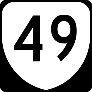
State Route 49 is a primary state highway in the U.S. state of Virginia. The state highway runs 69.01 miles (111.06 km) from the North Carolina state line in Virgilina, Virginia in Halifax County, where the highway continues south as North Carolina Highway 49, north to U.S. Route 360 near Burkeville in Nottoway County. SR 49 passes through Southside Virginia, connecting Virgilina and Burkeville with Clarksville and Chase City in Mecklenburg County, Victoria in Lunenburg County, and Crewe in Nottoway County. Via US 360, the state highway connects Richmond with the John H. Kerr Reservoir.

U.S. Route 221 (US 221) is a part of the U.S. Highway System that runs from Perry, Florida to Lynchburg, Virginia. In Virginia, the U.S. Highway runs 149.61 miles (240.77 km) from the North Carolina state line near Independence north to its northern terminus at US 29 Business, US 460 Business, and US 501 Business in Lynchburg. US 221 connects Independence, Galax, and Hillsville in Southwest Virginia while running concurrently with US 58. The U.S. Highway connects those communities with Roanoke via Floyd County, within which US 221 is the main east–west highway. Entering Bedford County, US 221 exits the Blue Ridge Mountains; it then passes through the Piedmont town of Bedford on its way to Lynchburg and shares a brief overlap with US 460 Business through the town. The U.S. Highway also runs concurrently with US 460 from Roanoke to Bedford and parallels that U.S. Highway from Bedford to Lynchburg.

State Route 122 is a primary state highway in the U.S. state of Virginia. The state highway runs 54.58 miles (87.84 km) from SR 40 in Rocky Mount north to U.S. Route 501 in Big Island. SR 122 passes through the Blue Ridge foothills of Franklin and Bedford counties, connecting Rocky Mount with the town of Bedford. The state highway provides access to Booker T. Washington National Monument and Smith Mountain Lake, and the National D-Day Memorial via its Bedford business route.

State Route 163 is a primary state highway in the U.S. state of Virginia. The state highway runs 6.74 miles (10.85 km) from U.S. Route 501 and US 29 Business in Lynchburg north to US 29 Business in Madison Heights. SR 163 is the original alignment of US 29 through Lynchburg, a highway has been twice bypassed: first by the Lynchburg Expressway and later by US 29's present bypass. The state highway provides access to downtown Lynchburg and many other historic neighborhoods of the independent city.

State Route 208 is a primary state highway in the U.S. state of Virginia. The state highway runs 47.35 miles (76.20 km) from U.S. Route 250 at Ferncliff east to US 1 and US 1 Business at Four Mile Fork. SR 208 is a major southwest–northeast highway through Louisa and Spotsylvania counties. The state highway connects the counties' respective seats of Louisa and Spotsylvania Courthouse, where the old route of the highway is SR 208 Business, with each other and with Fredericksburg near the highway's eastern terminus. SR 208 also has a direct connection with Interstate 64 (I-64) at Ferncliff and an indirect connection to I-95 near Fredericksburg.

A total of at least sixteen special routes of U.S. Route 460 exist and at least six have been deleted.


