Virginia State Route 619 (Prince William County)

Last updated

Circle sign 619.svg

State Route 619

Prince William with SR 619.png
Route information
Maintained by Virginia Department of Transportation (VDOT)
Length27.85 mi [1] [2]  (44.82 km)
Linton Hall Road 5.94 mi

Bristow Road 9.16 mi
Joplin Road 10.18 mi

Fuller Heights Road 1.79 mi
Major junctions
West endUS 29.svgVirginia 55.svg US 29  / SR 55 in Gainesville
Major intersectionsVirginia 28.svg SR 28 in Bristow

To plate.svg
Circle sign 649.svg
To SR 649 in Brentsville
No image wide.svgOld plate.svg
Virginia 234.svg SR 234 Old in Independent Hill
I-95.svg I-95 in Triangle

Contents

US 1.svg US 1 in Triangle
East endCircle sign 761.svg SR 761 near Marine Corps Base Quantico
Location
Country United States
State Virginia
Highway system

State Route 619 in Prince William County, Virginia is a secondary state highway. SR 619 provides a cross-county connector as well as a major artery for commuters. SR 619 is known by four names: Linton Hall Road, Bristow Road, Joplin Road, and Fuller Heights Road. There are also two short concurrencies: one with SR 234 Old in Independent Hill, and one with Fuller Military Road on the border of Marine Corps Base Quantico.

Route description

Linton Hall Road

Linton Hall Road starts out at the intersection with US 29 (Lee Highway) and SR 55 (John Marshall Highway). This intersection is part of the Gainesville Interchange project. Gallerher Road has been renamed SR 55 (John Marshall Highway), [3] and the former SR 55 between Gallerher and U.S. 29 is currently a dead end, and will become a cul-de-sac, without access to U.S. 29.

Linton Hall Road starts out as a six-lane divided highway passing the Virginia Gateway retail development to the north. As SR 674 (Wellington Road) is passed, there is empty land to the northeast (until SR 1040, Limestone Drive). This land will become part of the Virginia Gateway Center. [4] At Glenkirk Road, Linton Hall Road reduces to a four-lane divided highway.

Linton Hall Road passes by many more subdivisions, including Victory Lakes and Braemar in Bristow on its way to SR 28 (Nokesville Road). Linton Hall Road has been widened from two lanes undivided to four lanes divided from SR 675 (Glenkirk Road) to SR 621 (Devlin Road) by VDOT. [5] Prince William County was working on a project to widen Linton Hall Road from two lanes to four from Devlin Road to SR 28 (Nokesville Road). [6] This project is now complete. Part of the project includes straightening out Linton Hall Road near Braemar. This has left behind two segments of the old alignment of SR 619, named Devlins Grove Place and Braemar Village Plaza.

Bristow Road

On the other side of SR 28, SR 619 becomes Bristow Road and reduces to two lanes undivided. It passes through the center of the original town of Bristow, crosses Southern Railway tracks (that are also used by the Virginia Railway Express commuter service). Bristow Road then passes to the southwest of Manassas Regional Airport and intersects with SR 611 (Valley View Drive), which leads one to the new Bristow post office and to the unincorporated town of Aden. Soon after it intersects in Brentsville with SR 692, Lucasville Road, which will take one back to the south Manassas area. Near this location is where Cedar Run and Broad Run merge to form the Occoquan River. Once past the Cedar Run bridge, SR 619 continues past homes on large lots, farmland, and forest on its way to Independent Hill. It is there where it meets Independent Hill Road, part of SR 234 Old.

When SR 234 (Dumfries Road) was widened to four lanes divided, and relocated slightly north, the old Dumfries Road was renamed Independent Hill Road, and the rest was made an extension of Bristow Road, ironically signed as SR-619. After SR 619 turns right, unposted, onto Joplin Road, Bristow Road continues (also as SR-619) and intersects with the current SR 234, Dumfries Road.

Joplin Road

Joplin Road starts out as a two-lane undivided road in Independent Hill at an intersection with Bristow Road. It starts out in a southerly direction, soon crossing SR 646 (Aden Road) on its way out of town. It soon starts its life as the border between Prince William Forest Park and Marine Corps Base Quantico.

The road curves to the southeast, following the border between the park and the base. To the north, the park gives way to what is left of the town of Joplin. After a park entrance, there is another group of homes, and another park entrance. After that Joplin Road widens to four lanes divided, and almost immediately has an interchange with Interstate 95. It stays four lanes divided until it comes to an intersection with US 1. This is the end of Joplin Road.

Fuller Heights Road

Many mapping agencies consider that SR 619 follows Fuller Military Road. However, the legislature of the State of Virginia in 1983 released a report that concluded that Fuller Road is part of Marine Corps Base Quantico, a part of the U.S. Government, and as such, the Virginia Department of Transportation has not given Fuller Road any state route designation. Instead, Fuller Heights Road, which services a part of the town of Triangle has been designated as part of SR 619. The gate on Fuller Military Road for Marine Corps Base Quantico is after the intersection with Fuller Heights Road, so residents using SR 619 are not affected. [1] [7] [8]

There is even confusion by the Marines about SR 619. They released maps of Fuller Military Road in 2008 that showed that SR 619 was Fuller Road, and not Fuller Heights Road. [9]

After the intersection with US 1, SR 619 continues on Fuller Road for one block, and then immediately turns onto Fuller Heights Road as a two-lane undivided roadway. This route continues until the intersection with SR 761 (Windsor Road), where SR 619 terminates. South is a gate into the Marine Corps base, and north is more housing in Triangle.

Future construction

The Prince William County Board of Supervisors has gotten jurisdiction and passed a resolution [2] to widen the portion of Fuller Road between US 1 and Fuller Heights Road to four lanes divided, providing better access to both Triangle and Marine Corps Base Quantico.

History

Linton Hall Road

Name

Linton Hall Road was named after Linton Hall Military School, (later renamed Linton Hall School.) The school was named after a Catholic nun, Sister Baptista Linton, in honor of the land she donated to the church for the education of poor children. [10]

Construction

Linton Hall Road was two lanes up until 2005. [5] The VDOT project widened it to four or six lanes from US 29 to Devlin Road, and the Prince William County project widened it to four lanes divided from there to SR 28. [6]

Bristow Road

Bristow Road is named after the town at one of its ends, Bristow, Virginia. The road was always a two-lane undivided road to Independent Hill, and stopped at SR 234 (Dumfries Road). When SR 234 was widened and relocated north, most of Dumfries Road was renamed as an extension of Bristow Road. Now, Bristow Road extends all the way to the new alignment of SR 234, but not all of it is part of SR 619. See Virginia State Route 234 Old (Independent Hill) for more details.

Joplin Road

Joplin Road is named after the town of Joplin, for it was the main road traversing that town. When the Chopawamsic Recreational Demonstration Area was to be started, the residents of Joplin were made offers for their land. [11] All that remains of the town of Joplin is a few houses on Joplin Road and nearby roads.

Major intersections

The entire route is in Prince William County.

Locationmi [1] [2] kmDestinationsNotes
Gainesville 0.000.00US 29.svgWest plate.svg
Virginia 55.svg
To plate blue.svg
I-66.svg
US 29 (Lee Highway) / SR 55 west (John Marshall Highway) to I-66
Wellington Road
Bristow 4.106.60Circle sign 1566.svg SR 1566 (Sudley Manor Drive)
5.949.56Virginia 28.svg SR 28 (Nokesville Road)
Brentsville 10.2916.56Circle sign 692.svgTo plate.svg
Circle sign 649.svg
SR 692 (Lucasville Road) to SR 649
Independent Hill 15.1024.30Circle sign 3245.svgTo plate.svg
Virginia 234.svg
SR 3245 (Independent Hill Drive) to SR 234
former SR 234 north
15.6825.23To plate.svg
South plate.svg
Virginia 234.svg
To SR 234 south / Bristow Road
former SR 234 south
15.8925.57Circle sign 646.svg SR 646 (Aden Road)
25.5241.07I-95.svg I-95  Washington, Fredericksburg I-95 exit 150
Triangle 25.8641.62US 1.svg US 1 (Jefferson Davis Highway) National Museum of the Marine Corps, Locust Shade Park
26.0641.94Fuller Road - Marine Corps Base Quantico, Quantico, Marine Corps University
27.8544.82Circle sign 761.svg SR 761 (Windsor Road)
1.000 mi = 1.609 km; 1.000 km = 0.621 mi

Related Research Articles

<span class="mw-page-title-main">Quantico, Virginia</span> Town in Virginia, United States

Quantico is a town in Prince William County, Virginia, United States. The population was 480 at the 2010 census. Quantico is approximately 35 miles southwest of Washington, D.C., bordered by the Potomac River to the east and the Quantico Creek to the north. The word Quantico is a corruption of the name of a Doeg village recorded by English colonists as Pamacocack.

<span class="mw-page-title-main">Prince William County, Virginia</span> County in Virginia, United States

Prince William County is located on the Potomac River in the U.S. state of Virginia. As of the 2020 census, the population sits at 482,204, making it Virginia's second-most populous county. Its county seat is the independent city of Manassas.

<span class="mw-page-title-main">U.S. Route 360</span> Highway or spur in Virginia

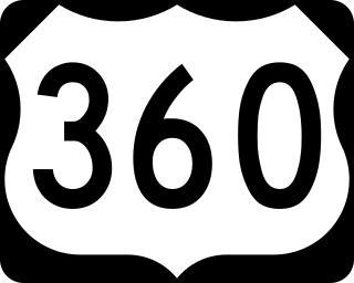
U.S. Route 360 is a spur route of US 60. The U.S. Highway runs 225.3 miles (362.6 km), entirely within the state of Virginia, from US 58 Business, Virginia State Route 293, and SR 360 in Danville east to SR 644 in Reedville. US 360 connects Danville, South Boston, Keysville and Burkeville in Southside Virginia with the state capital of Richmond. The highway connects Richmond with Tappahannock on the Middle Peninsula and the eastern Northern Neck, where it serves as the primary route through Northumberland County. US 360 is a four-lane divided highway for almost all of its length.

<span class="mw-page-title-main">Virginia State Route 156</span> State highway in Virginia

State Route 156 is a primary state highway in the U.S. state of Virginia. The state highway runs 57.38 miles (92.34 km) from U.S. Route 301 and SR 35 in Templeton north to US 360 Business in Mechanicsville. SR 156 follows a circuitous route through the eastern part of the Richmond–Petersburg metropolitan area. South of the James River, the state highway connects Templeton in Prince George County with Hopewell, which is directly served by SR 156 Business. SR 156 crosses the James River on the Benjamin Harrison Memorial Bridge and briefly passes through Charles City County. For most of its length in Henrico and Hanover, the state highway is a rural road that provides access to several units of Richmond National Battlefield Park. However, SR 156 provides access to Richmond International Airport, Interstate 64 (I-64), and I-295 as it passes through the Richmond suburbs of Sandston and Highland Springs as a major highway.

<span class="mw-page-title-main">Virginia State Route 244</span>

State Route 244 is a primary state highway in the U.S. state of Virginia. Known as Columbia Pike, the state highway runs 8.25 miles (13.28 km) from SR 236 in Annandale east to SR 27 and Interstate 395 (I-395) at The Pentagon in Arlington. SR 244 is a major southwest–northeast thoroughfare in northeastern Fairfax County and eastern Arlington County, connecting Annandale with SR 7 at Bailey's Crossroads and SR 120 in the multicultural Westmont neighborhood of Arlington.

<span class="mw-page-title-main">Virginia State Route 3</span> State highway in central Virginia, US

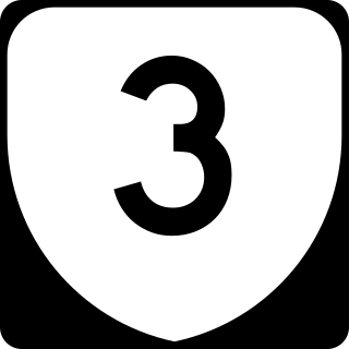
Virginia State Route 3 is a primary state highway in the U.S. state of Virginia that extends from the town of Culpeper south and eastwardly to Gloucester in Virginia's Middle Peninsula region. For many years, a portion was named "Historyland Highway".

<span class="mw-page-title-main">Virginia State Route 30</span> State highway in eastern Virginia, US

State Route 30 is a primary state highway in the U.S. state of Virginia. The state highway runs 61.87 miles (99.57 km) from U.S. Route 1 in Doswell east to Interstate 64 (I-64) and SR 607 near Norge. SR 30 runs east–west through Hanover and Caroline Counties, connecting US 1 and I-95 with the Kings Dominion amusement park and US 301. The state highway serves as the principal highway of King William County, connecting U.S. Route 360 with SR 33 in West Point via the county's namesake county seat. SR 30 also connects SR 33 and US 60 in New Kent and James City Counties.

<span class="mw-page-title-main">Virginia State Route 28</span> State highway in Virginia, United States

State Route 28 in the U.S. state of Virginia is a primary state highway that traverses the counties of Loudoun, Fairfax, Prince William, and Fauquier in the U.S. state of Virginia. The route serves as a major artery in the Northern Virginia region, with it being an important two-lane highway in rural Fauquier and Prince William Counties, the main thoroughfare through Manassas and Manassas Park, and a high-capacity freeway through Fairfax and Loudoun Counties.

<span class="mw-page-title-main">Interstate 95 in Virginia</span> Interstate Highway in Virginia

Interstate 95 (I-95) runs 179 miles (288 km) within the commonwealth of Virginia between its borders with North Carolina and Maryland. I-95 meets the northern terminus of I-85 in Petersburg and is concurrent with I-64 for three miles (4.8 km) in Richmond. Although I-95 was originally planned as a highway through Washington, D.C., it was rerouted along the eastern portion of the Capital Beltway concurrent with I-495. From Petersburg to Richmond, I-95 utilized most of the Richmond–Petersburg Turnpike, a former toll road. In addition to Richmond, the route also runs through the medium-sized cities of Emporia, Petersburg, Colonial Heights, Fredericksburg, and Alexandria.

Joplin is an unincorporated community and former town in Prince William County, Virginia. The town was located on land taken to form Chopawamsic Recreational Demonstration Area and is now part of Prince William Forest Park, a National Park Service property located adjacent to Marine Corps Base Quantico. The remains of the town, now just a collection of homes, lies on a stretch of Va. 619, Joplin Road, about 3 miles west of Dumfries.

<span class="mw-page-title-main">Bristow, Virginia</span> Unincorporated community in Virginia, United States

Bristow is an unincorporated community of Prince William County in Northern Virginia about 30 miles (48 km) from Washington, D.C. In 2014, Bristow's postal area population was 29,346, a 287% increase since 2000; however, the Bristow community is formally included in the Linton Hall, Virginia census-designated place (CDP).

<span class="mw-page-title-main">U.S. Route 1 in Virginia</span> Section of United States Numbered Highway in Virginia

U.S. Route 1 (US 1) is a major north–south U.S. Route that serves the East Coast of the United States. In the U.S. state of Virginia, US 1 runs north–south through South Hill, Petersburg, Richmond, Fredericksburg, and Alexandria on its way from North Carolina to the 14th Street bridges into the District of Columbia. It is completely paralleled by Interstate Highways in Virginia—Interstate 85 (I-85) south of Petersburg, I-95 north to Alexandria, and I-395 into the District of Columbia—and now serves mainly local traffic. At its north end, on the approach to the 14th Street bridges, US 1 is concurrent with I-395; the rest of US 1 is on surface roads.

<span class="mw-page-title-main">Virginia State Route 55</span> State highway in northern Virginia, US

State Route 55 is a primary state highway in the U.S. state of Virginia. Known for most of its length as John Marshall Highway, the state highway runs 64.71 miles (104.14 km) from the West Virginia state line, where the highway continues as West Virginia Route 55, east to U.S. Route 29 in Gainesville. West of its interchange with Interstate 81 (I-81) in Strasburg, SR 55 runs concurrently with the easternmost portion of US 48 as part of Corridor H. East of Front Royal, the state highway serves as the local complement of I-66 as it passes through the towns of Marshall, The Plains, and Haymarket.

<span class="mw-page-title-main">Virginia State Route 130</span> State highway in central Virginia, US

Virginia State Route 130 is a primary state highway in the U.S. state of Virginia. The state highway runs 34.69 miles (55.83 km) from U.S. Route 11 at Natural Bridge east to SR 669 and SR 670 east of US 29 near Madison Heights. SR 130 runs concurrently with US 501 from Glasgow through the James River gorge through the Blue Ridge Mountains, connecting eastern Rockbridge County with western and southern Amherst County near Lynchburg.

<span class="mw-page-title-main">Virginia State Route 144</span>

State Route 144 is a primary state highway in the U.S. state of Virginia. The state highway runs 13.97 miles (22.48 km) from SR 36 at Fort Gregg-Adams north to SR 145 at Centralia. SR 144's east–west segment is the main highway between Colonial Heights and both Fort Gregg-Adams and Hopewell. The state highway's north–south section connects U.S. Route 1 and US 301 in Colonial Heights with SR 10 in Chester. A section of it was first added to the state highway system in 1930, and it gained its current routing and designation by 1987.

<span class="mw-page-title-main">Virginia State Route 215</span>

State Route 215 is a primary state highway in the U.S. state of Virginia. Known as Vint Hill Road, the state highway runs 9.26 miles (14.90 km) from U.S. Route 15 and US 29 at Buckland east to SR 28 near Bristow. SR 215 forms part of a connection between Warrenton and Manassas.

<span class="mw-page-title-main">Virginia State Route 234</span>

Virginia State Route 234 is a primary state highway in the U.S. state of Virginia. It runs from U.S. Route 1 near Dumfries via Independent Hill as Dumfries Road, bypasses Manassas as Prince William Parkway, and has a brief concurrency with Interstate 66 for 2.27 miles (3.65 km) between exits 44 and 47 before continuing northwest via Catharpin to U.S. Route 15 near Woolsey as Sudley Road.

<span class="mw-page-title-main">Virginia State Route 645 (Fairfax County)</span>

State Route 645 in Fairfax County, Virginia is a secondary state highway. There are six portions, three of them being major, named Wall Road, Lees Corner Road, Stringfellow Road, Clifton Road, Main Street and Burke Lake Road. There are also numerous overlaps : some include SR 657 / Centreville Road, U.S. Route 50, SR 652, SR 612, and SR 641. A concurrency used to exist at US 29 near Centreville until the 1990s.

The Prince William Parkway is a road in Prince William County, Virginia. The road carries two designations. Starting in the east at the intersection with U.S. Route 1 (US 1) in Woodbridge to the west until intersecting with Dumfries Road south of Manassas, it carries State Route 294. At Dumfries Road, the Prince William Parkway assumes the SR 234 designation until ending at Interstate 66 (I-66) near Gainesville.

<span class="mw-page-title-main">Wellington Road (Manassas, Virginia)</span>

Wellington Road in Manassas forms part of a major connector between eastern Prince William County and Gainesville. The main connecting route between these two communities is the Prince William Parkway with Interstate 66; however, Wellington Road provides a well-traveled backup route.

References

  1. 1 2 3 2008 Virginia Department of Transportation Jurisdiction Report - Daily Traffic Volume Estimates - Prince William County Pp. 15 & 18-19 Retrieved October 7, 2009
  2. 1 2 3 Prince William Resolution 09-773 dated September 17, 2009; document dated October 6, 2009. Pp. 1 & 5 Retrieved November 6, 2009
  3. Gainesville Improvements Retrieved October 9, 2010
  4. Interactive map of Virginia Gateway Retrieved September 27, 2009
  5. 1 2 VDOT Completes Linton Hall Road Widening Retrieved October 27, 2009
  6. 1 2 FY 2010-2015 Capital Improvement Program Retrieved October 27, 2009
  7. Fuller Rd. Governed By US Government (1983 joint subcommittee report) Retrieved October 30, 2009
  8. Google Earth Desktop application of corner of Windsor Dr. & Fuller Heights Rd., Triangle, Virginia Retrieved October 31, 2009
  9. Main (Fuller Road) Gate improvements begin on or about May 1st 2008 Retrieved November 2, 2009
  10. Linton Hall School ~ History Retrieved October 28, 2009
  11. Chopawamsic Recreational Demonstration Area (the predecessor to Prince William Forest Park) Retrieved November 6, 2009