
A geographic information system (GIS) consists of integrated computer hardware and software that store, manage, analyze, edit, output, and visualize geographic data. Much of this often happens within a spatial database; however, this is not essential to meet the definition of a GIS. In a broader sense, one may consider such a system also to include human users and support staff, procedures and workflows, the body of knowledge of relevant concepts and methods, and institutional organizations.
DECnet is a suite of network protocols created by Digital Equipment Corporation. Originally released in 1975 in order to connect two PDP-11 minicomputers, it evolved into one of the first peer-to-peer network architectures, thus transforming DEC into a networking powerhouse in the 1980s. Initially built with three layers, it later (1982) evolved into a seven-layer OSI-compliant networking protocol.

Space syntax is a set of theories and techniques for the analysis of spatial configurations. It was conceived by Bill Hillier, Julienne Hanson, and colleagues at The Bartlett, University College London in the late 1970s to early 1980s to develop insights into the mutually constructive relation between society and space. As space syntax has evolved, certain measures have been found to correlate with human spatial behavior, and space syntax has thus come to be used to forecast likely effects of architectural and urban space on users.

OpenSceneGraph is an open-source 3D graphics application programming interface, used by application developers in fields such as visual simulation, computer games, virtual reality, scientific visualization and modeling.
In computational geometry and robot motion planning, a visibility graph is a graph of intervisible locations, typically for a set of points and obstacles in the Euclidean plane. Each node in the graph represents a point location, and each edge represents a visible connection between them. That is, if the line segment connecting two locations does not pass through any obstacle, an edge is drawn between them in the graph. When the set of locations lies in a line, this can be understood as an ordered series. Visibility graphs have therefore been extended to the realm of time series analysis.
A transport network, or transportation network, is a network or graph in geographic space, describing an infrastructure that permits and constrains movement or flow. Examples include but are not limited to road networks, railways, air routes, pipelines, aqueducts, and power lines. The digital representation of these networks, and the methods for their analysis, is a core part of spatial analysis, geographic information systems, public utilities, and transport engineering. Network analysis is an application of the theories and algorithms of graph theory and is a form of proximity analysis.
The Croquet Project is a software project that was intended to promote the continued development of the Croquet open-source software development kit to create and deliver collaborative multi-user online applications. Croquet is implemented in Squeak Smalltalk.

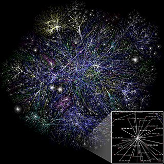
A spatial network is a graph in which the vertices or edges are spatial elements associated with geometric objects, i.e., the nodes are located in a space equipped with a certain metric. The simplest mathematical realization of spatial network is a lattice or a random geometric graph, where nodes are distributed uniformly at random over a two-dimensional plane; a pair of nodes are connected if the Euclidean distance is smaller than a given neighborhood radius. Transportation and mobility networks, Internet, mobile phone networks, power grids, social and contact networks and biological neural networks are all examples where the underlying space is relevant and where the graph's topology alone does not contain all the information. Characterizing and understanding the structure, resilience and the evolution of spatial networks is crucial for many different fields ranging from urbanism to epidemiology.
A GIS software program is a computer program to support the use of a geographic information system, providing the ability to create, store, manage, query, analyze, and visualize geographic data, that is, data representing phenomena for which location is important. The GIS software industry encompasses a broad range of commercial and open-source products that provide some or all of these capabilities within various information technology architectures.

In geometry, an isovist is the volume of space visible from a given point in space, together with a specification of the location of that point. It is a geometric concept coined by Clifford Tandy in 1967 and further refined by the architect Michael Benedikt.
Spatial network analysis software packages are analytic software used to prepare graph-based analysis of spatial networks. They stem from research fields in transportation, architecture, and urban planning. The earliest examples of such software include the work of Garrison (1962), Kansky (1963), Levin (1964), Harary (1969), Rittel (1967), Tabor (1970) and others in the 1960s and 70s. Specific packages address their domain-specific needs, including TransCAD for transportation, GIS for planning and geography, and Axman for Space syntax researchers.
A spatial database is a general-purpose database that has been enhanced to include spatial data that represents objects defined in a geometric space, along with tools for querying and analyzing such data.
Motion planning, also path planning is a computational problem to find a sequence of valid configurations that moves the object from the source to destination. The term is used in computational geometry, computer animation, robotics and computer games.
Oracle Spatial and Graph, formerly Oracle Spatial, is a free option component of the Oracle Database. The spatial features in Oracle Spatial and Graph aid users in managing geographic and location-data in a native type within an Oracle database, potentially supporting a wide range of applications — from automated mapping, facilities management, and geographic information systems (AM/FM/GIS), to wireless location services and location-enabled e-business. The graph features in Oracle Spatial and Graph include Oracle Network Data Model (NDM) graphs used in traditional network applications in major transportation, telcos, utilities and energy organizations and RDF semantic graphs used in social networks and social interactions and in linking disparate data sets to address requirements from the research, health sciences, finance, media and intelligence communities.

NetworkX is a Python library for studying graphs and networks. NetworkX is free software released under the BSD-new license.
Patrick Alasdair Fionn Turner (19 October 1969 – 6 October 2011) was a British-born scientist, who played a major role in the VR Centre for the Built Environment and the Space group at the University College London. His contribution had a great impact on the development of space syntax theory. This goes in parallel to his research into introducing a dynamic agent model that derives aggregate spatial analysis from the visual affordances of the built environment. Based on the principles of Turner's theory on Embodied space, his agent model proves to correlate well with natural movement behavior in architectural and urban environments. Turner was born on 19 October 1969, in London. He earned an MA in Natural Sciences from the University of Cambridge, and an MSc in Artificial Intelligence from the University of Edinburgh. Turner was last appointed a reader in Urban and Architectural Computing at the University College London in 2011. Turner died on 6 October 2011 after a long struggle with stomach cancer.
Fuzzy architectural spatial analysis (FASA) (also fuzzy inference system (FIS) based architectural space analysis or fuzzy spatial analysis) is a spatial analysis method of analysing the spatial formation and architectural space intensity within any architectural organization.

SAP HANA is an in-memory, column-oriented, relational database management system developed and marketed by SAP SE. Its primary function as the software running a database server is to store and retrieve data as requested by the applications. In addition, it performs advanced analytics and includes extract, transform, load (ETL) capabilities as well as an application server.