Isovist

Last updated
The pale blue area is the point isovist that can be seen from the centre of the circle. Isovist.svg
The pale blue area is the point isovist that can be seen from the centre of the circle.

In geometry, an isovist is the volume of space visible from a given point in space, together with a specification of the location of that point. It is a geometric concept coined by Clifford Tandy in 1967 and further refined by the architect Michael Benedikt. [1] [2]

Contents

Isovists are naturally three-dimensional, but they may also be studied in two dimensions: either in horizontal section ("plan") or in other vertical sections through the three-dimensional isovist. Every point in physical space has an isovist associated with it.

Concept

The isovist is one of the two representations of the structure of space, along with the spatial-envelope representation. [1] It is an approach in describing space from the point of view of a person within an environment. [3] It refers to the drawn polygon that covers an area that can be seen or reached when he walks in a straight line from a particular position. [3]

The boundary-shape of an isovist may or may not vary with location in, say, a room. If the room is convex (for example, a rectangle or circle), then the boundary-shape of every isovist in that room is the same; and so is its volume (or area, if we are thinking in plan). But the location of the viewpoint relative to the boundary would or could be different. However, if the room were non-convex (for example, an L-shaped or partitioned room), then there would be many isovists whose volume (area) would be less than that of the whole room, and perhaps some that were the whole room; and many would have different, perhaps unique shapes: large and small, narrow and wide, centric and eccentric, whole and shredded.

One can also think of the isovist as the volume of space illuminated by a point source of light. It can also be viewed in the 3D digital environment as the area not in the shadow cast by a single point light source. [4]

It is used in the field of architecture for analysis of buildings and urban areas, typically as one of a series of methods used in space syntax.

Isovist fields

An isovist field is the most common synonymous concept linked to an isovist as it encapsulates a mapping of spatio-visual properties often used for analysing buildings or built spaces and was first proposed by L S Davis and M L Benedikt in 1979. The varied shapes and sizes of isovists often have proposed numerical measures to quantify these. These measures create a set of Isovist fields which belong to a given path through a given environment (Benedikt, 1979). When applied to a building, the rigorous mapping of a complete set of spatio-visual properties produces an Isovist field. Every environment generates Isovist fields which are unique to that environment and the Isovist field is often useful when analysing a building in its entirety (Dawes and Ostwald, 2018). Obstacles may be in the way when creating the optimal isovist as the optimal viewshed of an individual from any given location (Emo, 2018). Many approaches have been taken to understand how isovists relate to each other and deliberation on overlapping isovists as the properties of isovist fields (Emo, 2018).  

Visibility graphs

Isovist fields have been used to generate visibility graphs which illustrate the spatial environment into a data format (Franz and Wiener, 2005). They can be analysed to compute the intervisibility of positions in a whole environment (Turner et al., 2001) and have become useful in industry when creating floor plans for certain spaces or determining experience of architecture (Franz and Wiener, 2005). When applied to such architecture, isovists and visibility graph measurands are further analysed to predict spatial behaviour of the individual (Franz and Wiener, 2005).

Origins

Isovists and similar spatial techniques have become encouraging methods of generally describing properties of architectural space (Franz and Wiener, 2005). Benedikt (1979) originally proposed isovists to be an objectively basic element which captures spatial properties by describing the visible area from a single observation point (Franz and Wiener, 2005). Isovists describe spatial properties from a beholder-centered perspective (Franz and Wiener, 2005). From early research it was found that the Isovist properties can be used to generate a more comprehensive or “global” mapping of a space.

James Gibson

Environmental psychologist James Gibson (1966) was a pioneer in the concept of examining the relationship between a viewer and their environment when developing his first model of the geometry of visual perception (Dawes and Ostwald, 2018). Gibson proposed three key characteristics which influence this relationship; the first being “ambient” to describe how any individual's understanding of an environment is restricted, the second being “optic” as the realisation environmental information is a constituent of vision, and the third being “array” as the ordered arrangement of elements as part of a larger system (Dawes and Ostwald, 2018). Gibson identified a ray of light as a geometrically structures source of information (Dawes and Ostwald, 2018) and as such, assisted in forming the foundations of visual perception concepts.

Michael Benedikt

Urbanist Michael Benedikt's paper ‘To take hold of space: isovists and isovist fields’ published in 1979 defined the Isovist as “the set of all points visible from a single vantage point in space with respect to an environment” (Benedikt, 1979). Benedikt was influenced greatly by the ideas that were proposed by Gibson, allowing him to push theoretical boundaries to pave the way for future research (Emo, 2018). As the first official definition of the Isovist, Benedikt pioneered the conversation of isovists and their subsequent analysis over the years to understand the role they have in the interplay between human vision and behaviour (Sengke and Atmodiwirjo, 2017). From this, the definition of the Isovist evolved further, being described as a “viewshed or an area in spatial environment directly visible from a location within the space” (Turner, 2001), then as “the space that can be seen from any vantage point” (Batty, 2001).

Implementation

Architecture

In architecture, an Isovist is largely represented as a polygon traced on a floor plan when represented in two dimensions (Ostwald, Dawes 2018) and utilised to analyse architectural and urban spaces. The concept of an Isovist has more frequently been used to analyse the experience of buildings and the properties of certain architectural works (Dawes and Ostwald, 2018). An experiment conducted by Franz, von der Heyde, & Bülthoff (2005), applied Isovist analysis in an architectural psychology context to predict experimental qualities of architecture from its spatial properties. The experiment concluded that isovists alongside visibility graph measurands which capture spatial properties affect the architecture experience. Further research has also determined that the largest and smallest Isovist areas in a given space have been found to be directly correlated to an individual's perception of the most exposed and most visible sections of a building.

Frank Lloyd Wright's Guggenheim Museum

Interior view of the Guggenheim Museum In the Guggenheim Museum 05.jpg
Interior view of the Guggenheim Museum

In relation to the Guggenheim Museum, the shape and size of the Isovist remains almost identical as an individual makes their way around the museum's ramp (Benedikt, 1979). The architect Frank Lloyd Wright stated, “no meeting of the eye with abrupt changes of form … the new painting will be seen for itself” (Wright, 1960), where this work of architecture was designed for the individual to engage with the art instead of the visitor's spatial variety. In this building, the isovist is constructed cyclically allowing the visitor to remain more actively engaged in each individual piece of art, creating spatial variety (Benedikt, 1979). Wright himself described this effect, “in the harmonious fluid quiet … of the unbroken wave … no meeting of the eye with abrupt changes of form … the new painting will be seen for itself”, (Wright, 1960).

Urban areas

In the context of urban areas and built environments, isovists are useful in analysing street life, safety and economical attractiveness (Van Nes, 2011). The location of important urban artefacts such as towers and lighthouses need to consider their panoptical view, how the isovists’ view subsequently increases or decreases. This panoptical view is defined by walls, buildings, moving objects, and free-standing objects such as trees, bushes and statues, where the Isovist's shape and size changes as one moves about the environment (Van Nes, 2011). As such, Isovist analyses have been proven useful in urban planning and strategic design of built environments to determine human behaviour in certain environments based on spatial perception.

Isovist as variables in an experiment conducted by Gerg Weitkamp, Ron van Lammeren, and Arnold Bregt concluded a strong correlation was found between the isovist variables and their perceived equivalents in an open field. Landscape openness was outlined as “the amount of space perceivable to the viewer” (Kaplan, Kaplan, and Brown, 1989), a concept which can be manipulated by isovist variables which have been proven as good indicators for perceived landscape openness (Weitkamp, van Lammeren, and Bregt, 2014).

Human behaviour and perception

Isovists and isovist fields have been utilised in assessing social and cognitive properties of architectural plans. An isovist accommodates all light rays visible to the human eye from any direction. They cover some subsets of sources of visual information for the individual which can be used to investigate or even predict human behavioural and cognitive responses to buildings (Dawes and Ostwald, 2013). From a fixed location, an isovist is delineated by every space visible in all directions and can reflect capacities and behaviours of people in space.

Visual experience of a human has been described as “seeing as experiencing” (Trevelyan, 1977) whereby the mind and body is influenced by its surrounding environment to impact human wellbeing as a whole (Sengke and Atmodiwirjo, 2017). Therefore, isovists have proven useful in certain applications of architecture. In the mechanism of seeing, isovist analysis can be conducted to determine the visual angle at which the human field of view is included (Sengke and Atmodiwirjo, 2017). Human behaviour and perception as such is stimulated by one's environment which is perceived through the “reflection of light on the surface that humans can respond … [where] in this process, the transactions happens through information provision and information reception” (Sengke and Atmodiwirjo, 2017).

In hospitals

In the physical environment of hospital inpatient wards, the physical qualities of the environment can influence the healing process of the patient (Sengke and Atmodiwirjo, 2017). Isovist analysis can be used to represent this experience of a patient by simulating the hospital ward environment to imitate the elements which can or cannot be seen by the patient as the view of the patient can affect their health condition (Sengke and Atmodiwirjo, 2017). Elements of a patient's view in hospital, such as having “contact with nature, finishes that provide a variety of colours and texture, art to provide simulation and distraction, and interior appearance design to inspire confidence and positive atmosphere” (Sengke and Atmodiwirjo, 2017), can collectively influence their experience and hence healing process in a hospital ward.

Criticism

Prospect-refuge theory

In 1975 Jay Appleton notoriously questioned environmental preference and proposed the prospect-refuge theory, a notion which employs the isovist to demonstrate how certain environments and an individual's visibility in such environment impacts emotional responses including fear and happiness. This theory analyses landscapes and their strategic evaluation as potential habitats, where the “prospect” component refers to the opportunity to see while the “refuge” refers to the opportunity to hide. When these two elements are combined, this theory allows a deeper understanding of environments and has been slowly accepted into environmental preference research (Dawes and Ostwald, 2013). Prospect and refuge can be measured individually or in combination to examine their relative sensitivities or robustness and later be applied to more complex architectures (Dawes and Ostwald, 2013).

Privacy issues

Isovists have the capacity to skew the optimal surveillance path of an individual and their perception of a particular environment. This concept impacts privacy issues when used to analyse the role of perception on crime. A report on crime in and around urban residential areas by Newman (1973, pages 30–34) demonstrated the significance of the relationship between visibility and crime. It was found the intending criminal is concerned with one's spatial characteristics, in particular the inconspicuousness of the target and their concealment from detection, attributes which are both impacted by the isovist. The isovist has therefore been found utilitarian to optimise space for a range of purposes (Desyllas, 2000; Hillier and Shu, 2000) when considering crime, spatial occupation, and rental returns.

See also

Related Research Articles

<span class="mw-page-title-main">Urban design</span> Designing and shaping of human settlements

Urban design is an approach to the design of buildings and the spaces between them that focuses on specific design processes and outcomes. In addition to designing and shaping the physical features of towns, cities, and regional spaces, urban design considers 'bigger picture' issues of economic, social and environmental value and social design. The scope of a project can range from a local street or public space to an entire city and surrounding areas. Urban designers connect the fields of architecture, landscape architecture and urban planning to better organize physical space and community environments.

Computational archaeology describes computer-based analytical methods for the study of long-term human behaviour and behavioural evolution. As with other sub-disciplines that have prefixed 'computational' to their name, the term is reserved for methods that could not realistically be performed without the aid of a computer.

<span class="mw-page-title-main">Space syntax</span> Theories in architecture and urban planning

Space syntax is a set of theories and techniques for the analysis of spatial configurations. It was conceived by Bill Hillier, Julienne Hanson, and colleagues at The Bartlett, University College London in the late 1970s to early 1980s to develop insights into the mutually constructive relation between society and space. As space syntax has evolved, certain measures have been found to correlate with human spatial behavior, and space syntax has thus come to be used to forecast likely effects of architectural and urban space on users.

<span class="mw-page-title-main">Landscape ecology</span> Science of relationships between ecological processes in the environment and particular ecosystems

Landscape ecology is the science of studying and improving relationships between ecological processes in the environment and particular ecosystems. This is done within a variety of landscape scales, development spatial patterns, and organizational levels of research and policy. Concisely, landscape ecology can be described as the science of "landscape diversity" as the synergetic result of biodiversity and geodiversity.

<span class="mw-page-title-main">Public space</span> Places generally open and accessible to everyone

A public space is a place that is open and accessible to the general public. Roads, pavements, public squares, parks, and beaches are typically considered public space. To a limited extent, government buildings which are open to the public, such as public libraries, are public spaces, although they tend to have restricted areas and greater limits upon use. Although not considered public space, privately owned buildings or property visible from sidewalks and public thoroughfares may affect the public visual landscape, for example, by outdoor advertising. Recently, the concept of shared space has been advanced to enhance the experience of pedestrians in public space jointly used by automobiles and other vehicles.

Landscape archaeology, a sub-discipline of archaeology and archaeological theory, is the study of the ways in which people in the past constructed and used the environment around them. It is also known as archaeogeography. Landscape archaeology is inherently multidisciplinary in its approach to the study of culture, and is used by pre-historical, classic, and historic archaeologists. The key feature that distinguishes landscape archaeology from other archaeological approaches to sites is that there is an explicit emphasis on the sites' relationships between material culture, human alteration of land/cultural modifications to landscape, and the natural environment. The study of landscape archaeology has evolved to include how landscapes were used to create and reinforce social inequality and to announce one's social status to the community at large. The field includes with the dynamics of geohistorical objects, such as roads, walls, boundaries, trees, and land divisions.

Ecological psychology is the scientific study of perception-action from a direct realist approach. Ecological psychology is a school of psychology that follows much of the writings of Roger Barker and James J. Gibson. Those in the field of Ecological Psychology reject the mainstream explanations of perception laid out by cognitive psychology. The ecological psychology can be broken into a few sub categories: perception, action, and dynamical systems. As a clarification, many in this field would reject the separation of perception and action, stating that perception and action are inseparable. These perceptions are shaped by an individual's ability to engage with their emotional experiences in relation to the environment and reflect on and process these. This capacity for emotional engagement leads to action, collective processing, social capital, and pro environmental behaviour.

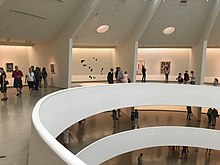
In architecture, visibility graph analysis (VGA) is a method of analysing the inter-visibility connections within buildings or urban networks. Visibility graph analysis was developed from the architectural theory of space syntax by Turner et al. (2001), and is applied through the construction of a visibility graph within the open space of a plan.

Environmental psychology is a branch of psychology that explores the relationship between humans and the external world. It examines the way in which the natural environment and our built environments shape us as individuals. Environmental psychology emphasizes how humans change the environment and how the environment changes humans' experiences and behaviors. The field defines the term environment broadly, encompassing natural environments, social settings, built environments, learning environments, and informational environments. According to an article on APA Psychnet, environmental psychology is when a person thinks of a plan, travels to a certain place, and follows through with the plan throughout their behavior.

<span class="mw-page-title-main">Urban morphology</span> Urban geography

Urban morphology is the study of the formation of human settlements and the process of their formation and transformation. The study seeks to understand the spatial structure and character of a metropolitan area, city, town or village by examining the patterns of its component parts and the ownership or control and occupation. Typically, analysis of physical form focuses on street pattern, lot pattern and building pattern, sometimes referred to collectively as urban grain. Analysis of specific settlements is usually undertaken using cartographic sources and the process of development is deduced from comparison of historic maps.

<span class="mw-page-title-main">Viewshed</span> Geographical area visible from a location

A viewshed is the geographical area that is visible from a location. It includes all surrounding points that are in line-of-sight with that location and excludes points that are beyond the horizon or obstructed by terrain and other features. Conversely, it can also refer to area from which an object can be seen. A viewshed is not necessarily "visible" to humans; the same concept is used in radio communications to indicate where a specific combination of transmitter, antenna, and terrain allow reception of signal.

Spatial network analysis software packages are analytic software used to prepare graph-based analysis of spatial networks. They stem from research fields in transportation, architecture, and urban planning. The earliest examples of such software include the work of Garrison (1962), Kansky (1963), Levin (1964), Harary (1969), Rittel (1967), Tabor (1970) and others in the 1960s and 70s. Specific packages address their domain-specific needs, including TransCAD for transportation, GIS for planning and geography, and Axman for Space syntax researchers.

<span class="mw-page-title-main">Spatial analysis</span> Formal techniques which study entities using their topological, geometric, or geographic properties

Spatial analysis is any of the formal techniques which studies entities using their topological, geometric, or geographic properties. Spatial analysis includes a variety of techniques using different analytic approaches, especially spatial statistics. It may be applied in fields as diverse as astronomy, with its studies of the placement of galaxies in the cosmos, or to chip fabrication engineering, with its use of "place and route" algorithms to build complex wiring structures. In a more restricted sense, spatial analysis is geospatial analysis, the technique applied to structures at the human scale, most notably in the analysis of geographic data. It may also be applied to genomics, as in transcriptomics data.

<span class="mw-page-title-main">Visual pollution</span> Aesthetic issue of the impairment ones ability to enjoy a vista or view

Visual pollution refers to the visible deterioration and negative aesthetic quality of the natural and human-made landscapes around people and to the study of secondary impacts of manmade interventions. It also refers to the impacts pollution has in impairing the quality of the landscape, formed from compounding sources of pollution to create the impairment. Visual pollution disturbs the functionality and enjoyment of a given area, limiting the ability for the wider ecological system, from humans to animals, to prosper and thrive within it due to the disruptions to their natural and human-made habitats. Although visual pollution can be caused by natural sources, the predominant cause comes from human sources.

Space in landscape design refers to theories about the meaning and nature of space as a volume and as an element of design. The concept of space as the fundamental medium of landscape design grew from debates tied to modernism, contemporary art, Asian art and design as seen in the Japanese garden, and architecture.

Spatial design is a relatively new conceptual design discipline that crosses the boundaries of traditional design specialisms such as architecture, landscape architecture, landscape design, interior design, urban design and service design as well as certain areas of public art.

The following outline is provided as an overview of and topical guide to social science:

Patrick Alasdair Fionn Turner (19 October 1969 – 6 October 2011) was a British-born scientist, who played a major role in the VR Centre for the Built Environment and the Space group at the University College London. His contribution had a great impact on the development of space syntax theory. This goes in parallel to his research into introducing a dynamic agent model that derives aggregate spatial analysis from the visual affordances of the built environment. Based on the principles of Turner's theory on Embodied space, his agent model proves to correlate well with natural movement behavior in architectural and urban environments. Turner was born on 19 October 1969, in London. He earned an MA in Natural Sciences from the University of Cambridge, and an MSc in Artificial Intelligence from the University of Edinburgh. Turner was last appointed a reader in Urban and Architectural Computing at the University College London in 2011. Turner died on 6 October 2011 after a long struggle with stomach cancer.

Fuzzy architectural spatial analysis (FASA) (also fuzzy inference system (FIS) based architectural space analysis or fuzzy spatial analysis) is a spatial analysis method of analysing the spatial formation and architectural space intensity within any architectural organization.

A conscious city is a large built environment that is aware of the needs and activities of its inhabitants and responds to them. Research in conscious cities explores how architecture and urban design can better consider and respond to human needs through data analysis, artificial intelligence, and the application of cognitive sciences in design.

References

  1. 1 2 Harris, Laurence R.; Jenkin, Michael R. M. (2011). Vision in 3D Environments. Cambridge, UK: Cambridge University Press. p. 311. ISBN   978-1-107-00175-6.
  2. Wagman, Jeffrey B.; Blau, Julia J. C. (2020). Perception as Information Detection: Reflections on Gibson's Ecological Approach to Visual Perception. New York: Routledge. p. 85. ISBN   9780367312954.
  3. 1 2 Hunter, Rebecca H.; Anderson, Lynda A.; Belza, Basia L. (2016). Community Wayfinding: Pathways to Understanding. Cham, Switzerland: Springer. p. 36. ISBN   978-3-319-31070-1.
  4. Bevan, Andrew; Lake, Mark (2013). Computational Approaches to Archaeological Spaces. Oxon: Routledge. p. 250. ISBN   978-1-61132-346-7.