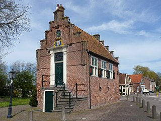
Spanbroek is a village in the Dutch province of North Holland. It is a part of the municipality of Opmeer, and lies about 9 km (6 mi) northwest of Hoorn.

Eefde is a village in the Dutch province of Gelderland. It is located in the municipality of Lochem, about 3 km northeast of the city of Zutphen.

Reuver is a village in the Dutch province of Limburg. It is located in the municipality of Beesel, about 10 km south of the city of Venlo. The successful metal band Epica comes from Reuver.

Krabbendijke is a town in the Dutch province of Zeeland. It is located in the municipality of Reimerswaal, about 6 km southeast of the town of Kruiningen. Krabbendijke has a station on the railway line Bergen op Zoom - Vlissingen.

Biessum is a vicinity in the Dutch province of Groningen. It is a part of the municipality of Delfzijl, and lies about 25 km northeast of Groningen.
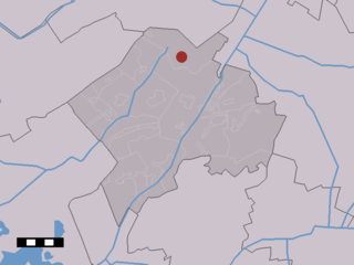
Oude Willem is a town in the Dutch province of Drenthe. It is a part of the municipality of Westerveld, and lies about 21 km southwest of Assen.

Wateren is a town in the Dutch province of Drenthe. It is a part of the municipality of Westerveld, and lies about 22 km west of Assen.
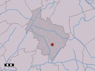
Bruntinge is a town in the Dutch province of Drenthe. It is a part of the municipality of Midden-Drenthe, and lies about 13 km northeast of Hoogeveen.

Hijkersmilde is a town in the Dutch province of Drenthe. It is a part of the municipality of Midden-Drenthe, and lies about 13 km southwest of Assen.

Penningsveer is a town in the Dutch province of North Holland. It is a part of the municipality of Haarlemmermeer and lies about 3 km (1.9 mi) east of Haarlem. The town is named after the ferry (Dutch:veer) that used to take travellers across the Liede. Travellers over land on their way to Amsterdam would pass through Spaarnwoude before reaching Halfweg. That route became obsolete when the Haarlemmertrekvaart was dug in 1631.

Weiwerd is a village in the Dutch province of Groningen. It is a part of the municipality of Delfzijl, and lies about 27 km east of Groningen. Formerly a farming community with its own church, school, and shops, the whole village was scheduled for demolition in the 1970s to allow the industrial area of Delfzijl harbour to be expand. Less than 10% of the original buildings are left.

Ockhuizen is a hamlet near the village of Haarzuilens in the Dutch province of Utrecht. It is a part of the municipality of Utrecht, and lies about 11 km northwest from the city centre of Utrecht.

Stokkelaarsbrug is a hamlet in the Dutch province of Utrecht. It is a part of the municipality of De Ronde Venen, and lies about 12 km south of Amsterdam. It is located on the border with the province North Holland, where the small river Winkel joins the Oude Waver.
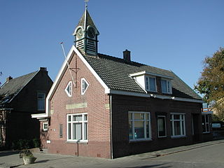
Langeweide is a hamlet in the Dutch province of South Holland. It is a part of the former municipality of Reeuwijk, and lies about 6 km east of Gouda.
Aam is a hamlet in the Dutch province of Gelderland. It is located in the municipality of Overbetuwe, about 1 km east of the town of Elst.

Den Ham is a hamlet in the Dutch province of Groningen. It is located in the municipality of Westerwolde, close to the border with Germany, between Bellingwolde and Nieuweschans.
De Heuvel is a hamlet in the Dutch province of North Brabant. It is located in the municipality of Waalre, on the north side of the town of Waalre.

Bears or Beers is a small village in the Dutch province of Friesland. It is located in the municipality Leeuwarden, about 8 km southwest of Leeuwarden. Bears has a population of about 133 in January 2017.

Terstraten, known as Tersjtraote in Limburgish, is a hamlet in the municipality of Nuth in the province of Limburg, the Netherlands. It is one of the so-called Bovengehuchten, or Upper Hamlets, of Nuth. All the houses are situated along the street Terstraten, which runs from the neighboring hamlet Brand via a hollow way towards the Maastrichterweg. In between the houses is a little square with a Christian cross underneath a tree. The houses in Terstraten are officially preserved heritage. The hamlet is known as a painters' paradise, due to the many 18th-century farmhouses with timber framing. Between Terstraten and the hamlet Brand runs the stream Platsbeek.

De Lutte is a village in the Dutch province of Overijssel. It is located in the municipality of Losser. It is located close to the border between the Netherlands and Germany. De Lutte is connected to Germany and Oldenzaal and Hengelo by the A1.


