
Arcadia is one of the regional units of Greece. It is part of the administrative region of Peloponnese. It is in the central and eastern part of the Peloponnese peninsula. It takes its name from the mythological figure Arcas. In Greek mythology, it was the home of the god Pan. In European Renaissance arts, Arcadia was celebrated as an unspoiled, harmonious wilderness.

Mount Kyllini or Mount Cyllene, is a mountain on the Peloponnese in Greece famous for its association with the god Hermes. It rises to 2,376 m (7,795 ft) above sea level, making it the second highest point on the peninsula. It is located near the border between the historic regions of Arcadia and Achaea—in the northeast of Arcadia, and entirely within modern Corinthia. It is located west of Corinth, northwest of Stymfalia, north of Tripoli, and south of Derveni. Several modern places are also named Kyllini.

Tripoli is a city in the central part of the Peloponnese, in Greece. It is the capital of the Peloponnese region as well as of the regional unit of Arcadia. The homonym municipality has around 47,000 inhabitants.

Levidi is a small town and a former municipality in Arcadia, Peloponnese, Greece. Since the 2011 local government reform it is part of the municipality Tripoli, of which it is a municipal unit. The municipal unit has an area of 312.641 km2. The town is situated on the northeastern slope of the Mainalo mountains, at about 850 m elevation. Levidi is 9 km northwest of Kapsas, 10 km east of Vytina, 12 km southwest of Kandila and 20 km northwest of Tripoli. It is at the junction of the Greek National Road 74 (Tripoli–Pyrgos) and the Greek National Road 66. Levidi was the site of several battles during the Greek War of Independence from the Ottoman Empire. The great Greek-Australian rugby league footballer George Peponis has ancestral ties to this town.
Kapsas is a community in the municipal unit of Mantineia in Arcadia on the Peloponnese peninsula in southern Greece. It is situated in a valley east of the Mainalo mountains, at 700 m elevation. It is 9 km southeast of Levidi, 11 km west of Nestani and 12 km north of Tripoli. The Greek National Road 74 passes through the village.

Greek National Road 74 is a single carriageway road in southern Greece. It connects Pyrgos with Tripoli, via Olympia and Vytina. Its length is 141 kilometres (88 mi). It runs through the western and central part of the Peloponnese peninsula, in the regional units Elis and Arcadia.
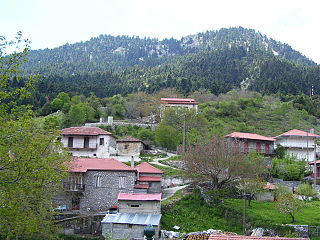
Alonistaina is a mountain village in the municipal unit of Falanthos, Arcadia, Greece. It is situated in the forested northern Mainalo mountains, at about 1,150 m. elevation, making it one of the highest villages in the Peloponnese. It is considered a traditional settlement and is situated 6 km north of Piana, 6 km southeast of Vytina, 9 km southwest of Levidi and 18 km northwest of Tripoli. Alonistaina has a school and a church.

The Eurotas or Evrotas is the main river of Laconia and one of the major rivers of the Peloponnese, in Greece. The river's springs are located just northwest of the border between Laconia and Arcadia, at Skortsinos. The river is also fed by underwater springs at Pellana and by tributaries coursing down from Mt. Taygetos and Mt. Parnon, which flank the Eurotas valley to the west and east, respectively. The river is 82 kilometres (51 mi) long, flowing in a north-south direction and emptying into the Laconian Gulf.

A polje, also karst polje or karst field, is a large flat plain found in karstic geological regions of the world, with areas usually 5–400 km2 (2–154 sq mi). The name derives from the Slavic languages and literally means 'field', whereas in English polje specifically refers to a karst plain or karst field.
Nestani is a village and a community in the municipal unit Mantineia, Arcadia, Greece.
Caphyae or Kaphyai was a city of ancient Arcadia situated in a small plain, northwest of the lake of Orchomenus. It was protected against inundations from this lake by a mound or dyke, raised by the inhabitants of Caphyae. The city is said to have been founded by King Cepheus of Tegea, the son of Aleus, and pretended to be of Athenian origin.
Orchomenus or Orchomenos was an ancient city of Arcadia, Greece, called by Thucydides the Arcadian Orchomenus, to distinguish it from the Boeotian town.

Aroanios is a river in the southern part of Achaea, Greece and a tributary of Ladon river. The water comes from the carbonate mountain range Aroania (1500-2300m). After 12 km, it meets Ladonas in the area of "Helongospilia” (Χελωνοσπηλιά).

Lake Stymphalia is located in the north-eastern part of the Peloponnese, in Corinthia, southern Greece. It is a closed karst basin with a wetland area and an agrarian area. The lake is an important stopover for migratory birds. The size of the lake varies, depending on the season.

Kiveri is a small village in the municipal unit of Lerna, Argolis, Greece. It is situated on the bay of Argos across from the tourist center of Nafplio. It has a population of approximately 1000. According to legend it was founded in 1600 BC by some of the first Dorian invaders of the Peloponnese. Scholarly research finds that the village has been continuously occupied since antiquity, its ancient name being Apovathmi. The recent unearthing of ancient graves do lend at least a little credence to the legend. Kiveri has a predominantly agricultural economy revolving around the growth and distribution of oranges and olives. There is also a small fishing industry.
Piana is a historical village of Arcadia and one of the most beautiful traditional Greek villages of Peloponnese. It is built at the Mainalo mountain, near the ruins of the ancient city Dipaia. Its population was 70 at the 2011 census.
The Pivka Basin or the Pivka Valley, also simply Pivka, is a varied basin in southwestern Slovenia, lying between high Dinaric plateaus, the Karst Plateau, and the Brkini Hills. It covers an area of 160 square kilometres (62 sq mi). To the northwest, it is bordered by Mt. Nanos, to the north, by Hrušica, to the east by the Javornik Hills and Mt. Snežnik, and to the west by the lower Slavina Plain and Tabor Hills. The lower part of the basin between Nanos and the Postojna Gate is known as the Lower Pivka Basin, and the upper part between Prestranek and Snežnik as the Upper Pivka Basin.

Argon Pedion is the geological name of a "closed karst basin" in the Arcadian highlands in the Peloponnese peninsula of southern Greece. The first known appearance of this name was in a publication by the ancient geographer Pausanias. He called it untilled plain, because the grassland and acres may be flooded beyond the time when annual vegetation starts. When the winter rains were very heavy, floods can even turn the plain into a temporary lake. Intensive karst formation prevents the formation of a permanent lake. In rare cases, even today, modern technologies can not prevent flooding.

Lake Taka is a temporary lake located in the south of a large basin called “Tripoli-Plateau” in Greece. In the winter, the southern part of the basin often gets flooded, and a lake forms from a large amount of fresh rainwater because of insufficient surface drainage. A wetland biotope quickly develops, and species of water-loving fauna appear. In the hot and dry summer, the lake dries up. Over time, karstification creates several ponors, where water leaves the basin through groundwater.

Kefalari is the name of the village and community Kefalari in Argolis. Several Greek villages in mountainous areas, where spring water is abundant, have similar names; this article is about the community at the northern border of the “Plain of Argos”, Peloponnese, at the Argolic Gulf. The village developed around a large geologically significant karst spring. In the mythology and the life of ancient Greeks this spring was of importance and today it is a place of orthodox pilgrimage.


