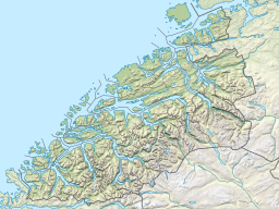
Volda is a municipality in Møre og Romsdal county, Norway. It is part of the Sunnmøre region. The administrative centre is the village of Volda. Other villages in the municipality include Dravlaus, Fyrde, Straumshamn, Leira, Bjørke, and Grodås. The municipality is located about 50 kilometres (31 mi) south of the town of Ålesund.

is a municipality in Møre og Romsdal county, Norway. It is part of the Sunnmøre region of Western Norway. The administrative centre of the municipality is the village of Ørsta. Other villages in the municipality include Hovdebygda, Flåskjer, Liadal, Urke, Barstadvik, Åmdalen, Follestaddalen, Nordre Vartdal, Vartdal, Sæbø, Sætre, Store-Standal, and Ytre Standal.

Geiranger is a small tourist village in Sunnmøre region of Møre og Romsdal county in the western part of Norway. It is in the municipality of Stranda at the head of the Geirangerfjorden, which is a branch of the large Storfjorden. The nearest city is Ålesund. Geiranger is home to spectacular scenery, and has been named the best travel destination in Scandinavia by Lonely Planet. Since 2005, the Geirangerfjord area has been listed as a UNESCO World Heritage Site. The Seven Sisters waterfall is located just west of Geiranger, directly across another waterfall called "The Suitor." Norwegian County Road 63 passes through the village. Geiranger Church is the main church for the village and surrounding area.

Dalsfjord is a former municipality in the Sunnmøre region of Møre og Romsdal county, Norway. The former municipality existed from 1924 until its dissolution in 1964. The 165-square-kilometre (64 sq mi) municipality included the area around the Dalsfjorden between Vanylven Municipality in the west and almost all the way to the Kilsfjorden in the east. The area is now a part of Volda Municipality. The administrative centre was the village of Dravlaus. Other villages in the area included Ulvestadbygda, Åmelfot, Steinsvik, and Dalsbygda.

Leira is a small village in the municipality of Volda, in Møre og Romsdal county, Norway. It lies between the villages of Bjørke and Viddal, at the end of Hjørundfjorden. The village is located in the Sunnmørsalpene mountains, about 6 kilometres (3.7 mi) from the mountains Skårasalen, Jakta, Kvitegga, and Hornindalsrokken.
Kilsfjorden is a fjord in Volda Municipality in Møre og Romsdal county, Norway. It is located in the central part of the municipality, about 6 kilometres (3.7 mi) east of the Dalsfjorden. The Kilsfjorden is located in the Sunnmørsalpene mountains and it flows north and joins the Austefjorden to form the Voldsfjorden. The village of Straumshamn lies on the southwestern coast of the fjord, at the entrance to the Kilspollen, a nearly 3-kilometre (1.9 mi) long inlet that comes off of the Kilsfjorden.

The Austefjorden is a small fjord which branches off of the main Voldsfjorden in Volda Municipality in Møre og Romsdal county, Norway. The 11-kilometre (6.8 mi) long fjord lies in the Sunnmørsalpene mountains about 5 kilometres (3.1 mi) north of the mountain Eidskyrkja in the northeastern part of the municipality. The Austefjorden and the Kilsfjorden join together to form the Voldsfjorden. The village of Fyrde is located at the innermost part of the fjord. There are several small peninsulas and outcroppings that jut out into the fjord, giving the fjord a meandering S-shaped path.

The Eiksund tunnel is an undersea tunnel in Møre og Romsdal county, Norway, which runs under the Vartdalsfjorden connecting the municipalities of Ørsta and Ulstein. The tunnel is 7,765 metres (25,476 ft) long and reaches a depth of 287 metres (942 ft) below sea level, and was the deepest undersea tunnel in the world until Norway's Rogaland county opened its 292 m (958 ft) deep Ryfast tunnel system in December 2019.

Austfjorden is a fjord in Vestland county, Norway. The 20-kilometre (12 mi) long fjord runs along the border between Alver Municipality and Masfjorden Municipality. It starts in Alver and extends to the northwest. The Masfjorden joins the Austfjorden from the north, and then the Austfjorden empties into the Fensfjorden before reaching the open sea near Fedje. The Austfjorden is the innermost arm of the Fensfjorden. The village of Knarrviki and the Mongstad industrial area lie on the western shore of the Austfjorden. The village of Myking lies on the western shore of the fjord, near the innermost part of the fjord.
Vartdalsfjorden is a fjord in Møre og Romsdal county, Norway. It begins at the Storfjorden and Sulafjorden in the northeast and flows through the municipalities of Hareid and Ulstein on the northern shore of the fjord and through the municipalities of Ørsta and Volda on the southern shore. The 20-kilometre (12 mi) long fjord has one road crossing, the Eiksund Tunnel. The deepest part of the fjord reaches 365 metres (1,198 ft) below sea level. The village of Vartdal lies on the southern shore of the fjord in Ørsta. From 1895 until 1964, the southern banks of the fjord were part of the municipality of Vartdal.

Dalsfjorden is a fjord in Volda Municipality in Møre og Romsdal county, Norway. The 17-kilometre (11 mi) long fjord flows north into the Voldsfjorden. The fjord averages about 1 to 2 kilometres wide and it reaches a depth of 209 metres (686 ft) below sea level. The fjord is surrounded by high mountains and the sides of the inner part of the fjord rise steeply up to 600 to 800 metres above sea level. There are several small villages along the shores of the fjord, the largest of which are Dravlaus on the western shore, Steinsvika at the southern end of the fjord, and Dalsbygda on the eastern shore. County Road 40 runs around the shoreline of the whole fjord.

Straumshamn is a village in Volda Municipality in Møre og Romsdal county, Norway. The village is located at the southern end of the Kilsfjorden branch of the Voldsfjorden. The Bjørkedalen valley runs south from Straumshamn cutting between the Sunnmørsalpene mountains. The village of Folkestad lies about 8 kilometres (5.0 mi) to the northwest and the village of Fyrde lies about 20 kilometres (12 mi) to the east. Kilsfjord Church is located in Straumshamn.

Fyrde is a village in Volda Municipality in Møre og Romsdal county, Norway. The village is located at the end of the Austefjorden branch of the main Voldsfjorden. The new European route E39 highway runs past the village of Fyrde. The new 6,563-metre (4.1 mi) long Kviven Tunnel runs through the mountain Kviven connecting the Fyrde area to the village of Grodås in neighboring Hornindal Municipality in Sogn og Fjordane county.

Dravlaus is a village in the municipality of Volda in Møre og Romsdal county, Norway. The village is located along the Dalsfjorden, about 5 kilometres (3.1 mi) south of the village of Lauvstad. The Dravlausdalen valley runs west from Dravlaus, along the Dravlauselva river. Dalsfjord Church is located in Dravlaus, along the shore of the fjord.

Volda Church is a parish church of the Church of Norway in the municipality of Volda in Møre og Romsdal county, Norway. It is located in the village of Volda, along the northeastern shore of the Voldsfjorden. It is the church for the Volda parish as well as the seat of the Søre Sunnmøre prosti (deanery) in the Diocese of Møre. The large stone church was built in a long church design in 1932 using plans drawn up by the architect Arnstein Arneberg. The church seats about 800 people.

Dalsfjord Church is a parish church of the Church of Norway in the municipality of Volda in Møre og Romsdal county, Norway. It is located in the village of Dravlaus, on the western shore of the Dalsfjorden. It is the church for the Dalsfjord parish which is part of the Søre Sunnmøre prosti (deanery) in the Diocese of Møre. The white, wooden church was built in a cruciform design in 1910 using plans drawn up by the architect Ole Havnæs. The church seats about 400 people. The building was consecrated by the Bishop Johan Willoch Erichsen.

Austefjord Church is a parish church of the Church of Norway in the municipality of Volda in Møre og Romsdal county, Norway. It is located in the village of Fyrde, at the eastern end of the Austefjorden. It is the church for the Austefjord parish which is part of the Søre Sunnmøre prosti (deanery) in the Diocese of Møre. The white, wooden church was built in a long church design in 1879 using plans drawn up by an unknown architect. The church seats about 150 people.

Rovdefjorden is a fjord in Møre og Romsdal county, Norway. The fjord runs through the municipalities of Sande, Herøy, Vanylven, Volda, Ørsta, and a tiny part of Ulstein. The eastern end of the fjord connects with the Vartdalsfjorden and Voldsfjorden and the western end of the fjord connects with the Hallefjorden. The Syvdsfjorden branches off the Rovdefjorden to the south. The fjord is bounded by the mainland to the south and the island of Gurskøya to the north.

Leikong is a village in Herøy Municipality in Møre og Romsdal county, Norway. The village is located on the eastern side of the island of Gurskøya. Historically, Leikong has been a regional centre for trade. It is located along a main road on the island of Gurskøya, but it is also located along the confluence of several fjords: Vartdalsfjorden, Voldsfjorden, Ørstafjorden, and Rovdefjorden. The village is home to Leikanger Church.


